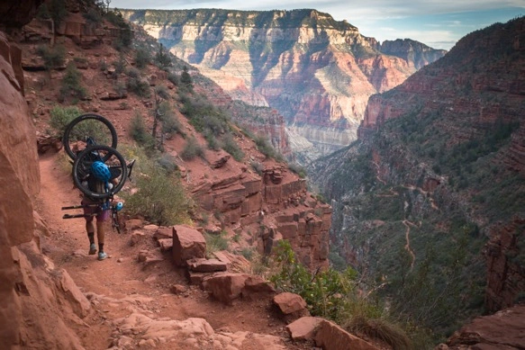
Sweaty palms hooked under the headtube and the right fork leg of the bicycle, I heft the load higher onto my back. The textured brass headbadge of my Meriwether frame keeps the painted pink steel from slipping from my right hand. Who said headbadges have no place on a bikepacking bike? Concerning a well-designed backpack and a reasonable load, the weight of the pack is meant to be shared by the hips and the shoulders, the remaining pack resting against the back. Only a few miles down the canyon and our 50 pound packs have already agitated both hip and shoulder. Mine is an old EMS backpack purchased ten years ago in New York which has never been backpacking– neither have I– yet has been in regular use as an in town-hauler, akin to a pick-up truck to a commuting cyclist. It knows the weight of a gallon of milk and a bag of apples and a twelve pack of beer, swimming in a week of other foods. It may not be ideal for the job of carrying a bicycle, but the fault may lie in the fact that the bicycle is a stout steel hardtail packed for a comfortable month-long trip across Arizona. By conventional bicycle touring standards it is a lightweight. Shedding my tent and full-size sleeping pad in favor of resting on a 99¢ windshield sunshade under the stars, this bikepacking rig still measures as a middleweight. By packbiking standards, it is a tank. If there is a graceful way to carry a bicycle through the Grand Canyon, it doesn’t start with a 50 pound pink steel bike.
Lael is no better situated. Her pack– I only realize once we’ve exited the canyon at the South Rim– boasts features which mimic those found on high-end packs, yet it sits too high above the hips, the straps dig into her shoulders, and the “suspension” system pokes into her shoulder blades. The hip belt buckle is broken and she ties the strap around her waist. This pack is borrowed from Bill and Kathi in Hurricane. We’re grateful for a solution which costs no more than return postage to Utah and a postcard. As bad as it seems, this might be about as good as it gets. Carrying a bike through the Grand Canyon isn’t easy. I can’t really blame the pack, nor the bicycle.
One foot in front of the other for 25 miles, 6000 feet down, 5000 ft up, we walk. We drop into the canyon a few hours before dark as visitors are exiting toward coin-operated showers or the luxurious dining hall of the Grand Canyon Lodge, precipitously located at the edge of the biggest cliff in the hemisphere. Past dark, Lael stumbles not once, but six or seven times. I demand that we stop to rest. She won’t admit that she is tired or that her shoes are inadequate, but promises not to do it again. Instead, I attempt to prove through some late-night logic that we need to stop and sit for a minute, that descending a cliff’s edge in the dark with bicycles on our backs is as much hazard as I am willing to accept. Missteps will only make it worse. We sit for our first break just before Manazanita Rest, almost 3000ft below the rim. This is the only time we will hike more than 2 miles at a time without removing the packs to rest and to refresh. We continue to the stock area at Cottonwood Camp for the night, the only available permitted campsite available when we applied at the backcountry office mid-afternoon. Our visit with the ranger was brief and professional. Ten minutes and twenty dollars later and we have a tag indicating a place to stay and the right to remain in the canyon for the night. The remainder of our hike to Cottonwood is without missteps.
The next morning, we rise before dawn to avoid the heat of the day. The previous night’s hike had been no more than 8 miles, although about 4000ft down from the rim, which towers above 8000ft. On this day, we continue downstream for eight miles along Bright Angel Creek to Phantom Ranch before contacting the mighty Colorado River and the main vein of the canyon. Thereafter– either by the South Kaibab Trail or the Bright Angel Trail– we will ascend 5000ft from the river up to the South Rim, a distance of about 10 miles by our chosen route along the Bright Angel Trail which affords a series of water and shade stops along the way. The longer route is more popular with day hikers and is used by mule trains serving Phantom Ranch. It rises less dramatically from the river, then tips skyward in the last five miles to gain 3000ft at once. Working our way along the North Kaibab Trail in the morning and up the Bright Angel Trail in the afternoon, we crest the South Rim just after dark by way of headlight and headlamp. Lael is ahead of me by one switchback and she screams, from just above my head, “This is the end!” We hug and high five in the dark, like the end of a pointless challenge on a reality TV show. What was once monumentally important is behind us, and now seems irrelevant except for sore calfs and shoulders and the abrasion which marks Lael’s hips. We haven’t showered since Las Vegas.
If anyone asks about carrying our bikes through the canyon, I’ll say, “It isn’t easy.” But it is possible. It is worth it. And we did it. Unstrapping the packs from the bikes and reinstalling the front wheel and the left pedal to the bike, we ride from the Bright Angel Trailhead to the General Market just before close. By morning, we’re snaking through pine forests en route to Flagstaff.
The history of carrying one’s bike through the canyon is barely a decade old. While on their groundbreaking AZT-by-bike scouting mission in 2005, Scott Morris and Lee Blackwell of Tucson secured permission from Grand Canyon National Park rangers to carry their bikes through the canyon, through a 25 mile trail corridor. Considering the arterial Grand Canyon trails are not wilderness, where possessing a bicycle would be expressly prohibited by federal law– still open to interpretation, says Casey Greene, who argues a disassembled bicycle is no more than a collection of bicycle parts– rangers decided on a “wheels must not touch the ground” approach to permitting bicycles in the canyon during Scott and Lee’s 2005 ride. A sign at each major trailhead clearly states “No Bicycles”, thus referring to bicycles which intend to be ridden. A disassembled bicycle, packed to one’s back, where the wheels do not touch the ground is legal (i.e. not prohibited, as has been decided in other parks). Just don’t try to ride the bike anywhere in the canyon. Park rangers aggressively enforce this rule, such as in the case of the Sedona 5 or the Riding the Spine crew.
Why would anyone want to carry a bicycle through the Grand Canyon? The nearly 800 mile Arizona Trail connects the Utah border with the Mexican border in a ribbon of singletrack and dirt roads, crossing directly through the Grand Canyon. North of the canyon are 80 miles of the the most pleasant forested trail in the whole state of Arizona, the Kaibab 101 Trail. South of the canyon are another 90 miles of trail to Flagstaff, and another 550 miles to the Mexico border. If you wish to ride the whole trail you can detour a great distance on paved roads around the canyon, pay a shuttle service to transport your bike, or hike your bike through the ditch and roll away at the other end. We’ve been in this position once before– wondering how best to enjoy the trails north of the canyon– and our solution was to skip the canyon and the Kaibab trails and start riding at the South Rim. This time we wished to visit the Colorado River and to start from the border of Utah.
From St. George and Hurricane, UT, Lael, Skyler, Panthea and I connect to northern Arizona via Colorado City and Fredonia, to Jacob Lake. The initial plan is to ride back into Utah via Kanab to meet the north end of the Arizona Trail at the Stateline Campground via the unpaved House Rock Valley Road. We soon realize that we can access the trail sooner by riding up to Jacob Lake on pavement, which further enables us to enjoy the singletrack descent to the Utah border.
Arriving at Jacob Lake in the afternoon, Lael and I shoot for the border via the AZT, arriving just past dark. In the morning, we loop back to Jacob Lake via the House Rock Valley Road along the Vermillion Cliffs National Monument, climbing back onto the Kaibab Plateau on paved route 89A. From Jacob Lake, we begin our southward trajectory toward the Grand Canyon about 50 miles away.
Further reading and planning:
For information visit Scott Morris’ Topofusion page dedicated to Cycling the AZT, link to forum discussions about the AZT750 and 300 time trial events (Google search for archived discussions), and read Scott’s recent account of touring the AZT with Eszter on his blog Diary of Scott Morris.
The Kaibab Plateau is part of the larger Colorado Plateau, shown here extending from the Utah border in the north to the Grand Canyon in the south. The AZT begins at the northeastern edge of the forested plateau in the narrow valley between the Kaibab and Paria plateau (top right). Trail 101 north of the Grand Canyon is one of the oldest sections of the AZT.

From Jacob Lake to the northern terminus of the AZT the trail slowly loses elevation from 7800ft down to 6500ft. The last few miles of trail quickly meet the border at about 5000ft in a series of switchbacks.


Descending to the Stateline Campground, the Utah border, and the Vermillion Cliffs at sunset on the AZT.

The beginning or the end at the Stateline Campground, depending upon which direction you travel. There is no water at the campground, although primitive sites and pit toilets are available.

By morning, we look up at the descent which concluded the night and decide on a mellow dirt road ride back toward Jacob Lake.

The ride takes us along the Vermillion Cliffs, now famous for the repopulation of California condors which has succeeded in the area. Kaibab Plateau on the left, Paria Plateau on the right.

The Jacob Lake Inn features a small grocery, a nice diner, and water. We enjoy two mid-day rests at Jacob Lake on consecutive days. Going south, there is also a good grocery at the North Rim of the Grand Canyon in the main campground.

The AZT north of the Grand Canyon is dreamy, alternating between wide open pine forests and newer aspen growth, the result of logging or fire.

On the heels of a heat wave, clear nights begin cooling toward freezing. Lael and I are willing to travel without a tent in such conditions, sleeping out on a ground cloth, minimal sleeping pads, and bare sleeping bags. The Buffalo Trick Tank is full of water, contained in a giant steel cylinder. Check our Fred Gaudet’s water resource for current water data on the AZT.


The Grand Canyon Lodge is a marvelous artifact from a time past. The current concessions operated by Xanterra likely pale in comparison to the grandeur of yesteryear. Still, the structure is remarkable and the setting unimaginably grand. Visitors– even unregistered guests– are invited to sit in this windowed room or out in the open air at the edge of the canyon.
Note, there is a good grocery store, coin operated showers, and a laundry at the campground. Walk-in sites are available for $6 per person and wi-fi is available at the grocery and the laundry.

There is a first time for everything. Until reaching the rim of the canyon I’ve never carried a bike on my back and never gone on an overnight hike.

About two hours before dark, we descend with relative haste. The next morning we repack our bikes with experience, improving load balance and clearance. On this first evening it seems my rear tire scrapes every ledge overhead, my fork touches every cliffside to my left, and my 785mm handlebars clang against every rocky step. We became quickly experienced at hauling our awkward loads, although it never gets easier.

Trail construction in the canyon is incredible. The engineering and execution of the North Kaibab Trail is remarkable, a jewel of trail design.

Meriwether Cycles socks. Under the laces the socks read, “Now go get lost!”


Night at Cottonwood Camp, and a pre-dawn start to the day.

The trail between Cottonwood and Phantom Ranch follows Bright Angel Creek without significant elevation change, a distance of about 8 miles. This is the only major temptation to ride the bike in the canyon. Most of the rest of the hike would be conventional hike-a-bike.


The Trans-Canyon Pipeline burst on the days we travelled in the canyon, forcing us to source our water from Bright Angel Creek. Taps at rest stops and at Cottonwood Camp were under pressure, but without water. This break in the line was the source. Helicopters circled within hours.

Phantom Ranch offers respite from mid-day heat, just over 100F on this day. Pre-arranged meals are served inside to registered guests and campers. Cold drinks and snacks are available for purchase to the passing hiker, for a reasonable charge considering they were hauled here my mules. A beer costs $5, a energy bar about $2.50, and an apple just over $1.
For our efforts the clerk offered our coffee for free, which we enjoyed from our small enameled steel cup.

The North Kaibab Trail descends from the North Rim into the Bright Angel Creek drainage, on the right side of the map, crossing the Colorado River to connect with either the South Kaibab or Bright Angel Trais to the South Rim.

The black bridge in the distance connects to the South Kaibab Trail, which features more open views of the canyon, but without any substantial shade or water along the way.

The silver bridge connects to the Bright Angel Trail. We cooled ourselves many times in various streams along the way.

Tourist train.
The Silver Bridge was constructed in the 1960’s, the Black Bridge dates from 1928.


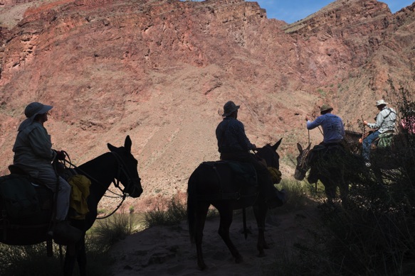
Mule train, packing supplies into Phantom Ranch and packing garbage out of the canyon.

From the Colorado River up to Indian Gardens.

From Indian Gardens, the trail turns sharply upwards. We never knew how or where the trail would exit the canyon, which seems impossibly walled on all sides. The trail always finds a way, easier seen from above.

The Bright Angel Trail receives a lot of traffic, and is loose and dusty in places, compared to the surface of the North Kaibab Trail.

By late afternoon, we enjoy shade beneath the South Rim.

The trail always finds a way.


And just as the sun sets, we reach our final water and rest stop on the Bright Angel Trail at the 1 1/2 Mile rest house, and old stone shelter adjacent to a water tap and pit toilets. From the Colorado River there are three official tap water sources on the Bright Angel Trail, a welcomed resource which enables us to travel without more than a few sips in our bottles.

At dark, we crest the rim and reassemble our bikes, riding directly to the grocery store and a bivy under the stars along a nearby section of the AZT. Elk bugle loudly through the night.

Resupply is easy at the South Rim village or in Tusayan, just outside the park. Each community has a proper grocery, although Tusayan boasts more commercial eateries as it is outside the park. The post office in the park at the South Rim offers full services during the week, including General Delivery shipments.
We rely on a GPS track, but when following the trail, it would he hard to get lost. Several wilderness detours in the south require deviation from the actual AZT, which is where the GPS becomes especially valuable.

Bikes+AZT

Grandview Lookout Tower, looking south toward the San Francisco Peaks above Flagstaff.

North to the Grand Canyon.

This section of the AZT is well signed and smooth. After Tusayan, clean water sources are limited, although we have twice sourced water out of the Russell Tank.

Russell Tank, like many systems in the area relies on a natural catchment area, a large steel container, and a method to dispense water to cattle via a trough. Our water came from the smaller covered tank adjacent to the trough. The large main tank, seen in profile to my right, is empty for the season.
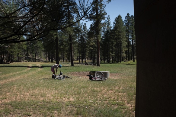
Nearing Babbit Ranch, a large private land tract which allows the AZT to pass via a series of doubletrack roads.

Power from one of the two major dams on the Colorado River.

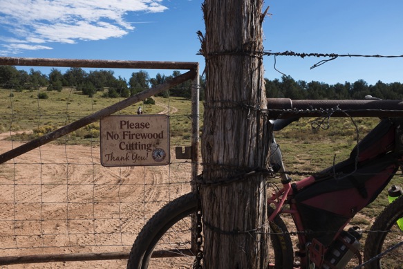


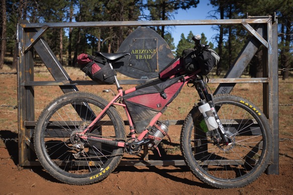
At the start of each major trail section is a steel Arizona Trail sign like this one, showing a map of the route through the state and an invitation to hikers, equestrian, and cyclists to enjoy some or all of the route.

Nearby is an official volunteer-supported water cache. We see unofficial caches along much of the route– usually one or two gallons of water under a tree or near a road crossing, or next to a fence. We try to leave water for hikers, who require more time to connect reliable water sources. We each pull a liter or two of water from this cache for the remaining distance to Flagstaff.

Leaving Babbit Ranch, back into the forest.

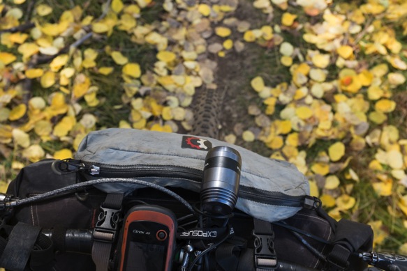
I’m using a Sinewave Reactor USB-charger to power my Garmin e-Trex 20 GPS. I’ll need to add a small in-line battery so that the device remains powered when I stop. So far, the steerer tube mounted charger has provided power without fail, and is out of the way of mud and other contaminants, unlike the B&M USB-Werk which I stored on the side of my down tube near my front wheel. The wiring for the Sinewave Reactor comes through the steerer tube and is a welcomed answer to the consistently flawed Supernova Plug charger, which has seen several failed iterations.

Humphrey’s Peak, 12,637 ft.

My new enduro-endurance bikepacker on the Arizona Trail, where it is right at home. The RockShox Pike fork is amazing. The geometry of the bike feels much more natural than the Krampus with the Fox Talas fork. I’m happy to be back on 2.4″ Ardent tires.
Rising again above 9,000 ft, we rejoin aspen groves near the Snowbowl.



Here, we connect to a network of trails enjoyed by Flagstaff locals, and a famed descent into town. Signs like these…

The trail is well traveled and smooth at times.

Elsewhere, more rocky and technical.


Leaving the Coconino National Forest for Buffalo Park and the Flagstaff Urban Trail System, we connect rocky singletrack to crushed gravel and pavement. A bike path along Route 66 and the BNSF railroad line takes us to a plethora of coffeehouses, breweries, and supplies.
Lael and I have spent time in Flagstaff in the past, making a home here for a few days two years ago in the fall. Get a cappuccino at Macy’s, a beer at Mother Road Brewing, and fix your bike at Flagstaff Bicycle Revolution which offers a public-use repair stand.


Where’s your front derailleur?
Broke on the first day of the AZT. Got a new one in Flagstaff. The other one had a good life, about a year and a half and lots of fun times.
Almost as cool as our Baja tour. *-)
Fantastic pictures. Crossing the grand with bikes on back, Wow. From bikepacking to packbiking. Your new pink machine looks great.
Great piece!
Jeff Della Penna TRAINING PARTNERS LLC 505.231.5039
>
Nicholas, that was a great read. I got a feel of what it would be like to pack a bike across the canyon, which I may try someday. Thank you for putting the effort into creating that post.
Great story, fantastic pics.
Did AZT750 this year … after seeing these pictures I might wanna go back 😉
https://guntherds.exposure.co
You are awesome! every time I read you I become all jealous! I want to follow your tracks! keep enjoying the beautiful roads you ride thru!
I’ve loved following you all for the past year or so. Finally some familiar terrain though! I was hiking M Humphrey’s last summer and almost died at the summit during a lightning storm above treeline.
Looking forward to some more of your travels. I can’t wait to get my own butt out on the road.
Trey, You live in Flagstaff? We might be back in Flag later this month.
I wish! I was in the area for work. I’m over in Connecticut…. Keep me in mind if you make it to New England!
Hola Nicholas,
Last Friday I got my Hayduke 27.5+ hardtail and it’s awesome! It came with hydraulic brakes & 1×10 and I’s analyzing turn it to 2×10 and replace the brakes with Avid BB7… but after a short daytrip (50+ miles going from pavement, to gravel, to “abandoned” train tracks) and not missing that much the extra gears, I’m not sure if it’s worth it (my budget is pretty tight also).
Do you think it would be crazy to ride 4000 miles with 1×10?
Saludos,
Federico
It isn’t crazy, as long as you have the low gears you require or you are at peace with the fact that you may be walking a bit. It sounds like you got out for a nice test ride, but don’t forget the kind of mountain terrain you may be riding. Switching a chainring is cheaper than switching to 2×10, so if you need lower gears consider a 28T ring, perhaps a steel ring if you can get your hands on one. For 4000 miles I would plan to change your chain about halfway through the ride. I don’t expect you will have any issues with the hydraulic brakes, and may have a hard time going back to mechanical brakes in the future. If it ain’t broke, don’t fix it!
Hola Nicholas, THANKS for your prompt response! I already have 2 rings a 28T & a 30T (and a spare chain). It make sense not changing to mechanics (and it’s cheaper) as I won’t be going through “very remote” locations along this trip very often 🙂
When do you leave on your trip?
I’s planning to leave next week, but I decided to delay it for a week to vote in the presidential elections and to see if I’m able to get a little more budget (I’m selling not essential used gear online)… as I’m planning to give away 1000 printed portraits along the road 🙂
Hi Nicolas! What a pleasure to see your photos. We had pizza and breaksticks on the last day of interbike, and hung out with Logan and tumbleweed bikes designer!
I’m happy to see your adventures going rad.
Are you enjoying that drive side hike-handle?
Also, I am glad to see your endorsing the sinewave charger. Am about to be done with my first dynamo wheels et, and was researching chargers. Do you have any other a that you want to, but have yet to try?
The Sinewave is great but may require a cache battery for some charging needs, look for a small battery with pass-through charging. Limelight has one that has been recommended. Alternatively I have enjoyed the B&M USB-Werk which has a small cache built into the system, which evens the output at low speeds and while stopped. But, the BM charger will draw power even when not in use and thus requires a switch if used with a light. The Sinewave models do not have this issue and when not in use, will not draw power away from the light.