Picketpost to the end on the Arizona Trail

Nicholas Carman1 5541

Lael on her Specialized Era Expert in the hills around Mt. Lemmon.  The AZT is an incredible resource.  For an alternate cross-Arizona route consider blending the AZT with the Flagstone 500 route which incorporates Sedona, some of the Coconino Loop, and the Black Canyon Trail, thereby avoiding paved detours along the middle section of the AZT.  Both are worthwhile routes through the state.  The Arizona Trail, or more accurately the AZT750 version for mountain bikes, should make every avid bikepacker’s list.  Check out Part I (Utah to Flagstaff) and Part II (Flagstaff to Picketpost) from our travels on the Arizona Trail.

She introduces herself as Corinna.  Asking where she is from, a question which is similarly challenging for us to answer, we receive a short history of her life.  She has recently taken a new job as a librarian in Durango.  She rides a Salsa El Mariachi.  The staff at Velorution Cycles are knowledgable and supportive, she tells us, and this is her first solo bikepacking trip.  This is her third, or perhaps fourth morning on the Arizona Trail.  We’ve been living on the trail for over two weeks, minus a five-day layover in Flagstaff during the rain.  Sitting with legs crossed, mixing Emergen-C vitamin drinks and dining on rice crackers and apples, the first thing I notice at eye level is the pattern of bloody scratches on her shins.  Ours looked the same just a few days ago, although by now the lightly scabbed wounds hardly show.  We inquire, knowingly, about the trail ahead.  We share similar details of the trail north of Oracle: overgrown, hard to find, and prickly.  But we’re happy to report— as we are crossing paths in opposite directions— that she is soon to enjoy the smoothest part of the entire Arizona Trail in the downhill direction.  If she was overjoyed at the good trail ahead, she doesn’t show it, nor do we grimace to learn that more leg scarring thorns lay ahead.  Like choosing to go cycling in England, you can’t hate the rain.  You can’t hate Arizona for rocks and thorns and 90 degree heat.  Most of the time, being here is pure desert bliss.    

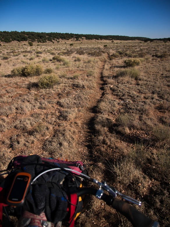
We arrive at the Picketpost Trailhead, the beginning of this section and the end of the long detour around multiple wilderness zones, with great excitement.  From our last time in Arizona in 2013 when we connected from Tucson back towards Phoenix via this route, this section was one of our favorite routes in the state.  The trail climbs several thousand feet along rideable singletrack to a series of high points, tracing high lines on the walls of deep canyons, plummeting down to the Gila River and the lowest point on the entire AZT.  The trail from Hwy 60 (Picketpost) to the small community of Kelvin on the Gila River is the keystone in the AZT, the most recently completed section of trail.  It is also the most stunning ridable section of trail— thereby excepting the Grand Canyon and sections of the Highline Trail.  This section is nearly 100% rideable.

Descending to the Gila River mid-afternoon, we spend more than an hour swimming in the shade.  By the time we are back on the bikes, the sun is low in the sky.  Even though we know better, we’ve miscalculated the remaining distance to Kelvin, where we hope to refill our waters.  The silty Gila River would be fine if treated, although we’re only traveling with a few spare chemical treatment tablets from South Africa with dubious properties.  The remaining 15 or 16 miles are wonderful riding, a little longer than expected, a little more topography than expected, and naturally, a little slower in the dark.  As we close to within 7 miles of Kelvin, in the dark, we both run out of water.  I have been rationing for the last hour and am quickly thirsty.  Without spoken agreement, we begin riding faster, grunting up short steep climbs, trusting the shadows and riding blind around tight corners.  It is an exhilarating ride fueled by desperate thirst.  We arrive without water, although Lael exhumes a small bottle of spirits out of her framebag and we wet our lips like sunburnt cowboys.  For a moment, it quenches the thirst.  We race the final mile to Kelvin for water.  Up the road there is supposed to be a trailer court.  We travel in that direction, into the darkness, but soon return to the glowing yellow lights of the locked ADOT yard.  I climb and squeeze between the gate and load all of our bottles and bladders with brackish, yet potable tap water.  Outside the fence we each consume over two liters while laying in the gravel, enjoying the feeling of mid-summer in October, now at 1600ft in southern Arizona. I return to refill our bottles, tearing the back of my cut-off t-shirt on a piece of barbed wire.  We roll away to camp for the night.

The following afternoon, forty or forty five miles down the trail towards Oracle, we cross a large wash and a low point on our track.  Rain clouds loom overhead, and only a short distance stands between us and our next resupply in the town of Oracle. I reason that we could arrive just after dark, perhaps and hour after sunset, two hours maximum.  Lael is skeptical, fooled one too many times by me, by straight-line mileage, and by the Arizona Trail.  We scout a route down into the valley, where we expect to find a paved road and several towns.  We race down Camp Grant Wash, keeping to the crusted sediments along the edges of the dry seasonal riverbed, avoiding the soft jeep tracks in the center.  We arrive at the railroad line adjacent to the road and ride the remaining miles into Mammoth in the dark.  It is a long detour for food, but since we are traveling without shelter, it also assures some chance of finding cover if needed.  We eat canned beans from the Dollar General and fresh pico de gallo from the new Mexican grocery next to the Circle K.  We sleep in town for the night, on a hill just above the main road.  In the morning we ride back out to the mouth of the wash and back up toward the trail.

Leading the way up the wash without GPS– as I have attached it to Lael’s handlebars for this trip– I miss the turn onto the trail.  I continue further and further up the wash until nothing looks familiar, thinking the trail crossing is still ahead of me.  I push towards rock outcroppings and even a windmill, faint recollections from yesterday afternoon.  But in different light, in a different direction, nothing looks familiar and I am lost. I could go back the way I came, but I feel like the AZT should still be ahead of me, or right near me, and I don’t know how to admit defeat and turn back.  I ride up a well-travelled side drainage toward the south, reasoning that I will at least cross the AZT at some point, but I don’t.  I climb and climb and climb the sandy track, desperate at least to gain some view of something.  By the time I reach elevation, I am hopeless that I can solve this riddle and resolute that I must retrace my steps, all of them.  But by that time I figure Lael will have left the wash, and would have gone back to Mammoth or toward Oracle on the AZT.  We don’t have cell service, nor an obvious meeting place.  I crest the hill and continue along the road.  I cross the Arizona Trail and begin back toward the wash.  But I discover that I am actually headed in the wrong direction, toward Oracle and away from Lael.  I reverse my route and now begin riding toward the wash on the AZT, about two thousand feet below.  The trail climbs and falls over a series of rounded peaks in these folded mountains.  I’m charging around corners at race pace, trying to make the most of my mistake and to find Lael as soon as I can.  Coming down the final rocky ridge toward the wash, I finally spot Lael walking her bike up the ridge.  We’re overjoyed at the encounter, nearly two hours after we split.  She decided, finally, that she would continue toward Oracle.  She left a note at the trailhead in the wash.  I fall to the ground, needing a proper meal.  Lael is crying and laughing.  It feels like a miracle, but we soon pack up and begin toward Oracle, together.

In three days, we’ve run out of water, run out of food, and lost each other.  That’s the price of riding like vaqueros, too confident in our abilities and in my sense of direction.  That, and the final ride to Oracle is a mess of overgrown trail, hard to follow and famously prickly.  That is how our legs came to wear all these scabs and scars, branding from the trail.  That is how Corrina and Lael and I commune upon meeting.  

The rains finally arrive in Oracle, and we seek shelter for the night under cover of $1.50 pints of Miller Lite at the Oracle Inn and a country band with a digital drummer.  We sleep under the pavilion to the side of the post office.  Gusting winds blow the rain sideways and I barricade our exposed down bags by turning several picnic tables on their sides.  In the morning, we resupply and head up Oracle Ridge.  

Oracle Ridge holds great weight around here, much like the Highline Trail and the Grand Canyon—these are the epic obstacles on an otherwise challenging route.  But, Oracle Ridge isn’t as bad as we had expected.  There is some rideable trail, some easy hiking, and some shrubby overgrown trail which could be a lot worse, which is proof that the trail isn’t very good.  The fact that this is still the Arizona Trail is remarkable considering the many sections of trail which receive frequent maintenance, seemingly swept clean on a daily basis.  We reason that even though we are carrying our bikes up 4,000ft, most people wouldn’t be able to ride much of the descent anyway.  About six hours after leaving Oracle, we exit the trail at Summerhaven, 20 miles and 4000ft away from our starting point.

The AZT750 continues along a prolonged stretch of pavement around wilderness, including a long descent, which stings after such a hard-fought ascent.  We enjoy the mellow pedal down Mt. Lemmon and seek shelter for a third night under the overhang of a locked concrete block toilet shelter in a closed campground.  In the night, we rearrange ourselves to avoid pooling water from the rain.  

Our ride resumes as the AZT exits wilderness, on a section of trail between Molina Campground and Redington Road, where it detours yet again around wilderness, channeling us into Tucson for the night.  Leaving Tucson begins a manicured section of trail through Saguaro Nation Park, the Colossal Cave area, across Cienega Creek, and under I-10.  And that’s where we meet Corrina, the only cyclist we meet along the entire AZT.

We tell her that we’re from Alaska, that we work seasonally and spend much of the year riding bikes.  She pauses, and asks our names.  

“Nicholas.” 

“And I’m Lael.”

Corinna informs us that she followed Lael’s Divide rides this summer and that it inspired her to get out and ride the AZT by herself.  

“Don’t curse me when the trail goes to shit”, Lael clarifies, distancing herself from responsibility.  “Mostly, the Arizona Trail makes me want to ride a road bike.”  

We laugh and point our tires in opposite directions.  

——————————–

Resupply, bold is on route: Superior, Kelvin (water), Kearny, Oracle, Summerhaven, Tucson, La Sevilla (water), Sonoita, Patagonia

Superior is 4 mi from Picketpost, Kearny is 7 miles off route, Oracle is 2 mi from the road crossing, Tucson is minimum 1.5 miles to decent resupply.  Kelvin is water, only.  


Download the complete AZT750 track at Topofusion.com.  Get current water date from Fred Gaudet’s site.

——————————–

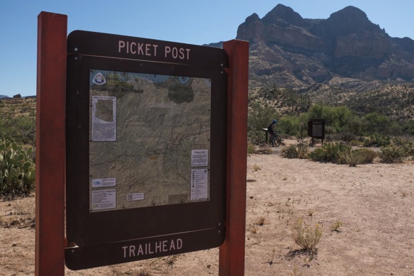
Leaving the Picketpost Trailhead toward Picketpost Mountain.

Nicholas Carman1 5436

Nicholas Carman1 5438

The trail reaches a series of high points.  The jeep track indicates the next high point in the distance, although the trail is hidden along the hillsides to the right.

Nicholas Carman1 5439

Epic AZT.  Rideable AZT.

Nicholas Carman1 5441

Nicholas Carman1 5443

Nicholas Carman1 5445

Nicholas Carman1 5446

Nicholas Carman1 5447

Coming over the third and final high point.

Nicholas Carman1 5449

Beginning the descent down to the Gila River.

Nicholas Carman1 5450

Ocotillo.

Nicholas Carman1 5452

Saguaro.

Nicholas Carman1 5453

Nicholas Carman1 5454

The 15 or 16 miles along the Gila River seem to catch many people off guard.  Don’t underestimate this section.  There is some great riding, but these aren’t free miles.

Nicholas Carman1 5455

Nicholas Carman1 5456

This is the Gila River.  Lael shares with me that on the Tour Divide, she sang the tune of the song “Tequila” to herself in the night while riding through the Gila.  Insert “the Gila” into the song, in place of “tequila”, then repeat the tune over and over and over.  These are the secrets to riding 200 mile days.

Nicholas Carman1 5457

Into the night, out of water.

Nicholas Carman1 5459

Nicholas Carman1 5462

Kelvin is just a dot on the map, no services other than water are available.  Kearny is about 7 miles down the road from here if necessary.  Oracle is another 60 miles of mostly singletrack.

Nicholas Carman1 5463

The Gila River.

Nicholas Carman1 5464

The much-loved Ripsey segment.  Views and high quality ridgetop singletrack.

Nicholas Carman1 5489

Nicholas Carman1 5490

Nicholas Carman1 5491

Nicholas Carman1 5492

Nicholas Carman1 5493

Nicholas Carman1 5494

The Meriwether is at home on many of these trails.  I think less often about full-suspension bikes, as a result.  

I’m happy to see a hardtail revival in the new breed of 27.5+ bikes like the Advocate Hayduke, Jamis Dragonslayer, and Marin Pine Mountain 2, but why are 29” trail hardtails losing steam, especially with the now common wide trail rims?  Even a company like Salsa, who claims the “Adventure by bike” motto, allows their El Mariachi 29er hardtail to languish in mediocrity while chasing esoteric “bikepacking” models?  

I replaced my broken front derailleur in Flagstaff with a Shimano SLX direct mount unit.  

Nicholas Carman1 5495

We’ve learned a lot in the past year, or year and a half.  In that time Lael has learned how to navigate by GPS, she’s ridden three different bikes, and clocked a whole lot of miles and saddle time.  Riding the Specialized Era on the AZT is a really positive experience, and puts her technical skills on a fast track.

Nicholas Carman1 5496

Nicholas Carman1 5499

I cut my rear tire sidewall, a Maxis Ardent EXO casing.  Lael adds stitching sidewalls to her toolbox.

Nicholas Carman1 5497

Nicholas Carman1 5500

At Freeman Rd., a little used trailhead provides a much needed water cache along this 60 mile stretch of trail between Oracle and Kelvin.  A local motel owner in Oracle stocks this cache, and leaves his business card with a welcoming note.  

Nicholas Carman1 5501

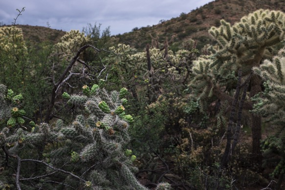
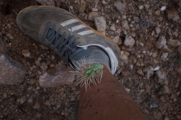
Cholla forests plus wind equal lots of cholla in the trail, lots of cholla in our tires, and lots of cholla in our legs.
Nicholas Carman1 5502

Nicholas Carman1 5503

Windmills and washes.  This section isn’t the most scenic, but the riding is great and old ranching history is abundant.

Nicholas Carman1 5504

Camp Grant Wash, our detour route to Mammoth.

Nicholas Carman1 5505

The threat of thunderstorms leaves little more than a few drops, but an impressive rainbow.

Nicholas Carman1 5507

Nicholas Carman1 5508

In rural Arizona, you can count on Circle K.

Nicholas Carman1 5509

Mammoth.

Nicholas Carman1 5510

Camp Grant Wash features a substantial freshwater seep.  We pulled water straight from the source.

Nicholas Carman1 5511

The remaining trail to Oracle is overgrown with dry grasses, which are losing lots of sharp seeds this time of year.  Acacia thwart low points and drainages.  Cholla pepper the hillsides.  

Nicholas Carman1 5512

Nicholas Carman1 5516

Oracle.

Nicholas Carman1 5517

Oracle State Park, en route to Oracle Ridge.  The first miles out of Oracle are great!

Nicholas Carman1 5518

Mt. Lemmon and Oracle ridge loom in the distance.  Thunderstorms threaten.

Nicholas Carman1 5519

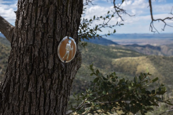
Classic AZT signage.

Nicholas Carman1 5520

The smoother side of the AZT.

Nicholas Carman1 5521

This is the part where we joke about how pleasant Oracle Ridge is, before the trail turns up, and before the trail nearly disappears.

Nicholas Carman1 5522

Nicholas Carman1 5523

Nicholas Carman1 5524

There are some rideable sections of singletrack, and a substantial section of jeep track in the middle which is rideable.

Nicholas Carman1 5525

There is a trail in there somewhere…

Nicholas Carman1 5527

Looking east over the San Pedro River.

Nicholas Carman1 5529

Rocky, overgrown, but not too bad with the bike.  There is a nicer way to ascend or descend, along the Oracle-Mt. Lemmon Rd., a winding graded dirt road connecting Oracle and Summerhaven.

Nicholas Carman1 5530

Nicholas Carman1 5531

Some riding.

Nicholas Carman1 5532

Ducking and crawling with the bikes.

Nicholas Carman1 5533

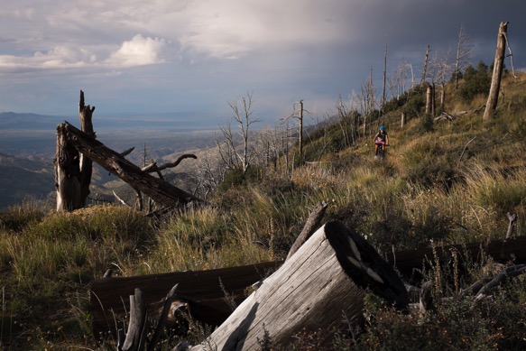
The final section includes some on and off riding, although there are definitely several miles without riding.  We’re happy not to have to fight thorns, at least.
Nicholas Carman1 5534

The paved Catalina Highway takes as back to 5000ft.  This is one hell of a road climb from Tucson.  

Nicholas Carman1 5535

Shelter from the storm.  Mostly, traveling without a tent has been a blessing.  Instead, we brought a simple ground cloth and our sleeping bags and pads.  Lael is using an XS Therm-a-rest Prolite pad, and I’m on a 99cent windshield sunshade.

Nicholas Carman1 5536

Just over the hill from the Molino Basin Campground.

Nicholas Carman1 5537

Nicholas Carman1 5538

Nicholas Carman1 5539

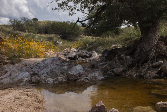
There is a lot of clear freshwater this time of year.  We both bathe and splash for a bit.
Nicholas Carman1 5540

The AZT750 route soon departs the actual AZT again as the trail continues into the Rincon Mountain Wilderness.

Nicholas Carman1 5542

Nicholas Carman1 5543

The AZT750 take a series of rough 4×4 tracks back to Redington Road, an unpaved access road connecting us with metro Tucson.

Nicholas Carman1 5545

Redington Road is all guns, and lite beer, and 4x4s.

Nicholas Carman1 5546

Leaving Tucson, following a pleasant paved section of about 15 miles, we reconnect with some of the smoothest singletrack of the entire route in Saguaro National Park.

Nicholas Carman1 5577

Nicholas Carman1 5547

Nicholas Carman1 5548

Water at La Sevilla Picnic area, between Saguaro NP and I-10.

Nicholas Carman1 5549

We continue south of I-10 on more super smooth trail, trying to finish in time to get back north for an upcoming weather window, which will be essential for Lael’s AZT750 ITT.

Nicholas Carman1 5550

Corinna, from Durango, CO on her Salsa El Mariachi with 1×10 drivetrain and Maxxis Ardent 29×2.4” tires.  She is the only bikepacker we met on the entire trail.  Read Corinna’s story about bikepacking the AZT300 on the Velorution site.

Lael later admits that she is surprised to meet a woman alone on the trail.  I suppose it gives her some perspective regarding all the strange reactions she has gotten while traveling alone.  

Nicholas Carman1 5253

The AZT: hike, horse, and bike.

Nicholas Carman1 5551

We peel away from the trail at Sonoita, needing time to get back north so that Lael can do it all again.  I thus continue a pattern started 8 years ago.  I have never completed a route or trail.  There is always reason to come back.

Nicholas Carman1 5552

Our shins will heal and we’ll be back for more of the AZT.  Arizona will always be one of our favorite places to ride.

Nicholas Carman1 5451


Flagstaff to Picketpost on the Arizona Trail

Nicholas Carman1 5365

The is Part II of a three part series about our tour of the Arizona Trail.  In essence, this section is really two parts: the singletrack ride from Flagstaff to Pine, and the wilderness detour from Payson to the Picketpost Trailhead at Hwy 60.  Check out Part I from the Utah border to Flagstaff, AZ.

There is more to Arizona than a few spare saguaro in an endless desert.  Arizonan topography is more complex than I once thought, including broad plateau, deep cut canyons, and sky islands.  Changing scenery is entwined with variable elevation, from golden aspens at 9000 ft to wide open pine forests at 7000ft, piñon and juniper and scrub oak at 5000ft and classic Sonoran scenery dominated by the towering saguaro cactus below 3000ft.  And in a few places, such as in the Grand Canyon or on Mt. Lemmon, you’ll traverse multiple zones in less than half a day.  The Arizona Trail crosses reliably flowing surface water, in the form of Arizona’s major rivers, in no more than a half dozen places.  As expected, overall, Arizona is a dry state.  

Leaving Flagstaff toward the south, the AZT wanders through spacious pine forests and open meadows, passing a series of shallow wetlands and lakes.  A full day of riding is required to exit the pines, at which point the trail reaches the edge of the Mogollon Rim and drops toward the Highline Trail and the town of Pine.  The quality of riding on the Mogollon Plateau is high, not full of thrills and big views, but mostly smooth with the exception of some rocky trail and tracks battered by cattle in wet weather.  The first miles out of Flagstaff are especially memorable.  There are minor resupply opportunities off-route in Mormon Lake and Happy Jack, although we packed food for the distance from Flagstaff to Pine, without a peanut to spare.  Pine is a great trail town thanks to several local eatieries and a brewery called That Brewery, as well as a nice local grocery store.  

The Highline Trail looms as one of the great challenges of the AZT by bike, a reputation bolstered by the number of times its name is uttered in simple reference to the major obstacles along the AZT, a menacing gang including the Canyon and Oracle Ridge.  But not all challenges are created equal and the Highline Trail is remarkably ridable with high scenic value, an impression gained from our extremely low expectations.  The Highline is a 50-plus mile trail along the Mogollon Rim escarpment, crossing every minor drainage which comes from the cliffs above, although the AZT only follows about 20 miles of that trail.  Sections of the Highline are highly ridable, seemingly taken right out of the Sedona playbook, which sits at a similar elevation not far away.  Southbound riders definitely benefit from some gravity fed assistance overall, although the trail climbs and descends in both directions.

South of Pine, riders continue along a brief sections of the actual AZT before beginning an extended detour around the Mazatzal and Superstition Wilderness areas ending at the Picketpost Trailhead where the route rejoins the AZT.  The bikeable AZT750 continues on a series of chunky dirt roads to Payson where full resupply is possible 24/7, and on graded dirt roads and pavement to the south, including the scenic Apache Trail along the Salt River drainage.  Between Payson and Picketpost, quality roads and frequent resupply make for a quick and easy ride.  

The Apache Trail connects a a series of dammed lakes along the Salt River, each lake taking the place of what was once a great valley or canyon.  The presence of crystal blue water in the desert is stunning, and a welcomed relief on hot days.  The Apache Trail connects us to the furthest reaches of urban Phoenix, to a community called Apache Junction which provides convenient resupply in the form of a Basha’s supermarket on route, as well as other amenities.

Beyond Apache Junction the AZT traces a series of dirt roads, including a final water resupply in Queen Valley, before reconnecting with the Picketpost trailhead at Highway 60.  From this point, the town of Superior is about 4 miles to the east.  From this point toward the town of Oracle, the riding gets really, really, good.

Get GPS data for the AZT750 at Topofusion.com.  Current water resources along the AZT managed by Fred Gaudet.

Resupply notes, bold is on route:

Nicholas Carman1 5407

Flagstaff, Mormon Lake, Happy Jack, Pine, Payson, Jake’s Corner, Punkin Center, Tonto Basin, Tortilla Flat, Apache Junction, Queen Valley, Superior

There are a number of easy water resupply point between Flagstaff and Pine in the form of USFS campgrounds, just off route.  There are several near Mormon Lake and several at the intersection with AZ Rte 87.  There is clear running water along eastern sections of the Highline Trail.

————————-

Riding out of Flagstaff. 

Nicholas Carman1 5352

Regaining some elevation, looking back at the San Francisco Peaks.

Nicholas Carman1 5353

Above Lake Mary.

Nicholas Carman1 5354

Keep gates closed.  Jumping fences often saves time over opening and closing gates, and you’ll grow a massive pair of guns like Lael.

Nicholas Carman1 5355

Without shelter, October nights leave us shivering in our damp sleeping bags until the sun is well above the horizon, at least up above 7000ft.  Lael’s new Specialized Era transforms her riding, making her more confident over technical terrain.  The full-suspension platform also tracks better over rough ascents, improving her ability to climb rocky trail.  Fatigue is also reduced on long days.  There are many challenging technical sections of the AZT which require intense focus, yet there are many mundane rocky sections which aren’t all that challenging, but slowly abuse the rider over the course of a day.  A bike like this especially helps with the latter.  Rear tire clearance is a little tight.  

The proprietary Brain suspension is unique to Specialized bike and reacts to the terrain— firm on smooth trail yet opening to full stroke on bigger hits.  It is a brilliant system and it works marvelously.  I was a skeptic, until the first moment I rode it. 

Nicholas Carman1 5356

I remember a lot of mundane bumpy trail on the Mogollon Plateau, not that challenging, but taxing.  There is also plenty of trail much like this between Utah and the edge of the Mogollon Rim.  Lael and I call this “green circle trail”, and we like it.

Nicholas Carman1 5357

Through old oak groves which feel like they once accompanied a ranch house, amidst a greater ponderosa pine forest.  Northern Arizona is amazing, and most people have no idea.

Nicholas Carman1 5358

Much of the state is fenced to keep cattle in and keep cattle out.  Nick from Rogue Panda describes to me that Arizona is a “fence out” state, which means it is the responsibility of the landowner to prevent grazing cattle from entering their properly, not the other way around.  Nick spent some years doing trail work on public lands in the west.  In many states, it is the responsibility of the rancher to contain their cattle which becomes a financial burden considering the massive land tracts in the west, so the “fence out” principle is pro-ranching.

Here, a fence divides grazing lands on the right and non-grazing lands on the left.

Nicholas Carman1 5359

Pines, volcanics, sunshine, and sweet, sweet singletrack.

Nicholas Carman1 5360

Nicholas Carman1 5363

General Springs.

Nicholas Carman1 5367

General Springs Cabin.

Nicholas Carman1 5231

At the edge of the Mogollon Rim is a brief section of trail called the Pipeline Trail, a several hundred foot scramble up, or down in our case.  Our first impression was, “so, this must be the rim”.

Nicholas Carman1 5368

Aside from the Colorado River we cross the first flowing water on the Arizona Trail just below the rim.  Naturally, we splash in a knee-deep pool.

Nicholas Carman1 5369

Nicholas Carman1 5370

Nicholas Carman1 5371

Tarantula.

Nicholas Carman1 5373

Nicholas Carman1 5372

Some chunk, but lots of great trail.  There are large sections which require hiking, but the overall experience in positive.

Nicholas Carman1 5374

The trail crosses many drainages which means lots of fresh water, and lots of short climbs and descents.  This is some fine technical riding.

Nicholas Carman1 5375

Burn.

Nicholas Carman1 5388

Juniper.

Nicholas Carman1 5396

Shred.

Nicholas Carman1 5377

Nicholas Carman1 5392

Newer AZT signage on the right, older Highline signage on the left.  The Highline Trail is a classic in Arizona.  The descent down to the Geronimo Trailhead—southbound, remember— is awesome!

Nicholas Carman1 5393

Nicholas Carman1 5240

Nicholas Carman1 5394

Nicholas Carman1 5397

We finish the night by descending the final 800ft into Pine in near darkness, an exciting and frightening challenge at the end of a proper full day of riding.  Lael still doesn’t have the guts for such stuff, but my new pink bike nails it.  The geometry of the Meriwether, the Pike fork, a fresh pair of Ardent tires– they let me do things I shouldn’t.

Nicholas Carman1 5399

The following day we ride through Payson, stopping to dip in the East Verde River.  Surface water in Arizona is a precious resource.  I am sure to swim in all of it.

Nicholas Carman1 5400

Descending from Payson, adjacent to the Beeline Hwy.

Nicholas Carman1 5401

Jake’s Corner.

Nicholas Carman1 5404

Resupply in rural Arizona.  Okocim beer was a staple from our time in Poland.  This is the first time I have seen it in the US, at a small grocery in Tonto Basin, AZ.  Reminds us of our time with Przemek in Poland and Ukraine.

Nicholas Carman1 5405

Rural America is beautiful.

Nicholas Carman1 5406

Theodore Roosevelt Lake, collected from the upper Salt River drainage.

Nicholas Carman1 5409

This dam marks the point where the Salt River convenes into a narrower drainage, most of the way to Phoenix.  Along the way the river is collected in a series of lakes which are partly responsible with providing water to the greater Phoenix area.  The Colorado River picks up the slack.  The unpaved Apache Trail, eventually a paved road nearer to Phoenix, is a great ride bounded by wilderness to the north and the south, highlighted by a brilliant strip of water.

Nicholas Carman1 5410

Nicholas Carman1 5234

Migrating retirees treat this area much like migrating birds, stopping for a few weeks in spring and fall while traveling between their summering grounds up on the Mogollon Plateau and wintering grounds to the south in places like Slab City.

Nicholas Carman1 5236

Nicholas Carman1 5411

Leaving pavement for a bit.  This 150 mile road detour, both paved and unpaved, certainly shortens the time is takes to cover the 750 mile route.

Nicholas Carman1 5413

Nicholas Carman1 5414

We find ourselves camping on a sandy beach for the night, just a few steps away from clear freshwater.  I would have never expected this in Arizona.

Nicholas Carman1 5415

Nicholas Carman1 5237

Our campsite is on the beach in the foreground.

Nicholas Carman1 5416

The Apache Trail is an old stagecoach route from Tonto Basin to the Greater Phoenix area, which follows human trade and travel routes along the Salt River which have been in use for many centuries.  Theodore Roosevelt, who was president at the time of the construction of both the dam and the road, says, “The Apache Trail combines the grandeur of the Alps, the glory of the Rockies, the magnificence of the Grand Canyon and then adds an indefinable something that none of the others have, to me, that is most awe-inspiring and most sublimely beautiful.”  

Nicholas Carman1 5417

The western portion of the road is now paved, the eastern portion alternating between wide graded sections and narrow pieces of dirt, clinging to rocky mountainsides.

Nicholas Carman1 5418

Nicholas Carman1 5419

Nicholas Carman1 5420

Nicholas Carman1 5422

Tortilla Flat.

Nicholas Carman1 5238

Nicholas Carman1 5423

Nicholas Carman1 5424

As near as you’ll get to Phoenix on the AZT750.

Nicholas Carman1 5425

The AZT750 passes a Basha’s grocery in Apache Junction, the last good resupply until Oracle.  If touring northbound, the four mile detour to Superior might make sense.  Picketpost (the trailhead at Hwy 60, near Superior), is about 90 miles from Oracle.  

En route to the Picketpost Trailhead from Apache Junction along a powerline road, with a brief stop in the rural retirement community of Queen Valley.  There is a diner and a very small store there.

Nicholas Carman1 5426

Picketpost Mountain, a welcomed sight guarding the nicest section of the AZT.  From here to the Gila River is a newer piece of trail worthy of Theodore Roosevelt’s description of the Apache Trail.  If only TR rode a mountain bike…

Nicholas Carman1 5427

Rejoin the AZT, duck under Hwy 60.

Nicholas Carman1 5429

Picketpost marks the end of the annual AZT300 race, an event which predates the hefty AZT750.  The AZT300 begins near the Mexican border (lopping 14 miles of dirt road riding from the actual border), and includes a high volume of singletrack, excepting some detours around wilderness in the Tucson/Mt. Lemmon area.  The 300 miles route has been ridden in as little as 45 hours and 7 minutes by Kurt Refunder.  We’ll certainly take much longer, enjoying the majesty of Arizona.

Nicholas Carman1 5430

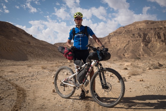
Crossing the Judaean Desert, West Bank, Israel

Nicholas Carman1 4252

It is HLC season in Israel.

Nowhere else have we engaged the local bikepacking community as in Israel.  America is a big country and there are many riders, but there are miles and miles of trail for each rider to hide.  South Africa is a big country which claims a lot of riders, but most mountain biking seems to happen behind closed doors on private land tracts, only on the day of a race or scheduled ride.  Israel is a small country with a lot of people and a lot of public trails.  The people are active, organized, and committed.  Self-supported bikepacking is rapidly growing out of a foundation of mountain biking and hiking.

We receive the details of a plan on our small yellow phone to meet Ilan Rubinstein at Mitzpe Yeriho at 1800 hours.  We will sleep within the confines of the community, a Jewish settlement on a hill above the city of Yeriho (Jericho) in the West Bank.  We ride at 0600 hours.  Active, organized, committed.

We were first invited to participate in the HLC race last fall, via the blog.  By the time we crossed the border from Egypt I had received invitations for accommodation or conversation over coffee in places further north.  Facebook friend requests flood from serious looking riders, their names masked by Hebrew characters which I still cannot read.  We meet on the trail, partly by coincidence, and they know all about us.  I don’t usually recognize them by name, but we are friends.

The 1400km HLC was organized by a core group of riders in less than a year, and the first race took place in April 2014 from the southern flank of the tallest mountain in Israel, Mt. Hermon, situated at the junction with Lebanon and Syria.  Zohar Kantor, a Tour Divide veteran, conceived the event.  Limor Shany traced a line across the country from north to south, an extension of the week-long supported mountain bike tours he has been operating for years.  Ilan Tevet is the ever-convincing marketing man with a Swiss Army knife of skills to facilitate and promote the event.  He was the one to invite us to Israel and to the HLC last October.

Last year, the weather was hot in April, with two substantial heat waves during the HLC.  April is a month tightly sandwiched between cool wet winter and oppressively hot summers– the weather can go either way, but is most likely to be hot and dry.  The north of the country features a typical Mediterranean climate with wetter winters, while the south is consistently dry most of the year.  In almost any part of the country, substantial rain results in unrideable trails.  Limestone soils quickly clog tires and irregularly shaped limestone fragments– their exterior surface slickened by moisture– are hazardous when wet.  I’ve heard the complaints from last year’s heat, but Lael and I have spent enough time traveling this country during the rains to know which is worse.

The culture of the HLC isn’t entirely new, except for the essential details of being a week long self-supported race across Israel.  Israelis love mountain biking and regularly ride in groups, scheduled one day a week or more.  We’ve met many groups of riders who have been together for as much as a decade.  Ilan Tevet’s group rides very early on Tuesday morning and gathers for a stomach full of hummus at 8AM, before parting ways for their respective professional lives.  Some groups employ a more advanced rider to aid skill building and as a guide.  And the bikes!– we’ve seen more high-end bikes in Israel than anywhere in the world.  Spotting an Ibis, Turner, or Santa Cruz in the wild in America is uncommon, except in high-octane wealthy mountain towns like Crested Butte or Moab, or attached to riders with supreme skill.  Even in the middle of a suburban forest in Israel these bikes are not uncommon, and their association with skill is seemingly at random.  The impact of global marketing has also pressed enduro and all-mountain trends into the Israeli mountain bike culture.  Knee pads and other armor are common.  At the same time, lycra kit mated to Epics and Scalpels and Superflys are all part of the scene.  A few rigid singlespeeders keep it honest.  And on Shabbat, we ride.  Check out the Ben Shemen forest on Shabbat.  Only Marin comes close in my experience.
Bikepacking is growing thanks to the HLC and to the popularity of overseas events like the Tour Divide.  Bikepacking for fun, or mountain bike touring, seems to be missing from the current patchwork of Israeli mountain bike culture, to the point that when we describe to some riders that we are touring the HLC route, they are confused about how this is possible.  American riders often make the same mistake, failing to differentiate touring the Great Divide Mountain Bike Route from racing the Tour Divide.
Coming from Jerusalem to Mitzpe Yeriho, we descend 2000ft on paved highways toward the Dead Sea.  We are the first to arrive and take a place at the picnic table outside the small grocery in the community.  Like many small planned communities in Israel, there is a gate surrounding the property and a structural steel gate at the entrance, often kept open during daytime hours.  But this is the West Bank, and even if only in my imagination, it is different here.  The shacks of sheepherding families line the roadside from Jerusalem.  But when we enter Mitzpe Yeriho, we could be in any other community in Israel, from the Negev to Galilee.

Ilan Rubinstein arrives first from Eilat, and quickly unveils a third of a bottle of Johnny Walker.  We’re sitting in front of half-empty pints of Tuborg Red and a tub of hummus, one half of our now-typical dinner.  Ilan serenades us with stories about the “spirit of the trail” and about the life-changing experience of racing the HLC.  It is inspiring stuff and Ilan is one of the greatest students and most sage instructors of the method.  But Ilan scratched from the HLC last year after a monstrous effort to Jerusalem.  The details of the end of his race are never made clear to us.  Despite countless queries, he avoids answering by chasing tangential trail philosophies.  He did the same thing last time we met him on the beach in Eilat.  There is something out there for him yet.  He arrives on a Specialized Epic with a combination of Revelate and Nuclear Sunrise gear.

Omri arrives next, a much younger man on a smartly packed Cannondale Scalpel with Porcelain Rocket gear.  He scratched even sooner in the race last year, but is quick to admit his mistake, with a smile.  The HLC is not like a short-source XC race, where he excels and where he draws much of his experience.  You cannot ride the same way, at the same intensity.  He recently spent several months in Ecuador touring Andean backroads, shadowing some of the routes he’d seen on Cass’ blog While Out Riding.

Nir deboards the same bus as Omri, a relative novice mountain biker (in time, not skills, since starting to ride three years ago) and a first time HLC racer.  He rides a singlespeed Kona Unit packed with Revelate Gear.  Nir is comfortable telling Ilan when he is overthinking, which amuses us greatly.

We’re just along for the ride.

Nicholas Carman1 4197

Nicholas Carman1 4222

Awake before dawn, above Jericho and the Dead Sea.  How else could you convince men to wear tights and sleep on plastic house wrapping on the ground in a park?

Nicholas Carman1 4199

Leaving Mitzpe Yeriho, we pass several small homes with large flocks of sheep and goats.  These poor Arab families are increasingly a minority in Area C of the West Bank as Israeli settlements grow at an extraordinary rate.

Nicholas Carman1 4201

A climb ending in a steep hike downhill sets the tone for the day.

Nicholas Carman1 4202

Nicholas Carman1 4203

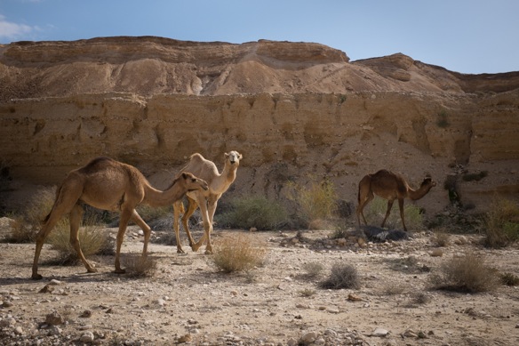
Searching for trails etched by sheep and camels over decades and centuries.

Nicholas Carman1 4204

Unlike many of the official hiking and cycling trails and 4×4 routes we have been riding, this trail likely predates the state of Israel by many years.

Nicholas Carman1 4207

A nearby mountain bike route called The Sugar Trail passes from the hills above Jerusslem to the Dead Sea, once a popular trade route now a popular shuttle run.

Nicholas Carman1 4211

Singlespeed and happy, Nir keep an even keel and an even cadence.  The sign on the front of his bike indicates that he is riding the HLC to raise money and create awareness for Asperger’s syndrome.

Nicholas Carman1 4212

Nicholas Carman1 4215

There are a series of wells along the first part of our ride, which makes carrying 7L of water feel a little silly.

Nicholas Carman1 4213

HLC training.

Nicholas Carman1 4214

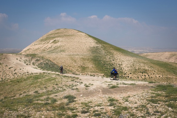
The Judaean Desert is never this green, locals say.

Nicholas Carman1 4218

Mountain bike traffic– luggage and water uphill, full-face helmets downhill.

Nicholas Carman1 4269

Nicholas Carman1 4219

Continuing to the south, the desert becomes increasingly green.

Nicholas Carman1 4226

Nicholas Carman1 4225

Nicholas Carman1 4227

Nicholas Carman1 4228

Nicholas Carman1 4229

Short steep hikes punctuate much of the first part of the ride.  Following GPS tracks up and down steep hillsides within sight of rideable trails is amusing, but the resultant ride is absolutely worth it, making connections one would not have seen from afar or from available basemaps.  The combination of local intel and a GPS are irreplaceable.

Nicholas Carman1 4231

A donkey would be a better tool than a bike up here.  Sage is in season, easily identifiable by smell from several meters away.

Nicholas Carman1 4233

Nicholas Carman1 4235

Nicholas Carman1 4236

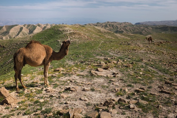
Camels and green grass.

Nicholas Carman1 4238

Nicholas Carman1 4239

Nicholas Carman1 4237

Some flow, some chunk, some hiking, and some technical descents if you choose to ride them– HLC training.

Nicholas Carman1 4240

Nicholas Carman1 4241

Nicholas Carman1 4243

Nicholas Carman1 4244

Ilan, the bikepacking poet from Eilat.  Ilan is well-known to provide hospitality to passing cyclists and has met many riders connecting distant parts of the globe, coming through Israel from Jordan and Egypt.  He has arranged for us to sleep in the aquarium in Eilat on several occasions, where he works as an accountant (with seemingly endless vacation time to go bikepacking).

Nicholas Carman1 4245

Nicholas Carman1 4246

Nicholas Carman1 4247

Nicholas Carman1 4253

Nicholas Carman1 4255

Still over 2000ft above the Dead Sea, Jordan in the distance.

Nicholas Carman1 4254

Metsokei Dragot, water refuel.

Nicholas Carman1 4256

Mostly doubletrack from here to the end of the day.

Nicholas Carman1 4257

Nicholas Carman1 4258

Nicholas Carman1 4259

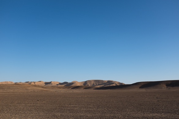
Morning above the Deas Sea, cool air reminding us that we are here in the right season.  This place is an oven in the summer.

Nicholas Carman1 4260

Our track crosses a series of deep wadis which drain to the Dead Sea.  We can ride into these canyons, but not out.  Local Palestinian 4×4 clubs are out enjoying the day, bumping Arabic electro tunes.

Nicholas Carman1 4261

Nicholas Carman1 4263

Lael judging form.  Looking good guys.  Good luck at the HLC!

The race starts from Mt. Hermon on Thursday morning at 7:00.  Follow along on the HLC 2015 Trackleaders page.

Nicholas Carman1 4264

Nicholas Carman1 4265

We eventually arrive at an important junction where we can continue toward our planned destination at the Aravah Junction, or ride toward Arad and end the day at a reasonable hour, before dark.  Before the decision is made, minds wander to cold beers and obligations at work the following day.  We finish our crossing of the desert in Arad, where regular bus services take Omri, Ilan, and Nir back to their lives.

Nicholas Carman1 4266

Nicholas Carman1 4268

We reconnect with the HLC track in Arad and begin riding north for a second time along this section.  If anyone asks, we live on this off-road artery across Israel, on the HLC.

Nicholas Carman1 4267

Central Negev Loop with Ilan and Danny, Israel

Nicholas Carman1 3815

The plan is to meet in Ezuz on Thursday night, near the border with Egyptian Sinai.  We’ll ride for two days through a southwestern slice of Israel normally reserved for artillery training and ranging antelope, and not much else save for a single road crossing with a free campground and a water tap.  Israelis call this “the backyard”.  When we arrive, I ask about the terrain even through I’ve studied the GPS track.  “Should be mostly dirt roads”, Ilan says.  

Ilan and Danny are coming from the city, escaping busy lives for fifty something hours of touring and training in preparation for the upcoming Holyland MTB Challenge, a north-to-south cross country endurance race set to depart in early April.  Ilan is, as he calls it, a shadow organizer of the event, who is proud of the route, the website, and the chance for others to ride and race across Israel.  Both Ilan and Danny rode last year– mostly together– and both scratched from the race after five days.  Achilles tendons worn by pushing bikes uphill is the shared excuse, although they weren’t on track to finish the 800+ mile route within the 11 day cutoff.  Both are keenly working to improve several underrepresented mountain biking skills: bike pushing, sleeping comfortably and efficiently outside, and learning to rest and relax while stopped outside gas stations and grocery stores.  

Lael and I plan to arrive in Ezuz by way of dirt roads from Sde Boker, which is a quick ride on hardpacked dirt with tailwinds.  It is Thursday afternoon and the area marked “No Tresspassing!  Firing Area”, is silent.  The Israeli weekend is Friday and Saturday.  We arrive in Ezuz four hours before Ilan and Danny will arrive, but just as two other riders depart the cafe.  One rider is named Ilan.  For a minute, I’m confused.  What is your last name?  “Rubenstein”, he clarifies.  Ok, not the Ilan we are meeting, but he knows that the other Ilan is coming.  How is it that on the same day two bikepackers named Ilan are riding across the same desert tracks from Ezuz, a tiny community of only twelve families?  This Ilan assures me that the coincidence was discovered days ago, via email or forums.  Since the route is only passable on weekends, and the desert is only palatable in the cooler months, and the HLC is fast approaching, the coincidence is understandable.  This is our second major introduction to the active bikepacking community in Israel.  The first are the dozens of emails I’ve received from riders who have offered assistance, shelter, and routing through their country.  Lael and I remark that South Africa was supposed to be real hot about mountain biking.  I’d never heard of mountain biking in Israel, but I’ll be sure that you do.  These people actually ride bikes!

Danny and Ilan arrive in the evening as scheduled.  After introductions and a beer, we settle into a nearby grove for an early rise, agreed not to come from an alarm– we’ll meet in the morning when we wake.  Seems logical.  You never know who you’ll meet on the internet.  

Morning brings a casual pedal up-drainage, slowly trending steeper through gravelly wadi and hard dirt riverbank.  The effort comes from the upper legs, from deep muscles, but is not entirely exhausting for us.  That is, Lael and I have been at this for over six months, and we’ve been sucking air tackling steep climbs and gravelly wadi since arriving in Eilat.  Danny and Ilan are more accustomed to the hard dirt trails up north, and probably office chairs, I think.  They describe spacious pine forests and manicured trails in the center of the country.  

Nearing our expected midpoint lunch stop– a campground with water– we split the group in half.  Lael and I ride onward to rest at the campground.  Lael wants to go for a run, so we agree to get there first.  Danny and Ilan rest in the shade of a river bank, agreeing to meet a short time later.  Danny arrives at the campground as Lael is off running.  We talk.  Lael returns.  The three of us talk, fill waters, lube chains.  Ilan is missing.  Danny and I jump on our bikes, now several hours since arriving here for our rest.  The sun is getting low.  We meet Ilan just over the first rise, pushing his bike.  He has pushed for 6km, which accounts for some of the only easily rideable dirt road of our half-day wadi ascent, not that it was easy.  But it was rideable.   

Under the shade of stone walls and palm fronds– a free camp area provided by the Israeli government– we clean out the inside of his tire.  Danny has a tube that doesn’t have any holes in it.  Ilan has been carrying his tube for years– never needing it, until now– discovering it has since been damaged by two years of transport on a bike.  Flipping his Trek Superfly right side up, we consult the maps loaded to memory and agree to ride the paved road to Mizpe Ramon.  There, we eat, we sleep, and restart in the morning.  Most importantly, we alter our course across the desert in trade for some fresh singletrack.  A section of the Israel Bike Trail from Mizpe Ramon to the ruins at Moa (near Zofar) has recently been built and signed, the newest piece in an expansive cross-country trail project which mirrors the Israel National Trail.  And, we’ll descend all day.  At least, we’ll finish the day lower than we started.

The IBT is a delicacy in a land of rough cut 4×4 tracks and sandy wadi.  The modern, durable trail is cut from cliffbanks, sinuous and signed for miles.  Intermittent sections of doubletrack offer mental respite from the trail, although in total, the IBT is suitable for novice to intermediate riders with strong fitness.  This is not the kind of trail that will scare first time bikepackers.  It will embrace them, leaving a smile.  It is a welcomed resource in a country already densely woven with riding and walking.  Israel is a great place to ride, and it’s getting better.  Events such as the Holyland MTB Challenge are working hard to make that fact known.

Swinging from canyon wall to canyon wall, traversing the sandy wadi with spinning legs and speed, the IBT shuttles us back down to sea level, to a series of ancient ruins, to a McDonalds on a paved road, to a bus back to Tel Aviv, and to the end of our brief partnership.  Ilan washes in the public bathroom, exiting almost as if he has showered wearing flip-flops and wet hair.  Lael and I are quick to buy and finish an expensive beer from the convenience store.  Sharing a few more pedals strokes away from the McDonald’s, we turn back upstream toward Sde Boker, now 11 feet below sea level in the Aravah Valley.  Danny and Ilan continue to the bus stop on the roadside.  

Arriving at Sde Boker, about 1500ft.

Nicholas Carman1 3756

David Ben-Gurion, the first prime minister of Israel, lies here.  The community also claims a university in an idyllic mountain desert landscape.  Many rural Israeli communities were built in the 1950’s and 60’s, reminding me of the many large university building built during this era in the US.  I think of SUNY Albany.  The designs are efficient, square, concrete.

Nicholas Carman1 3757

Nicholas Carman1 3855

Nicholas Carman1 3758

Sde Boker has a small bike shop, guarded by a tough group of local riders.

Nicholas Carman1 3759

To Ezuz.  They say it rained the week before we arrived.  Nothing but sun for us, although nights are cool and breezy.

Nicholas Carman1 3760

Ezuz.  Singlespeeds, Revelate luggage, and some capable riders.  Ilan Rubenstein, on the right, had kindly contacted me via the blog prior to our meeting.  I just didn’t know we’d meet like this.  We wait for Danny and the other Ilan.

Nicholas Carman1 3761

Pizza and beer in the middle of nowhere, Israel.

Nicholas Carman1 3763

In a stack of National Geographic magazines, I spot a series of issues from 1973 and 1974.  I know what I am looking for: “Bikepacking Across Alaska and Canada” by Dan Burden, May 1973.  This is the earliest use of the word bikepacking I’ve seen in print.

For Velo Orange fans, you’ll be excited to know the article which follows it is about the wild horses of the Camargue preserve in Southern France.  The Camargue is the name of a new Velo Orange touring frame with clearance for full-size 29″ tires.  An unnamed disc variant is soon to be released, although the styling breaks from the traditional European elements Velo Orange has championed for so long. 

Nicholas Carman1 3764

Many Israelis speak excellent English.  Even so, there is a unity in familiar equipment and sleeping on the ground.

Nicholas Carman1 3768

Nicholas Carman1 3770

As promised, “dirt roads”.  Kinda soft for 2.2″ tires, in my opinion.  Thinking about coming back to these parts with fatbikes some day.

Nicholas Carman1 3772

Some riding, some walking.  Good training for the HLC.

Nicholas Carman1 3771

Nicholas Carman1 3778

Nicholas Carman1 3773

Nicholas Carman1 3774

Nicholas Carman1 3776

The track finally climbs out of the wadi onto a hard dirt road.  We ride to fresh water, leaving Danny and Ilan behind.  

Nicholas Carman1 3777

Nicholas Carman1 3779

Nicholas Carman1 3780

Danny and I return to find Ilan, pushing his bike.  The rear rim skips across angular rocks, the deflated tire battered by months of use and six kilometers of pushing.

Nicholas Carman1 3782

Nicholas Carman1 3781

Nicholas Carman1 3784

Nicholas Carman1 3822

A quick tour of the tar road to Mizpe Ramon.

Nicholas Carman1 3788

Nicholas Carman1 3791

Nicholas Carman1 3792

Digital and caloric refuel at the gas station in town, before rolling less than a kilometer down the road to a free public camping area for the night.

Nicholas Carman1 3824

Nicholas Carman1 3795

Nicholas Carman1 3794

The small forest features fresh water, toilets, and trash cans.  A youth groups tends a fiery blaze for a few hours, until bedtime.  Free camping is awesome.

Nicholas Carman1 3796

The next morning, we arrive at the edge of town, at the edge of a cliff, at the edge of a crater, called makhtesh in Hebrew.

Nicholas Carman1 3798

Fresh IBT, all day long.

Nicholas Carman1 3820

These non-impact craters are the largest of their kind in the world, and the Hebrew word is accepted by the geologic community to describe them.  A single water gap drains each crater.  There are three prominent craters in the region.

Nicholas Carman1 3813

Nicholas Carman1 3814

Danny removes a broken spoke which has wound itself into the back of his cassette, hindering the freehub.  Both Danny and Ilan are part of a MTB group– 4 Epic– which organizes local races and rides.  Israelis are organized and efficient.  

Nicholas Carman1 3818

High quality trail, simple and durable, perfect for multi-day rides.  Would you please sign it in the other direction?  The trail is currently only signed north to south.

Nicholas Carman1 3826

“Get off bikes!”  Yeah right.

Nicholas Carman1 3825

Nicholas Carman1 3828

Nicholas Carman1 3830

A gasline road rolls across the basin of the makhtesh.  On their second day from town, and from office chairs, these guys are finally finding their stride.  Less than two months to go!  We talk about new gear choices for this year, and new strategies.  Ilan is walking the 11 flights of stairs to his office, preparing his hike-a-bike legs.  Rubber soled shoes are to be used instead of the hard plastic soles found on many performance shoes.

Nicholas Carman1 3831

Nicholas Carman1 3833

Nicholas Carman1 3834

Some of the trail is “green circle”, which makes Lael grin.

Nicholas Carman1 3836

Nicholas Carman1 3837

Ilan rides a full-suspension Trek Superfly with a mix of Revelate Designs and Nuclear Sunrise luggage.  The framebag space of a hardtail would be nice, he says.  The modular waterproof Revelate Terrapin setbag allows easy gear removal at the end of the day.  An SP dynamo hub powers an Exposure headlight, and soon, also the GPS.  A Lezyne backpack carries extra food and water.

Nicholas Carman1 3841

Nicholas Carman1 3842

Danny is riding a hardtail Trek Superfly with a Jones Loop H-barRevelate Designs luggage, and a Wingnut pack for extra food and water.

Nicholas Carman1 3843

Up, but not much.

Nicholas Carman1 3844

Nicholas Carman1 3845

And down.  Way more flow than the previous day.  

Nicholas Carman1 3847

Finishing with a short downstream wadi ride, we miss the final section of IBT singletrack to Moa.  We’ll have to come back with our Alaskan friend Christina for this piece of trail.  She arrives next week.

Nicholas Carman1 3849

Retro-modern: checking the bus schedule aside several thousand year old ruins.

Nicholas Carman1 3851

The end of our partnership.  Back to our real lives.

Nicholas Carman1 3852

Nicholas Carman1 3853

Nicholas Carman1 3854

Back to Sde Boker, by the now-familiar HLC route over the Marzeva climb.

Nicholas Carman1 3856

Nicholas Carman1 3857

Nicholas Carman1 3858

Nicholas Carman1 3859

Nicholas Carman1 3860

Camel tracks.

Nicholas Carman1 3862

Nicholas Carman1 3863

Back up to Sde Boker, just 1500ft above sea level.  Our next day of riding will take us all the way down to the Dead Sea, more than 1000ft below sea level.

Nicholas Carman1 3864

Thanks to Danny and Ilan for a great weekend on the bike.

Thanks to Tamir and Adi for hosting us in Sde Boker.

Ilan– the other one– we may still see you in Eilat.

Nicholas Carman1 3868

From Eilat on the IBT and HLC, Israel

Nicholas Carman1 3696

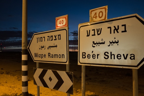
No culture shock, except two-thirds of every road sign is illegible, and one-third is in English.  And, for the first day we don’t know the exchange rate from shekels to dollars, so Monopoly rules apply (try not to spend, but it is not real money so who cares).  The other two languages are Hebrew and Arabic, with Hebrew on top.  

Leaving Egypt, border agents rigorously inspect a few chosen items, ignoring most of the rest.  They seem most curious to fondle the sack of flatbread in my framebag, ignoring the conspicuous 2L steel bottle on the underside of my down tube.  Israeli border agents are far more professional, interviewing each of us separately to determine how we manage to travel with so little luggage, for so long.  “Don’t you stop to see the sights?”  Lael informs her that we are always seeing sights, all the time.  Our bikes are loaded onto the conveyor and sent through the x-ray machine.  

Public bathrooms with sit-down toilets and paper and hot water, and they don’t cost two rand.  Free sugar packets from every roadhouse.  But cane juice is gone and the bread isn’t as good as Egypt, and everything seems really expensive except it’s really just like America.  Local kibbutz communities do produce organic dates, olives, goat yogurt, and wines; although expensive, they are worth the money.  The biggest homecoming to the first world?  Some schmuck who asks too many questions he already knows the answer to, while I am eating.  Don’t interrupt my meal to be a schmuck.  I’m far too familiar with this practice.  Americans do it well.

We connect signed dirt trails straight out of Eilat, linking to the Holyland MTB Challenge race route and the Israel Bicycle Trail the next morning.  The Holyland MTB Challenge took place for the first time last April, connecting the southern border at the Red Sea to the Golan Heights in the north, near Syria.  The Israel Bike Trail will also connect the country north to south, and is currently complete from Eilat to Mitzpe Ramon, included miles and miles of freshly signed and graded singletrack through the mountainous desert.  Thus far, in two days of riding, the two routes coincide for much of their distance.  Thus far, the riding and camping is Israel is great.   

Leaving Eilat and the Red Sea.

Nicholas Carman1 3676

Hiking and cycling trails, signage not seen since Europe. 

Nicholas Carman1 3677

Nicholas Carman1 3679

Designated camping areas minimize impact on the land.  Often provided for free, they do not have water, but offer space and fire pits.  So far, I’ve seen only drive-in sites on dirt roads.  

Nicholas Carman1 3678

Nicholas Carman1 3681

Technical riding on rocky sandy footpaths, trying to find our own way through the mountains.

Nicholas Carman1 3682

Easy cycling routes, mostly on dirt roads.  Camels on wheels are cool.

Nicholas Carman1 3683

The colors of the Israel National Hiking Trail.

Nicholas Carman1 3684

Which provides a shortcut up a mountain.  We choose to hike our bikes to avoid a $12 per person park fee, required by way of the main dirt road and the HLC/IBT route.  

Nicholas Carman1 3686

Nice trail.

Nicholas Carman1 3688

Nicholas Carman1 3689

Which opens up to a rideable plateau up top and a playground of trails.

Nicholas Carman1 3690

Nicholas Carman1 3691

Nicholas Carman1 3692

Eventually connecting to the IBT and the HLC route.

Nicholas Carman1 3694

Nicholas Carman1 3697

Israel Defense Forces (IDF) property and nature reserves cover much of Israel, I’ve been told.

Nicholas Carman1 3698

Incidentally, IBT signage only routes from north to south– no signs coming from the south.  Hopefully the northbound signage is forthcoming.

Nicholas Carman1 3675

Fresh trail.

Nicholas Carman1 3699

And an unofficial wild camp on an east facing ridge.  A campground listed on my GPS turned out to be a commercial quarry.  Instead, we take the opportunity to camp up high, overlooking the Aravah Valley and Jordan.

Nicholas Carman1 3670

Haven’t found alcohol for our stove yet, so a fresh cup of singletrack will have to do.  The imprint of the trail-building machines can still be seen.  Jordan in the distance.

Nicholas Carman1 3671

Switchbacks and countours– modern trailbuilding, durable trail.

Nicholas Carman1 3701

Old trail, and new bike-specific trail, both apparently in use.

Nicholas Carman1 3702

Some sand, not too much, but just enough soft stuff to think that now would be a good time for 29+.  Are those Surly Dirt Wizards available yet? 

Nicholas Carman1 3703

Fresh goat yogurt at our only resupply point for the day, the cafe at kibbutz Neot Semadar.

Nicholas Carman1 3705

More fresh trail.

Nicholas Carman1 3704

Arroyos, called wadi, which is Arabic for valley, usually a dry desert valley.

Nicholas Carman1 3672

We plan to ride a few more days of the HLC/IBT before turning west to meet a group of riders over the weekend, which will lead us back south toward Eilat.  Thereafter, we shoot north to meet our friend Christina in Tel Aviv, who is flying from Alaska for ten days of sun and sand in the desert.  Cool nights, warm days; dry, not too hot, fresh trail– nothing not to like.  

Nicholas Carman1 3669

Dragon’s Spine: Semonkong, Lesotho to Monantsa Pass, South Africa

Nicholas Carman1 3178

Semonkong- Ha Kobeli- Senqunyane River-  Mantsonyane- Pass of Jackals- Thaba Tseka- Ha Leoka- Letlapeng- Khatse Dam- Mapeleng- Ha Lejone- near Kaa Mine- cross Motete River- along Malibamatsu River- Oxbow- Moteng Pass- along Caledon River- Monantsa Pass   

This is the second part of our ride across Lesotho, following the Dragon’s Spine Route as described by the GPS tracks downloaded from the Dragon Trax website.  Check out the first few days of our ride from the border of South Africa at Tele Bridge to Semonkong, Lesotho

On the morning of our ninth day in the country, as we crest the border to Monantsa Pass and ride back into South Africa, I am relieved to be leaving Lesotho.  But Lesotho ranks next to Albania and Arizona and Alaska as one of the most unforgettable places we’ve ridden.  It has been a bewildering and beautiful week, with the most challenging riding of the summer, now the first week in December.  We are inspired to see people living their lives close to the land and traveling by foot, towing 50kg sacks of maize atop surefooted donkeys over great distances, because secretly, we despise cars as much as young Albanian men aspire to own them.  But the ubiquity of certain insistant exclamations and queries from the roadside– such as “Where to?!” and “Give me the sweets!”– is tiring, overwhelming, and finally disappointing.  While living outdoors and traveling at a human pace in Lesotho, on foot or by bicycle, you’ll never not be near people.  And when Lael and I finally find a quiet place away from any roads, houses, maize fields, trash, or donkey tracks, a shepherd comes down the mountain to stand close and watch us.  A little disappointed, as my energy for this kind of thing has waned in the past week, I manage to smile and say hello.

Completely encased within the border of South Africa, the tiny Mountain Kingdom of Lesotho is a world away from its geographic guardian.  Lesotho is lively and exciting, with a unique history that defines a population with more hope and happiness than its neighbor, despite greater poverty on paper.  But wealth (or poverty) as described by per capita annual earnings in South Africa and Lesotho does not tell the whole story, not only because Lesotho is far less expensive than South Africa, but because a majority of the Basotho live in rural villages tending to their families and communities, producing food, keeping animals, building homes, and not earning or requiring much money for petrol, electricity, DSTV, or even cold beer.  Whereas, many poor South Africans are forced to leave their families for much of the year to work on distant farms or in distant mines, factories, or the homes of wealthy white families to earn money.  In South Africa, people live in villages and townships, structured community spaces arranged near shops and schools and other places that cost money.  Conversely, the mountainous countryside of Lesotho is blanketed by people and maize, with many small villages of loosely organized homes naturally scattered along a hillside, the land considered a community resource of the Basotho people held in trust by the king.  Despite the world’s third highest rate of HIV/AIDS and barefoot children with tattered pants running through the hills, Lesotho seems like a happy place.  People are proud to live here.  Children smartly inform us, “maize is our staple food” (although nobody in southern Africa seems to realize that maize was at once imported from Mesoamerica to this continent by Europeans, a fact I recall from grade school).  Much of the black population of South Africa has been broken by Apartheid– no wonder the people are frequently charged with being unmotivated, uneducated, and unhappy.  Lesotho is much, much different.  As much as I was eventually ready to leave the country, crossing into Lesotho is a breath of fresh air.

Aside from the inevitable challenges and awakenings of travel in a foreign land, the riding in Lesotho is epic.  The geography of the country is hard to grasp at first– aside from being extraordinarily mountainous.   A limited pattern of tar roads and decent quality gravel roads cross the connect the country and feed the growing demand for faraway goods, all of which come through the capital city of Maseru.  In much of the rest of the country, famously bad roads, footpaths, and animal trails connect everything.

Our less than obvious route across Lesotho crosses deep river valleys and high passes, and we touch our tires to tar only four or five times in about seven days of riding.  If looking for a memorable route across the country, the Dragon’s Spine Route delivers, but it is challenging.  There are more than a few other ways to plan routes through Lesotho.  Exit or entrance via the infamous Sani Pass is recommended by Logan at Pedaling Nowhere.  The riders at Lesotho Sky may be able to provide detailed information about off-road routes and more conventional gravel roads and tar.  In addition to a mostly complete, but discontinuous GPS track across the country, I relied heavily on both the Tracks4Africa basemaps and the OpenMTBmaps.  Both are recommended when traveling off the beaten path in South Africa and Lesotho, as each provides a unique yet incomplete vantage.  The tar roads are largely free of traffic, except near Maseru.

Leaving Semonkong with a load of food for two days, and the sense that something unique lay ahead.  Our GPS track ventures into roadless terrain, and without topographic detail, I can only guess what lay ahead.  There is a river crossing, some GPS waypoints indicating “steep” sections of 4×4 tracks, and other fragments of information that incite some caution (and excitement).

Nicholas Carman1 3039

A nice evening for a ride, and a very nice road.

Nicholas Carman1 3040

Nicholas Carman1 3041

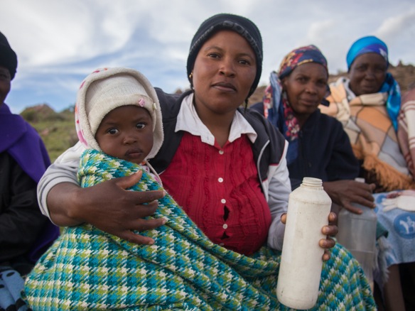
These woman stop us with cheers and jeers, insisting that we try their maize beer.

Nicholas Carman1 3044

Some for baby, too.

Nicholas Carman1 3045

And when the 2L Coke bottle empties, the big blue jug appears to refill it.

Nicholas Carman1 3047

Going down.

Nicholas Carman1 3048

Nicholas Carman1 3049

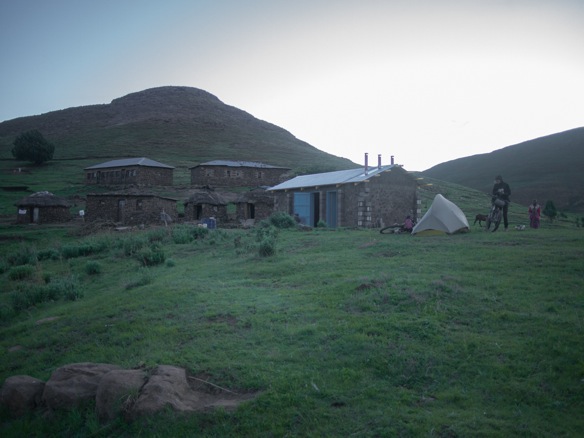
At dark, we ask to put our tent near this village, a practice we’ve developed to limit curiosity in our presence and avoid alarm.  Thankfully, the man constructing the structure near our tent is from Maseru, speaks English, and generally understands and appreciates what we are doing, avoiding the usual confusion and excitement of our arrival.  This also ensures a little privacy as well, although we do have two visitors while we set-up the tent and unpack.  By zipping ourselves into our nylon cocoon, the girls eventually get bored and wander off.

Nicholas Carman1 3051

The World Food Programme is responsible for administering many programs in Lesotho.  This building will be a kitchen for the school.

Nicholas Carman1 3052

Our audience, who we regrettably shut out after we unpack our things.  Tired from riding all day, we are most tired from being around people all the time.

Nicholas Carman1 3050

Nearing the hottest part of the year, Lesotho is just right in summer.  The sun is still intense, but the days are nice and the nights are cool.  Most of the country is above 5000ft.

Nicholas Carman1 3053

In the evening, we’d turned off the main dirt road onto a steep track.  The only discernible tracks end at the village where we camped.  Beyond that, it is all donkey tracks and foot paths along an old road bed.

Nicholas Carman1 3054

A chasm lie ahead– that must be the Senqunyane River.

Nicholas Carman1 3056

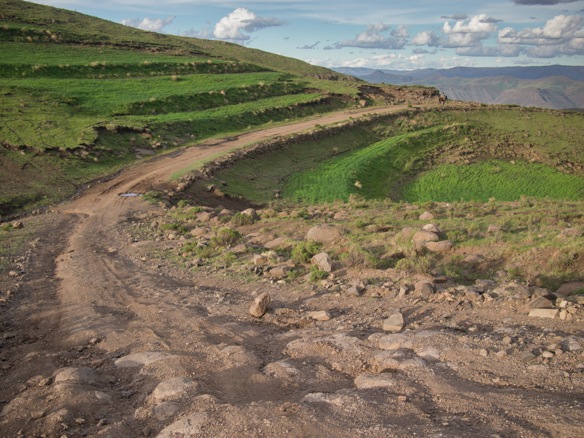
We descend all the way down to river level on a technical track, presumably once passable by 4×4 and probably not impossible to drive in most places, but there is no sign it has been driven in decades.

Nicholas Carman1 3057

Views, and a technical ridable descent to an eventual swimming spot.  Nothing not to like.

Nicholas Carman1 3061

Sheep traverse the mountainside above, on what appears to be a good trail.

Nicholas Carman1 3062

Nicholas Carman1 3063

A little steep for loaded hardtails.  Rather, a little too steep for kids without health insurance many hours from whatever or whomever would help if we needed it.  The concept of self-preservation is present in our minds while traveling rough and remote tracks.

Nicholas Carman1 3064

Nicholas Carman1 3065

Nicholas Carman1 3069

The newer bridge replaces an often dangerous ford, still required for the cattle.

Nicholas Carman1 3066

Nicholas Carman1 3067

Immediately, the track ascends the other side.  It rises more steeply than we descended, I think.

Nicholas Carman1 3070

Soon, there are children keeping pace with our hike up the mountain.  This total ascent is about 2500ft, although more elevation is gained later.  A lot of the ascent is unreadable, but a pleasant enough place to push a bike.

Nicholas Carman1 3072

Along the way, a growing group of children take chase.  One particularly confident girls insists questioningly, “You are lost!?”.

“No, I am not lost”, I inform her.  She insists, again and again.  “Fada, you are lost.”  Many of these children call us father and mother.  Not sure if this is a typical sign of respect, or something related to the history of Christian missionaries in Lesotho.

Nicholas Carman1 3071

After the usual introductions in which kids demand sweets and I laugh at them– asking instead if they would respond to my enthusiastic greeting– we break for some photos.  Kids love to see the images.  I think it is a reasonable way to exchange a few moments together, and to forget the sweets.  It is not uncommon to be asked for sweets again as I take my first few pedal strokes away.  I laugh again, half-heartedly.  Bye!

More than “Hi” or “Hello”, people love to say say “Bye” or “Bye Bye” in Lesotho, often used as a greeting as well in more rural places.  In order of frequency we hear the phrases “Give me sweets”, “Where to?”, “Bye bye”, and “Good morning”.  Morning lasts all day.

Nicholas Carman1 3073

We eventually crest the ridge to discover a deep river valley on the other side as well.  We continue along the ridge, continuing to gain some elevation.

Nicholas Carman1 3074

Thunderstorms closing it, threatening.

Nicholas Carman1 3075

Nicholas Carman1 3078

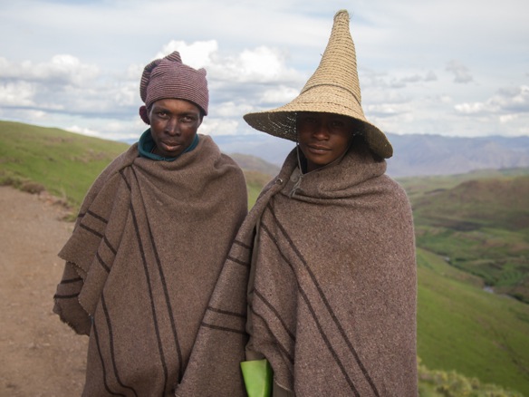
We take cover for a few moments as the wind blows and some water falls from the sky, thinking something really severe will develop.  Everyone else seems to know that the storm will not materialize, but they offer us a roof for some time.  The eldest daughter in the red and white robe is preparing to become a sister in Roma, a small city nearer to Maseru.

Nicholas Carman1 3079

“Shoot me!”

Nicholas Carman1 3080

“Me too!”  Lesotho is an aspiring photographer’s dream.

Nicholas Carman1 3081

Maize for miles, all planted and harvested by hand, ploughed by animal, and most often transported by donkey to town for milling, and again by donkey on the return trip.

Nicholas Carman1 3082

A 3-string gas can banjo.

Nicholas Carman1 3083

Nicholas Carman1 3084

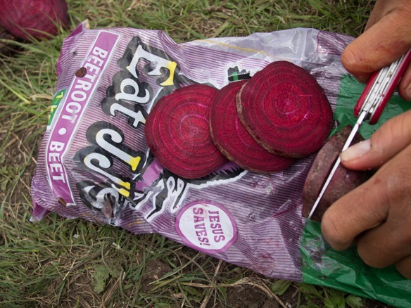
Christianity is widely present in Lesotho.  Our bag of beets reminds us.

Nicholas Carman1 3086

Nicholas Carman1 3087

As we near Mantsunyane and a motorable road, outhouses, green plastic Jojo water tanks, and corrugated metal re-enter the landscape.

Nicholas Carman1 3088

Nicholas Carman1 3090

Nicholas Carman1 3091

Nicholas Carman1 3093

Nicholas Carman1 3094

And we dance.

Nicholas Carman1 3095

There are always shortcuts for animals and people on foot.

Nicholas Carman1 3096

Nicholas Carman1 3097

Finally, after a full day or riding and pushing, we are within sight of Mantsonyane.

Nicholas Carman1 3102

The nuns that teach at the large school here are all waiting for rides home, this being a Friday several weeks before Christmas.

Nicholas Carman1 3103

Nicholas Carman1 3104

Mantsonyane.

Nicholas Carman1 3105

Friday night pony races.

Nicholas Carman1 3106

A quick resupply in town, including apples, onion, cold beers.

Nicholas Carman1 3108

And of course, repackaged off-brand Nik Naks.  Originally sold in 5 or 10kg tubes (usually almost 2m long), this seasoned puffed maize is redistributed into small bags and sold for 1 rand or 1 maluti, equal to about $0.10.  These smaller bags were only a half maluti, so I bought six.

Nicholas Carman1 3198

We follow the tar from Mantsonyane to Thaba-Tseka fro about 30 miles, over a high pass.  The road is nearly empty, save for a few donkeys and white government vehicles.

Nicholas Carman1 3109

From the roadside we are invited to camp in a village and are led to meet the chief, a woman.

Nicholas Carman1 3111

Complete with crash test dummy.

Nicholas Carman1 3110

Camping adjacent to the chief’s house, the crowd of curious children keep their distance, for which we are thankful.  After we have zipped our tent closed for the evening, for privacy, two small girls come by and are quietly felt nearby, whispering.  Lael unzips and pokes her head out.  They politely inform us, “We are here for the sweets.”  Lael informs them that we don’t have any, and apologizes, not that we are sorry.  We’ve been asked for sweets in many ways but I’ll never forget the phrasing, “We are here for the sweets.”  Priceless.

Nicholas Carman1 3112

We awake to the chief sorting her maize at sunrise, tossing pebbles and ill-conceived kernels by the wayside.

Nicholas Carman1 3114

She then instructs this boy to stitch the bag back together.

Nicholas Carman1 3115

This shepherd has bought two fresh rolls from the shop for us.  Bread is a delicacy for those that rely on maize.  This village is much different that many of the places we’ve been in the last few days, as it is bisected by one of the only tar roads in the country.

Nicholas Carman1 3117

We climb the Pass of Jackals toward Thaba-Tseka and turn towards the infamous Khatse Dam.  South Africans are especially proud of this massive civil works project, which provides power for Lesotho and water for South Africa.  The project forcibly relocated many people, who ironically live without electricity.

Nicholas Carman1 3119

The tar road brings us to our highest elevation in the country, over 9500ft.  This is the first time we have been able to look out without seeing signs of people everywhere.  Not that two shepherds didn’t find us in the twenty minutes we rest by the roadside.  We offer some of our tea and scones, which they are obliged to accept.

Nicholas Carman1 3118

No people, for the first time.

Nicholas Carman1 3120

Nicholas Carman1 3121

Nicholas Carman1 3122

Thaba-Tseka.

Nicholas Carman1 3124

The dirt road towards the Khatse Dam is well-traveled and in very nice condition.

Nicholas Carman1 3125

Nicholas Carman1 3126

Nicholas Carman1 3127

I exercise some tactics to avoid being asked for sweets, proactively greeting and questioning the children who come to the roadside.  The idea is to distract them from their practiced and half-hearted routine.  It works about half of the time, or less.

Nicholas Carman1 3128

They are picking fresh greens which grow wild in the young maize fields.

Nicholas Carman1 3129

A talkative shop owner offers us pap and eggs upon learning that we are from America.

Nicholas Carman1 3130

The Khatse Dam.

Nicholas Carman1 3131

And our campsite, aside yet another school.

Nicholas Carman1 3136

By morning, our audience awaits.

Nicholas Carman1 3138

Nicholas Carman1 3140

For some reason the GPS track from the Dragon Trax site chooses the tar road to Ha Lejone instead of the nice gravel road along the lake.  I inquire locally and am told there are some “rascals” along this road.  I can understand, I think, as I did sense some tension on our way to the dam yesterday.  I suspect some resentment toward South Africans as a result of the dam.  We proceed with curiosity.

Nicholas Carman1 3141

Nicholas Carman1 3142

It proves to be a gorgeous ride on the mountainsides along the lake, and the feeling in each community is quite normal.  That is, until a boulder comes tumbling down the mountain from several hundred meters above, sent by some mischievous shepherds.  Rascals might be the exact word to describe this kind of behavior.  The boulder missed by about ten meters.  I heard it a few seconds before it came hurtling onto the road surface behind me.  A good shot, I say.  The boys send two more rocks downward.  I should hope this is an isolated incident.

Nicholas Carman1 3143

Nicholas Carman1 3146

The lake is crossed by several small bridges.

Nicholas Carman1 3147

We seek shelter from a thunderstorm in a small bottle shop in Ha Lejone.

Nicholas Carman1 3150

Curious, as always.

Nicholas Carman1 3148

But these kids are tons of fun.  Most kids in Lesotho are loads of fun, if you can find the energy for it.  We can’t fault them for finding us interesting and wanting attention.  We love them, but by the end of the day, we relish the few moments of peace in our tent.

Nicholas Carman1 3149

Away from Ha Lejone along the lake, we consider two route options.  The Dragon Trax route follows a river, away from any roads or trails shown on my basemaps.  Locals don’t know anything about the route.  It will either be a well traveled footpath that only people in the last few villages use, or it won’t be much of a trail at all.  The alternate route is a 4×4 road past the Kaa Diamond mine over a pass to the main tar road, landing somewhere near the AfriSki center on the other side.

Nicholas Carman1 3151

Nicholas Carman1 3152

Now that we are mining country, even the good gravel roads get extremely steep.

Nicholas Carman1 3153

Storms continue to threaten.

Nicholas Carman1 3158

Nicholas Carman1 3157

Nicholas Carman1 3160

Nicholas Carman1 3161

Nicholas Carman1 3162

We climb one last time for the evening and descend to the Motete River for the night.  We’ll begin first thing in the morning.

Nicholas Carman1 3165

Nicholas Carman1 3166

Damp roads and a chance of rain invite us in the morning.

Nicholas Carman1 3167

Nicholas Carman1 3168

Nicholas Carman1 3169

The road continues for several kilometers, diminishing along the way into a wide footpath tracked only by feet.

Nicholas Carman1 3170

Nicholas Carman1 3171

And then a series of singletracks to the last village.

Nicholas Carman1 3173

This is where it gets interesting.  From here, we follow the Malibamatsu River to the tar road, a distance of almost 20 miles.

Nicholas Carman1 3174

At first, we find remarkably ridable hillside singletrack.

Nicholas Carman1 3175

Pick and choose from mostly ridable trail, but with frequent dismounts.

Nicholas Carman1 3176Nicholas Carman1 3179

Nicholas Carman1 3177

Nicholas Carman1 3180

The trail becomes less defined, rougher, and less continuous, easily confused with the thousands of sheep trails on the hillside.  We continue as near to the track shown on the GPS as possible, which often lands us onto reasonably passable trail.  Eventually, the we must cross the river, four times in total, in quick succession.  At this point it has been raining slowly for several hours.  We wade waist deep through a strong current, about as deep and swift as I am comfortable carrying our bikes.  We leave our shoes on, and hoist the bikes mostly out of the water, partly floating them on the surface to reduce the strain and to stabilize ourselves.  When crossing the river in the opposite direction to keep the bicycles on our right hand side but not upstream of us, which presents a serious hazard, we point the tires upstream and walk sidestep from bank to bank.

Nicholas Carman1 3181

These two shepherds try to help Lael find a better place to cross, as I have already carried both bikes across this section which went nearly to my chest.  This was the fourth and most challenging ford.  There are no villages for many kilometers in either direction.   These boys are tending to a flock of sheep for the summer, living in very simple thatch roofed round houses, like slouching squat versions of the nicer roundhouses most Basotho inhabit.  These guys were actually really cool, and asked for our phone number to call us later.  We informed them that we did not have a phone, which was shocking and hilarious.

Nicholas Carman1 3182

Eventually, after hours of bushwhacking along infrequently ridable sheep trails, the route regains some definition.  The rain leaves us, and the feeling comes back to our fingers and toes.  We were at once quite miserable.  A lightness returns to the day.

Nicholas Carman1 3185

Nicholas Carman1 3186

To finish the route to the tar road, the trail shortcuts several meanders.

Nicholas Carman1 3188

Nicholas Carman1 3187

Nicholas Carman1 3191

A shepherd’s shelter, which often takes a high vantage.  Each shelter is spaced just within sight of the next one, usually a km or more away.

Nicholas Carman1 3192

Nicholas Carman1 3193

The last few km are partly ridable, the sun shines, and what once felt like a huge task, is not more than a powerful memory.

Nicholas Carman1 3194

We immediately point our tires up Moteng Pass and spend the entire climb praising the virtues of tar roads.  After many miles of pushing, my Achilles is very tight.  The tar is a relief for now.

Up.

Nicholas Carman1 3195

And down, at breakneck speeds down 4000ft.

Nicholas Carman1 3196

The Dragon Trax route continues north up another roadless river valley to connect near the border.  We opt for a casual long-cut on the tar road, to connect with a gravel road along the border.  This likely adds over sixty miles, but our bodies enjoy the chance to pedal and dry out.

Nicholas Carman1 3197

Nicholas Carman1 3199

Nicholas Carman1 3201

Nicholas Carman1 3202

We turn onto gravel for our final day of riding toward Monantsa Pass.

Nicholas Carman1 3203

The white flag indicates that there is maize beer for sale.  Yellow indicates fresh fruit.  Green, vegetables.

Nicholas Carman1 3204

I assist with some roadside bike repair.  My Crank Brothers Multi-Tool is a marvel, especially the chain tool.

Nicholas Carman1 3208

Nicholas Carman1 3205

Sorry, no sweets, kids.

Nicholas Carman1 3206

Riding to South Africa, which will be a relief.

Nicholas Carman1 3210

We take a wrong turn just before the border and climb an extra 1500ft into a wooded meadow.  There have been very few trees in all of Lesotho.

Nicholas Carman1 3211

We camp for the night, and plan to ride across the border in the morning.  At least up here we are treated to a peaceful night.  It feels like Northern Arizona up here.

Nicholas Carman1 3213

Donkey wake us in the morning.

Nicholas Carman1 3214

Descend to the main dirt road.

Nicholas Carman1 3215

And climb to the border.  There are crews of workers lazily tending to road construction matters near the top of the pass.  Less than a 100m from the border, one woman demands, “Give me your squeeze bottle!”  She is referring to the water bottles on my fork.  I look at her, sweating and panting from a steep climb in intense sun.  I shake my head no, and push for the border.  I love you Lesotho, but I need a break.

Nicholas Carman1 3217

The descent off the backside of the Drakensburg into South Africa feels like a homecoming.

Nicholas Carman1 3216

Dragon’s Spine: Lundean’s Nek, ZA to Semonkong, Lesotho

Nicholas Carman1 2504

Lundean’s Nek- Teleriver- Qoboshane- Tele Bridge (RSA/Lesotho border)- Alwynskop- Ha Falatse- Phamong- Bethel- Ketane- Ha Khomo a Bokone-Ha Mojalefa Tsenekeng- Semonkong

Four boys take chase from the last town, meeting us on the road as they shortcut a series of switchbacks that we work desperately to climb.  At each turn, they stop and wait without saying a word.  They continue the slow run as we pass, keeping aside or behind by only a few feet.  Our route is a rough dirt road turned steep 4×4 track, and will soon become not much more than a loose assortment of footpaths and donkey tracks.  At the end of the doubletrack-width road, we scout the route ahead.  The eldest boy indicates one track versus another.  We continue up.  Over a thousand feet higher than where they began, the four boys turn back towards home.  One is wearing knee high rubber boots.  Another is barefoot.  They are not winded.  Barely in the first grade, these young men are stoic.  Children in Lesotho are like men and women, only smaller.

Looking for the route up to the saddle on a goose chase set forth by the pink line on my GPS– one in a series of tracks I casually downloaded from the Dragon Trax website several weeks ago– we push through the boulder field at the end of the road and choose one of many trails into the scrub.  Naturally, we follow either the best looking path or the one with the least elevation gain, ascending slowly enough to make me wonder how we will intersect the pass, likely to arrive well below it.  Slipping sideways on granular decomposing bedrock, we look upwards.  There are a dozen sheep above us along an approximate line on the hillside.  Lael thinks there is a better trail.  We point the bikes straight up the hill and begin pushing, using the brakes in the manner of an ice axe to hoist ourselves over tufts of brown grass.  We drop our bikes along the trail and break for water.  Two woman appear from the direction of the last town, carrying small backpacks and large handbags of goods.  They walk past without saying anything, barefoot.  I am amazed to see them here.  If they are surprised by our presence they don’t show it. 

The trail continues upwards as a pronounced bench cut by hoof and human, punctuated by steep scrambles through boulders worn into trail.  Looking back, I imagine that with some skill, this is mostly rideable.  We make only a few pedal strokes up to the saddle.  

At the top, a group of five men and women are seated, sharing two large mugs and one big chicken bone.  One mug contains a maize drink, lightly sweetened.  The other, which they decline to share with us, is an alcoholic maize home-brew.  They indicate through charades that it will make our heads crazy.  The chicken bone is offered, which I decline.  The sweetened maize drink is nice.  Reminds me of a drink the Raramuri prepare in the Copper Canyon, Mexico.  Two woman in the group ask for “sweets”.  We offer a small bag of raisins in trade for the taste of their drink.  Lael unveils the raisins as if a consolation for not having chocolates or candy– which we assume they are referring to– but they are delighted nonetheless.  

Despite constant exclamations for “sweets!” by the people along the roadside, I haven’t given anything to anyone, at least not since I bought some apples and nik-naks for the young girls that entertained us with a vast repertoire of songs from school.  They were adorable, educated, polite– less than five years old, I think– and did not ask for anything.  But it was lunch time, and I felt inclined to share something as Lael and I sipped a 1L glass bottle of Stoney.  Lael cut up the apples and tore open the bags of puffed maize, instructing them to share with the youngest int he group.  They did.

Once the formalities are finalized with the woman holding the chicken bone– pointing to the next village and pointing to the last– we say “Dumalang. Thank you.” and roll over the hill.  No one in the group is incredulous that we are on top of the mountain with our bicycles.  I am.

On an adjacent hillside is a small round house with a thatch roof, around which dozens of people have gathered near a smoking fire.  Something special must be cooking on that fire– an animal, I assume– and the maize beer must be flowing.  The group is loud, making an impression of being no less than a proper party, perhaps more.  This is Friday night in Lesotho.

Our route continues away from the party, now on a better trail along the hillside which is rideable about half the time, maybe more.  We gain some distance on the two barefoot women we met earlier, to lose it at the next short rocky ascent.  Coming to another saddle, a group of single-room round houses appear.  We arrive just behind the two women, who now laugh loudly.  They are tired and happy to be home.  I am happy for them, and at least I realize it is amusing that I am here.  Several children nearby agree.  

We continue away from the village on a wider bench lined with cobbles on either side.  The track appears to have been a road, or perhaps was planned as a road.  It remains for many kilometers as an easily identifiable corridor of footpaths and donkey tracks, all the way to Semonkong, always with rocks piled alongside.  Far from the open roads of the karoo, this is still the Dragon’s Spine route.  Lesotho, as it should, lends its own character to the route.

Nicholas Carman1 2795

From Barkly East and Wartrail we cross Lundean’s Nek into a fragment of the former Trankei region, between mountains and the border of Lesotho.  Transkei was one of several apartheid-era black homelands, or Bantustans as they were later called.  We are still in South Africa, but life is different here.  There are no white people, and the home life is based upon subsistence farming, not daily toil for basic wages.  The result,  as I see it in my brief visit, is not a wealthier life, but quite possibly a richer life.  Many criticize the black homelands projects for creating regional ghettos based upon race.  I agree upon principle. However, the communities seem strong and people seem more open and energetic with us.  The Bantustans were designed to become independent states, forcibly separate from the nation of South Africa.  If it sounds like a strange and strong-armed social engineering project, it was.  While separate from South Africa, none of the Bantustans were ever recognized by any other nation, a purposefully defeating geopolitical purgatory.

Nicholas Carman1 2791

Along the Tele River, between the former Transkei and Lesotho.

Nicholas Carman1 2800

Villages feature public taps.

Nicholas Carman1 2801

Nicholas Carman1 2802

There are people everywhere, absolutely everywhere.

Nicholas Carman1 2804

While there are several river fords to cross into Lesotho, we continue in South Africa to the official crossing at Tele Bridge.  

Nicholas Carman1 2805

Nicholas Carman1 2806

Ooph.  Beware with bottles on the fork that they do not dislodge during rough descents.  We’ve made velcro straps to secure the bottles, but this still happened.  I went straight over the bars.

Nicholas Carman1 2808

Afternoon thunderstorms are becoming more frequent, although not entirely regular.  Often, clouds build for hours and hours.  We hide inside a store.

Nicholas Carman1 2813

Funny guys, tough guys, and nice guys– South Africa is full or characters.

Nicholas Carman1 2812

Nicholas Carman1 2814

Nicholas Carman1 2815

Late in the evening, we make friends at the bottle shop.  We are led around by the local English teacher to see the farming project in place on his property.  I can tell he’d had a few drinks already.  We oblige nonetheless.

Nicholas Carman1 2819

We spend time in the bottle shop with a group of young men.  This woman owns the shop.  Good conversations cannot be taken lightly, and we talk for hours.

Nicholas Carman1 2821

We take a tour around town.  Many young people out walking in the evening.  For the night, we stay inside a fenced property adjacent to the bottle shop.

Nicholas Carman1 2820

By morning, we ride into Lesotho.

Nicholas Carman1 2824

Free condoms in the toilet.  Lesotho has the third highest rate of HIV/AIDS in the world.

Nicholas Carman1 2825

Lesotho. South Africa is across the river.

Nicholas Carman1 2826

Alwynskop, Lesotho.

Nicholas Carman1 2827

Nicholas Carman1 2828

Nicholas Carman1 2830

Nicholas Carman1 2829

Nicholas Carman1 2831

We connect to the tar road at Alwynskop for several miles to meet a dirt road toward Phamong.  

Nicholas Carman1 2833

We’ve been told about the condition of the roads in Lesotho.  So far, so good.  There are many signs indicating projects funded by the USA, EU, and other wealthier nations.

Nicholas Carman1 2832

Nicholas Carman1 2837

We stop to avoid the sun for some time.  Immediately, people move in our direction, toward our bikes, toward us.

Nicholas Carman1 2838

This young girl recites a school lesson, “I am a girl.  I am five years old.  I live in a city.  My name is…”.  

Nicholas Carman1 2839

The group joins for a shoot.

Nicholas Carman1 2840

Followed by an impromptu performance of song and dance.  The first song is in English, “Early to rise, early to bed…”, while the remaining are in Sesotho.  A half hour later I share apples and maize puffs, partly to save these girls from themselves.  They are slowly losing steam near the end of the performance.

Nicholas Carman1 2844

Day one in Lesotho features incredible roads.  But we’re still waiting for the kinds of roads that make this country (in)famous.

Nicholas Carman1 2846

Everyone has a voice, and everyone uses it.  I’ve never waved so many times in one day.

Nicholas Carman1 2847

Nicholas Carman1 2848

Nicholas Carman1 2849

Another stop.  Michael Jackson comes bumping out of this shop.  Curious, I enter and buy some maize puffs and a beer.  The stereo is operated by the small solar panel outdoors.  The rest of the playlist is comprised of African tunes.  We’re starved of music, and spend some time in the shade listening.

Nicholas Carman1 2853

As Lael boils eggs over a beer can stove on the ground outside, an audience surrounds.  Even I recognize how unusual we are, especially Lael.  Just as our audience peaks, she often feels the need to fit in her six minute jump roping routine.

Nicholas Carman1 2850

The stone-faced group is quickly cajoled into shouts and smiles.

Nicholas Carman1 2852

Nicholas Carman1 2854

Nicholas Carman1 2855

Nicholas Carman1 2856

We’re headed to the village of Bethel, where we’ve ben told we can find a Canadian man.  No more was told about him, but I am curious.  In Phamong, I ask directions to the Canadian.  “His name is Mr. Ivan,” I am told.

Nicholas Carman1 2857

Nicholas Carman1 2858

Nicholas Carman1 2749

We find Mr. Ivan and his home, his school, his gardens, and his solar projects.  He is a former Peace Corps volunteer who settled in Bethel many years ago, and has been growing his positive influence through education and employment.  He’s an eccentric obsessed with solar energy, permaculture, and education.  He is exactly what people in this country need.  He’s also Ukrainian, via Saskatchewan.  It is not until he says “as common as borsch” in conversation that we make the connection.  The phrase has now entered my vocabulary.

Nicholas Carman1 2882

Nicholas Carman1 2760

Our route after Bethel promises to be more adventurous.

Nicholas Carman1 2859

Nicholas Carman1 2860

Nicholas Carman1 2861

We will follow the serpentine line into the mountains, and will stay high on dotted lines until descending into Semonkong.

Nicholas Carman1 2863

Climbing from Bethel toward Ketane.

Nicholas Carman1 2897

Nicholas Carman1 2896

Nicholas Carman1 2898

Nicholas Carman1 2901

Shops are stocked with maize, maize puffs, vegetable oil, soaps, matches, candles.  Cookies, cold drink, and beers are sometimes available.  Methylated spirits and paraffin are also common.  The official currency of Lesotho are maluti, which are price fixed against the South African rand, which are also accepted everywhere.  

Nicholas Carman1 2904

Nicholas Carman1 2905

Nicholas Carman1 2908

Nicholas Carman1 2909

Nicholas Carman1 2912

Nicholas Carman1 2914

Nicholas Carman1 2915

Leaving Ketane, toward the end of the road.  

Nicholas Carman1 2916

Nicholas Carman1 2917

Nicholas Carman1 2918

These are the boys who steadily chase us uphill.  

Nicholas Carman1 2919

The end of the road, and the beginning of our adventure into the mountains.  The boys return home.

Nicholas Carman1 2921

Just a couple of “peak baggers” in Lesotho, coming home from market.

Nicholas Carman1 2923

Nicholas Carman1 2924

Nicholas Carman1 2925

Nicholas Carman1 2926

Nicholas Carman1 2931

Nicholas Carman1 2928

Nicholas Carman1 2930

Party house.  Friday night in Lesotho!

Nicholas Carman1 2932

Nicholas Carman1 2934

Nicholas Carman1 2935

Every inch of rideable trail is worth the effort.  To share the same footpath as thousands of people over many decades is powerful.  

Nicholas Carman1 2936

Nicholas Carman1 2937

The outline of a road guides us beyond the first village.

Nicholas Carman1 2938

By morning– in fact, before sunrise– a man calls out loudly in front of our tent.  “Morning!”.  I hear his voice, unzip the fly, and peer outside with sleepy eyes.  He is beaming, wearing a smile.  We exchange greetings in English and Sesotho, and I lay back to sleep.  He just couldn’t help himself.  We made our presence known in the evening to ask for a place to camp.  There is plentiful open space here, but people are so curious it is best to introduce yourself.  I most villages, it is recommended to ask the chief for permission to camp.  Our tent rests between towns for the night.  

Nicholas Carman1 2940

The idea of a road continues, village to village.  There are no vehicles, no corrugated metal, and no outhouses this far out.  Eventually, these features return one by one as we near the other end, near Semonkong.

Nicholas Carman1 2941

Nicholas Carman1 2943

Nicholas Carman1 2945

Nicholas Carman1 2944

Nicholas Carman1 2947

Nicholas Carman1 2949

Nicholas Carman1 2948

Nicholas Carman1 2950

Nicholas Carman1 2951

Nicholas Carman1 2953

Nicholas Carman1 2955

Outhouses and corrugated roofing reappear, indicating our proximity to town.

Nicholas Carman1 2956

Nicholas Carman1 2957

Finally, we encounter a group of students who have been hired to register voters for the upcoming elections.  We make friends with many high school aged youth.  They speak English and are more connected to urban styles and global perspectives.  Cell phones are ubiquitous.  

Nicholas Carman1 2958

Nicholas Carman1 2959

New styles for the 2015 spring bikepacking season.  A photo shoot ensues with both of our bikes and helmets.  

Nicholas Carman1 2960

At last, the road becomes passable by 4×4., but this last climb has us pushing.  From the end of the road near Ketane to the beginning of the road near Semonkong, I estimate that about 50-60% of the route is ridable.  Through this section we are on and off the bike frequently, although the connection this route makes is worthwhile.

Nicholas Carman1 2961

Nicholas Carman1 2962

We join the flow of people to and from town. It is Saturday, and many people are returning from market with 50kg bags of maize meal, large bags of maize puffs, and other necessities and delicacies.  It is amazing the things woman can carry on their heads.

Nicholas Carman1 2963

Nicholas Carman1 2964

Nicholas Carman1 2965

Voter registration PSA.

Nicholas Carman1 2966

Maletsunyane Falls, the tallest falls in all of Lesotho.

Nicholas Carman1 2967

Finally, while a high quality gravel road continues toward town, the local people straight-line over hills to shorten the distance.  Our GPS track follows.

Nicholas Carman1 2968

Nicholas Carman1 2969

Nicholas Carman1 2970

Who cares about singletrack when you have six to choose from?

Nicholas Carman1 2971

Into Semonkong.

Nicholas Carman1 2972

Nicholas Carman1 2973

Shopping.

Nicholas Carman1 2974

And out of town as fast as we can.  The town is deflated after a busy market day.  This is our first city in Lesotho, barely more than a few thousand people, and we don’t find much reason to linger.  We’re meant to be in the mountains, I realize.  The next segment promises similar adventure, as the GPS does not indicate a road for some of the distance.  Donkey track, forgotten 4×4 road?  Certainly, we’ll find footprints.  There are people everywhere.  

Nicholas Carman1 2977

Ride from home: Kincaid STA trails

NicholasCarman1 845

Kincaid Park is a 1500 acre forest park at the apex of the Anchorage Peninsula, where the Turnagain Arm and the Knik Arm of the Cook Inslet meet.  The park is situated on a decommissioned military site, along a zone of coastal bluffs, slumps, and glacial topography.  It has hosted groomed, lighted, and well-used cross-country ski trails for years, one of Anchorage’s breeding grounds for competitive skiers, including one of the winningest American XC skiers of all time, Kikkan Randall.  In recent years, dedicated bicycle singletrack has been built, including named and mapped trails.  This past year, several new phases of trail construction have given us many more miles of singletrack to explore.  Elsewhere in the park, there are facilities for sledding, a biathlon shooting, a motocross course, soccer fields,  a multi-purpose stadium, a disc golf course and trails of all kinds for skiing, running, snowshoeing, and both summer and winter cycling.  

While the city is laced with wide, groomed multi-use trails in winter, the only other dedicated winter singletrack system is found in, and adjacent to, the Campbell Tract, a BLM property on the hillside.  Some new winter trails are beginning to arise near APU.

Several days ago, Lael and I set out to explore some of the new Kincaid trails.  Riding the Surly ECR, I quickly found the limitations of 29×3.0″ tires on softer snow.  Riding was fast and assured on the heavily trafficked Coastal Trail, but the ECR slithered along the softer singletrack.  I still managed to ride a few miles, while Lael gracefully rode ahead on her new Salsa Mukluk 3.  A real fatbike is a necessity.

Riding out the Coastal Trail.  From our current location, we are about 6.5 miles to this network of singletrack trails, all along the famed 9-mile Coastal Trail.  On clear days, Mount Susitna– “the Sleeping Lady”– graces the horizon.

NicholasCarman1 840

The sun makes a slow dance across the horizon, in a period of about five and a half hours.  The main trails in town are well travelled by skiers, runners, and bikers, mostly on fatbikes.  A classic ski track is also imprinted on the right side of the trail.

NicholasCarman1 841

Middle Earth is the backbone of the new system of trails at Kincaid.  These trails were designed and built by the STA, or the Singletrack Advocates of Anchorage.

NicholasCarman1 776

Moose are common on every outing.

NicholasCarman1 842

Topography and fatbiking don’t always mix well, for lack of traction, but these trails gently asked the hillsides.

NicholasCarman1 843

To greater views of Cook Inslet and Mt. Susitna.

NicholasCarman1 780

NicholasCarman1 844

NicholasCarman1 846

NicholasCarman1 847

Winter riding is as good, or better than summer singletrack riding in Anchorage.  All which is boggy, and buggy and swarming with bears in the summer, is silently put to sleep by a blanket of snow.  the urban-based riding in Anchorage is some of the best anywhere.

NicholasCarman1 781

After a quick tour of the trails, we return home along the Coastal Trail as dusk.  

NicholasCarman1 848

More rides and trails soon.  There is much more to explore in town, with some excellent backcountry opportunities nearby.

Back in Alaska

NicholasCarman1 581

We are back in Alaska.  Lael grew up in Anchorage, and I’ve lived here twice before, seasonally.  The first time, we lived in a late 60’s camping trailer on a bluff above the Nenana River while working at a restaurant outside Denali National Park in the summer of 2009.  In 2011, we returned to spend the winter in Anchorage, discovering winter riding, fatbikes, and snowy singletrack in a season of record snowfall.  Last winter we lived in Albuquerque, NM.  We are back in Anchorage for the season.

Much is the same as before: it is cold and snowy, the roads are rutted and icy, vehicles are monstrous and drivers are aggressive, days are short, the city is huge (second largest by area in the US) and getting outdoors is essential to enjoying the long, dark season.  However, much has changed: fatbikes are more prevalent around town, and better equipment is available; more trails have been built or packed into the snow; studded tires are available in every wheel and tire size for bicycles, including fatbikes; and, we are much better prepared for the winter riding season.  Note how the latter are all solutions to the former– for us, fatbikes are the reason that life is possible in Anchorage in the winter.

The last time I was near sea level was in Ukraine along the Black Sea.  Before that, Holland.

Just beyond sunrise and the Garmin already reads, “Sunset in 5hr 13min”.  Our arrival in Anchorage is well timed, as the season is already gaining daylight towards June.

NicholasCarman1 772

Winter riding is much of the reason we have come this far north for the winter.  The urban-based riding in Anchorage is some of the best anywhere.  Links lead to old posts from winter 2011-12, our first winter in Anchorage.

NicholasCarman1 595

Sunrise.

NicholasCarman1 768

Group rides.

NicholasCarman1 593

Night rides.  Lots of night rides.

NicholasCarman1 737

Sidewalks.

NicholasCarman1 771

Wildlife.  Moose are a common sight around town.

NicholasCarman1 758

In the winter, nobody misses the bugs or the bears, or soggy trails.

NicholasCarman1 591

Sunset.

NicholasCarman1 751

Night rides, again.

NicholasCarman1 764

Busy boulevards— lots of those too.

NicholasCarman1 585

Icy, rutted roads.

NicholasCarman1 736

Ice beards.  Everyone grows a beard in the winter in Alaska– everyone.

NicholasCarman1 766

New trail facilities, bypassing a previously necessary hike-a-bike along a frozen stream under the highway.

NicholasCarman1 746

Snowy singletrack.  Miles and miles of singletrack.

NicholasCarman1 589

And much more to explore.

NicholasCarman1 745

Fatbikes are loads of fun, and Anchorage is the center of the fatbike universe.  While many people are excited simply to see a fatbike in person at their local shop, in Anchorage, it is possible to view and test ride fatbikes from every manufacturer.  Already, I’ve spotted bikes from Salsa, Surly, 9zero7, Fatback, Specialized, Trek, Kona, 616, and Borealis.  Lael– lucky as always– has already been treated to a brand new Salsa Mukluk 3 in her first week in town.  I am still shopping for a bike.  Many base model bikes are now specced with aggressive Surly Nate tires and practical 2x drivetrains.  This year, the Salsa Mukluk borrows from last year’s Beargrease, with an all aluminum frame and fork to save weight.  With Lael’s bike, I plan to drill the rims, set-up the tires tubeless, mount a wide carbon handlebar, and source a framebag and pogies.  She plans to ride it a lot.

NicholasCarman1 582

Fatbiking has a long history in Alaska.  This 90’s-era Specialized downhill tire was notable for a large-volume casing, aggressive tread pattern, and lightweight construction.  Likely due to a lightweight casing, it was not a reliable tire under extreme DH condition, and quickly disappeared from the market.  Only a few prescient winter riders snagged them before they disappeared.  Mounted on 80+mm Remolino rims– designed by Ray Molina in southern New Mexico– these Big Hits were serious equipment back in the day.

NicholasCarman1 739

I’ve had a taste of a similar tire size recently, riding 29×3.0″ Knards in the snow.  I am waiting on some hubs to build a set of wheels with 50mm wide Surly Rabbit Hole rims.  While I still intend to buy a proper fatbike, the ECR will remain as the ‘fast bike’ for when trail conditions are firm and well-frozen.  Hopefully, one of the bikes will receive some studs.

NicholasCarman1 749

Singlewall rims with cutouts are standard equipment these days, while heavier doublewall designs like the Large Marge rims we pushed around two years ago are almost nonexistent from the scene.  These gold anodized rims were made in a limited run.  Naturally, Lael has her eye on some gold Rolling Darryl rims.  These are 65mm Marge Lite rims, weighing in at less than 700g.

NicholasCarman1 735

More likely, we’ll simply have her unholy 82mm Rolling Darryls drilled at Paramount Cycles here in Anchorage.  The process is said to shave over 200g per wheel, and allows for a custom rim strip.  A tubeless set-up should shave some more weight from the wheels, at little cost.  A lighter weight downhill tube (26×2.3-3.0″) is another simple trick to shed some grams from the wheels, but is not advisable in thorn country.  Tubeless is still a foreign concept to many cyclists in Alaska, as in other parts of the country.

NicholasCarman1 754

Gigantic rims and tires are all the rage in the fatbike market this year.  Several manufacturers have moved to a 190mm rear dropout spacing (compared to 170mm or offset 135mm), which makes room for the widest rims and tires on the market, and retains compatibility with a full MTB drivetrain.  There are some great new tires in limited distribution from Fatback, Vee Rubber, and Specialized, but most of the talk is about Surly’s Bud and Lou tires, the pair of shred-your-face-off front and rear specific tires, measuring almost 5 inches.  Mounted to 100mm Surly Clownshoe rims, this is the best you can do when the snow piles up.  Note, this 9zero7 frame is also sculpted out of carbon fiber, something that has become more common and highly coveted in in the last few months.  Recent releases from Salsa, 9zero7, and Borealis have excited riders, although Fatback will be bringing their expertise to a carbon frame in the next few months.

NicholasCarman1 770

In the 90’s, a custom bike like this John Evingson frame from Anchorage, AK was the best equipment available for riding on snow.  Surely, it is a beautiful frame, and a highly capable bike.

NicholasCarman1 733

But the current off-the-shelf offerings show several decades of development.  The last eight years– since the introduction of the Surly Pugsley– have been particularly fruitful for fatbiking equipment.

Since test-riding this carbon fiber Salsa Beargrease, I am tempted by the qualities of a rigid carbon bike, especially when riding bootpacked and bumpy trails.  The Beargrease is a lively machine.

NicholasCarman1 734

However, if I had my pick of bikes (cost, no object), I might go home with a Borealis frame.  I haven’t ridden one yet, but the shape of the tubes and the silhouette of the frame from afar indicates a sense of style, even beyond the function it exudes.  On such bikes, SRAM XX1 1 x 11speed drivetrains are common.

NicholasCarman1 774

Part-time residency also gives us time to enjoy the holidays and spend time with family.  As we work our way towards next summer, our plans will reveal themselves.  Until then, we’ll just enjoy the luxuries of living in town and having a soup pot larger than 1L to prepare meals.

NicholasCarman1 730

NicholasCarman1 726

I first spotted the new 2014 Adventure Cycling calendar this week.  Lael took this photo of me outside Del Norte, CO on the Great Divide Route, aboard my Surly Pugsley.  I take it as a sign that we should be out riding by June.

NicholasCarman1 773

This little guy is the reason we first discovered fatbikes two seasons ago.  His little sister is the reason we are back.

NicholasCarman1 702

NicholasCarman1 583

I’ve spent a few days on a borrowed Mukluk 2, which shaves a few pounds off the Muk 3, featuring an upgraded parts spec and lighter wheels.  I enjoyed the bike, but the experience of riding the Beargrease has me wondering if it might be worth it for the winter.  I’ve hardly ever had a new bike in the last decade.  A $3500 canon fiber fatbike is a big leap, but why not?

Realistically, I am most likely to buy a base model bike as soon as it snows more than a fees inches again, to avoid fishtailing around town on skinny tires.  Almost a week since the last snowfall, the Surly ECR has been a practical machine, capable of some snowy trail riding at extreme low pressures.  Fresh Knard tires hook up well with frozen hardpacked snow, and once I build wheels with wider Rabbit Hole rims, they should be even better.  But, a fatbike is necessary to ride absolutely every day, and to explore the trails.

NicholasCarman1 747

NicholasCarman1 753

NicholasCarman1 731

NicholasCarman1 750

AZT: Grand Canyon to Flagstaff

NicholasCarman1 12

The Arizona Trail is one of the newest additions to the scene of long-distance hiking and bikepacking routes.  Originally conceived by Flagstaff resident Dale Shewalter in 1985, it was officially completed in 2011 with many volunteer hours and the assistance of federal National Scenic Trails funding.  Dedicated signage is now present from the northern terminus at the Utah border, to the southern terminus at the Mexican frontier.  Counting nearly 800 miles of trail along the way, the trail will continue to change as trail designers and trail crews sculpt better routes across the rugged Arizonan backcountry, including more durable singletrack trail with greater natural and scenic value for all user groups, including hikers, cyclists, and horseback riders.  The trail is technically done, although it will continue to change and improve.

For cyclists, the Arizona Trail is not as straightforward as if hiking the route.  Aside from some tough climbs and technical trail, several logistical challenges affect cyclists.  Wilderness sections of trail must be circumnavigated, as bicycles are prohibited; the Grand Canyon stands in the way as either a long hike-a-bike or a multi-day paved detour from the North Rim to the South Rim; and several challenging sections of trail promise additional hiking and pushing.  Add the challenges that all trail users face, such as sourcing food and water along the way, and the AZT becomes an epic undertaking.  Section riding lessens the challenge, and is a good way to enjoy a slice of Arizona and the AZT.

There is no single, definitive resource when planning to bikepack the AZT.  First published in 2002, Andrea Lankford’s book Biking the Arizona Trail suggests one possible route, which favors rideable dirt roads in place of the actual AZT at times.  To experience the state of Arizona on rideable off-pavement routes, this would be a great place to start.  More cavalier cyclists, with ultralight loads and racer’s legs, often choose to stick to the actual AZT as much as possible.  Back in 2005, Scott Morris and Lee Blackwell set off to ride, hike, and push through as much of the route as possible, bringing home valuable perspectives and GPS data for the rest of us to ponder.  Scott had previously ridden Andrea’s route in 7 days, while this effort consumed 25 days.  As a part-time Arizona resident with a handle on conditions of the changing trail, including newly-built sections, Scott says:

No one AZT trip has been the same. New sections are built, old ones rerouted, and the biggest question an AZT thru-rider should ask themselves is, “how much do I want to stick to the trail?”

There are two extremes of this route choice. Staying with the trail can lead to some long hike-a-bikes (but also amazing terrain). The other extreme is the route described by Andrea Lankford’s book, which is often comprised of dirt roads.

The current recommendation is to go with a route that is somewhere between the Lankford route and the “trail-no-matter-what”. There are several key sections of beautiful trail that simply weren’t built when Lankford wrote her book. There’s no need to spend so much time on dirt roads.

As such, we set out from the South Rim of the Grand Canyon last week to take a look for ourselves.  Along the way, we’ll follow some of the actual AZT, the best recommendation for cycling routes around wilderness, and on occasion, we’ll choose the easier of several options, especially to avoid prolonged hike-a-bike.  Our intention is to experience the state of Arizona by bike, for the first time.  As always, our intention is to live well and have fun.  In the coming weeks, we hope to bring more transparency to cycling the AZT.

The best resource for history, inspiration, and routeplanning a tour of the Arizona Trail is Scott Morris’ website Bikepacking.net, with a page dedicated to riding the AZT.

NicholasCarman 1 12

At the Grand Canyon, we pick up a package shipped to us General Delivery by Big Agnes.  Our first night in the Fly Creek UL2 proves our new shelter to be a cozy place to spend a 19 degree night.

NicholasCarman 1 13

In the morning, Lael looks for a way to keep her fingers warm.  She slides some spare sil-nylon stuff sacks over her wool mitts.

NicholasCarman 1 14

Setting off for good from the town of Tusayan, south of the Grand Canyon Village, we enjoy an afternoon ride along meandering singledoubletrack along the Coconino Plateau.  The trail is well signed, and makes for a pleasant afternoon on the bike.  Carpets of pine needles and dappled sunlight are most of the reason we came to ride in AZ.  Riding amongst Arizona pines has been alluring for a long time.

NicholasCarman1

NicholasCarman1 2

NicholasCarman1 4\
NicholasCarman1 3

NicholasCarman1 5

NicholasCarman1 6

Signage on this section of trail indicates distances to trailheads and major road crossings, as well as stock tanks along the trail, which are potential water sources in season.  Lots of tanks are dry by this time of year in the high country.

NicholasCarman1 13

From atop the firetower, overlooking the Grand Canyon to the north, at sunset.

NicholasCarman1 8

NicholasCarman1 10

NicholasCarman1 11

The next morning, we rise to more rideable singletrack.  There are a few short pushes, especially as we acclimate to loose, rocky Arizona riding.  As a matter of habit, I will not mention these short periods off the bike, as they are a natural part of bikepacking.  Longer, more memorable pushes, however, will receive attention.  All nice riding here.

NicholasCarman1 14

The GPS track downloaded from Bikepacking.net indicates a waypoint, with text: “Sign says walk bicycles, but rideable”.  These little nuggets of information are invaluable when staring at a 2 1/2 inch LCD screen, chasing a pink line across the state.

NicholasCarman1 15

These high county forests are cattle country, with numerous cattle gates of various designs.  This one gives me a photographic perch as Lael rides beneath.

NicholasCarman1 16

Fire also plays an important role in these seasonally dry pine forests.  While mature ponderosa pines typically survive the fires, the understory remains open and airy as a result.

NicholasCarman1 17

NicholasCarman1 18

Not here, but almost anywhere else.  Camping on the AZT is a dream.

NicholasCarman1 19

Only a day away from a proper grocery store, with generally cool weather, we enjoy fresh vegetables along the trail.  A bag of washed kale makes for a hearty salad trailside.

NicholasCarman1 20

Stock tanks come in many shapes and sizes, containing water from nearby surface water collection ponds.  When the ponds flood, gravity forces water through underground piping to fill the tanks with water.  Many tanks are fully-contained to limit evaporation to the atmosphere.

NicholasCarman1 21

The large tanks can then be used to fill water troughs for cattle.  Almost no water is present at this tank, called the Russell Tank, except for some lightly-frozen water in the smaller covered reservoir.  It smells alright, and we treat several liters with our UV pen.

NicholasCarman1 22

The central section of the route from the Grand Canyon to Flagstaff includes a series of dirt roads, some of which trace an old wagon route to the Canyon.  Just before 1900, the ride cost $20 and took about 12 hours.

NicholasCarman1 23

Out of the forests and into more open country.

NicholasCarman1 24

Crossing a large private land tract.  Gaining passage across such properties is essential to the success of long-distance routes such as the AZT, or hiking routes such as the PCT.

NicholasCarman1 25

Federal funding is also essential, in addition to countless volunteer hours.  Join the Arizona Trail Association to support the trail and to gain access to guides and trail resources.

NicholasCarman1 26

Open country en route to the San Francisco peaks above Flagstaff.  The route south of the Grand Canyon makes its first major climb up to 9000ft along the flanks of the Snowbowl ski area north of town.  The highest point, Humphrey’s Peak, reaches to 12,633 ft, the highest point in Arizona.

NicholasCarman1 30

Fast dirt road riding comprises about 30 miles of the AZT across the Babbit Ranch.  A nice place for a sunset ride.

NicholasCarman1 31

NicholasCarman1 33

Shooting for some cover from the wind, we ride back onto USFS property.  Trail signage commemorates the official completion of the trail in 2011.

NicholasCarman1 35

Arizona promises memorable sunsets, clear nights, and warm days, even into November.

NicholasCarman1 37

And crisp mornings.

NicholasCarman1 40

Clear skies all around, save for some lenticular clouds looming over the San Francisco peaks.

NicholasCarman1 41

Back into the pines, we find some cover from strong winds this morning.  At singletrack speeds, winds are not a huge issue.  Still, a calm day makes for better picnics.

NicholasCarman1 45

Up into aspens above 8,000ft, better cover from the wind and some meandering sections of trail marked “new AZT” on the GPS are worth writing home about.  This is one of the nicest, most durable sections of trail anywhere.  With such high standards of trail building, the AZT is soon to be a premiere long-distance bikepacking route.

NicholasCarman1 47

We’ve just missed the golden hues of fall, as these trees now await frosty mornings and snow.  Looks a little like Anchorage in the winter.  We’ll be there soon enough, just in time for Christmas and the fatbiking season.

NicholasCarman1 48

Out of the aspen and back into the pines, we top out near 9000ft before beginning a nearly 15 mile descent into town– all on singletrack.

NicholasCarman1 51

Mexico, only 611 miles away.  Gone are the days of touring a hundred miles a day on pavement.  Bikepacking on singletrack is a whole other world.

NicholasCarman1 53

A bit of snow up high reminds us to keep moving south.

NicholasCarman1 55

Down, down, down…

Not a bad place for big tires, or suspension.  For those contemplating the new 29+ (29×3.0″) tire platform available on several new Surly models, Andy (aka Big Dummy Daddy) has written a thoughtful ‘reckoning’ of the E.C.R. from a recent ride aboard one of these bike camping beasts at a Surly-sponsored bike camping event in Colorado.  However, trails like this lead me more to the higher bottom bracket and descent-oriented geometry of the Krampus.

NicholasCarman1 61

Lael lands hard on the sharp edge of a rock– on her rear tire, that is– pinching a hole in the thick rubber of her 2.25″ On-One Smorgasbord tire.  A few minutes and some Stan’s sealant do the trick.

NicholasCarman1 60

Singletrack all the way into Flagstaff.  This is a great introduction to any town.

NicholasCarman1 63

We find a home for the night with Cosmic Ray, a local cycling legend and Warmshowers.org host.  Ray publishes a series of mountain biking and hiking guides throughout Arizona.  He has been riding and touring for decades, recently making passage along the EuroVelo6 Route across Europe.  Note, the TA 50.4BCD chainring in the mobile.

NicholasCarman1 64

Details from drafts of the 24th edition of his mountain biking guide.

NicholasCarman1 65

An airstream trailer houses the two of us for the night, plus a particular tattooed Pugsley rider from Santa Fe.

NicholasCarman1 66

Ray has been at it for a minute, having co-owned a bike shop in town back in the 80’s.  These days he rides, and edits his guides, which are updated annually.

NicholasCarman1 67

A nice collection of bikes mark various points in his cycling life.  This repainted Ritchey is a gem.

NicholasCarman1 68

Although he also spent a lot of time on an early Stumpjumper, back in his bike shop days.  He claims to have modified balloon-tire cruisers with gears and brakes prior to mass-produced models.  Marin, Crested Butte, Flagstaff…

NicholasCarman1 70

Now, his tourer and daily rider is a custom Coconino Cycles frame.  Macy’s coffee shop in Downtown Flagstaff is his usual morning hang, and a great place to enjoy an espresso in the morning.  It is a great place to get a feel for Flagstaff as well.  Thanks Ray for the hospitality, and the intel on Arizona Trails.  Check out the legendary “Cosmic Ray” guides at bike shops all over Arizona, or online at Amazon.

NicholasCarman1 71

Leaving Flagstaff towards Sedona, Jeremy joins us from Santa Fe for a few days of riding.  Step number one when leaving town on a fatbike, let some air out.  We plan to ride some AZT, and some of the Coconino Loop route towards Sedona for a few days in the sun down near 4000ft, before returning to Flagstaff.  Be back soon!

NicholasCarman1 72

News and updates:

The computer:  Moving on from the financial heartbreak of a waterlogged computer, I replaced the old machine with a new one.  Apple quoted $800 for repairs, and was unclear about whether data recovery would be possible.  There are a few days of photos that weren’t backed up anywhere else, although most of my files are safe.  Best Buy was offering the computer for $50 off the full retail price, although the price listed in the store (from last week’s sale I presume), was a full $100 off the full price.  I jumped at the chance, they honored the price– I insisted– and then put some of the money saved towards a full warranty against drops and spills for the next year.  I am handy with used bikes, free camping, and cooking healthy food on the road for cheap.  Computers, unfortunately, have been an expensive habit.  I’m learning; I promise to do better.  Time to move on.

Bunyan Velo: Bunyan Velo is offering a stack of stickers for $5.00.  Issue No. 4 is due out in January.  A printed anthology has been discussed, in addition to more affordable printed goods in various formats.  Support the future of Bunyan Velo with a few stickers.  Other BV paraphernalia coming soon.

Zippers, zippers, zippers!:  Zippers are dying everywhere, mostly from extended use and now, from gritty southwest sand and clay.  Framebag zippers are joining the fate of windbreakers, layers, tents, and rain jackets.  There is an inexpensive repair shop in Flagstaff that repairs zippers.  The result isn’t pretty, but it is cheap– a six-pack of beer and “at least five bucks” was the charge.  I offered $23 for two new sliders, one new zipper with slider, and some basic stitching on Lael’s torn sleeping bag.  Look for the small shop on San Francisco St.

This winter:  We plan to return to Anchorage for the winter.  As soon as we get back, we’ll be looking for work, fatbikes, and friends.  Any help is appreciated.  Due back mid-December, most likely.  Wanna ride fatbikes?

This color dirt only found in Sedona…

NicholasCarman 1 8

NicholasCarman1 81