Real touring bikes: Yukon

Don’t listen to my advice about selecting a touring bike, as I’m hefting a purple snow bike around the continent.  As for good advice, maybe these bike have something to offer.  This will become a regular feature; as I see them, I’ll share them.  From $200 to $4000; 32mm or 94mm tires, 26″ or 700c; carbon and steel;  racks, bags, rafts and plastic totes, these bike will do it.  This is the antidote for all those pictures of shiny new touring bikes on the internet– these are real bikes.

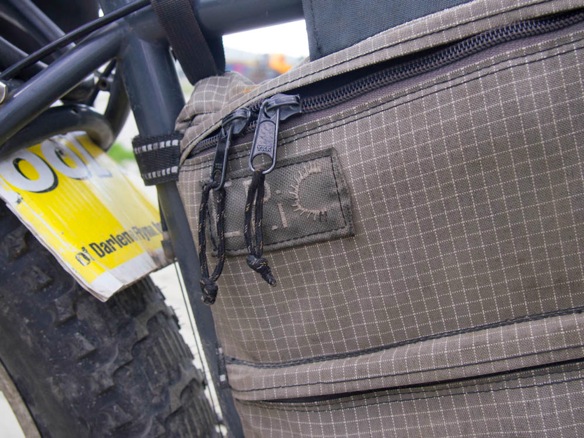
First, Matt’s Surly Pugsley with fat tires, coruplast fenders, vintage EPIC Designs framebag (from Eric Parsons, of the renamed Revelate Designs), and Alpaca packraft.  Matt lives on a sailboat in Juneau, having sailed north though the Inside Passage from the Puget Sound.  This is a true Alaska bike, especially with the raft.  I spotted Matt’s name in the logbook at the cabin on the Trans-Canada Trail from Braeburn, dated from 2010.  Surly Racks support Ortlieb panniers in the rear and the raft up front.  Titec-made Jeff Jones-designed bars, Ergon grips and Paul Thumbies are standard on sensible upright touring bikes.  Endomorph tires are mounted front and rear at 30 psi for paved stretches.

2194WP

2196WP

2506WP

The odd couple:

2200WP

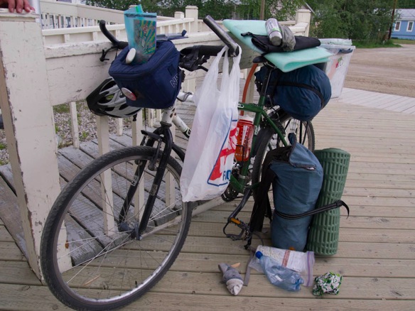
Ela’s recent purchase of a used Kona Fire Mountain made my day.  She leads mountain bike trips in Skagway for a local company, but found some time to look around up north.  I love her “system”– a plastic tote on a standard rear rack, a couple stuff sacks and an NRA lunchbox-turned-handlebar bag.
2189WP

2190WP

2185WP

2187WP

And of course, Dave and Sarah’s custom Robin Mather tourers.  Hopefully, I’ll run into them again to catch a better look.  Next time I see them Dave will be riding without front panniers, and with a new Porcelain Rocket frame bag.

2113WP

2110WP

And these old guys from Juneau left me half a cinnamon roll in Braeburn, which I blame for my muddy wanderings on the Trans-Canada Trail.  While enjoying and ruminating over the roll and a cup of coffee, I spotted the trailhead behind the Braeburn Lodge.  They ride matching Bruce Gordon BLT (Basic Loaded Touring) bikes.  These are the Petaluma, California bikes, not the Taiwanese BLT bikes offered more recently.

2420WP

2415WP

Adam has attempted an Argentina-to-Alaska ITT, but relaxed when he reached the northern part of South America due to muscle strains.  Still only 103 from Ushuaia, he is within two weeks of Deadhorse at Prudhoe Bay.  He was missing one chainring bolt entirely, and the other was replaced with standard stainless hardware store fare.  The hash marks on the seat tubes signify the number of days on the road.  A Trek TT bike was used on purely paved portions.  The ride supports autism.

2691WP

2688WP

2694WP

This French rider was on a 1986 Alex Singer, built with Reynolds 531 All-Terrain tubing.  With a small pair of rear panniers and a Gilles Berthoud handlebar bag he was quite proud of his minimal load, communicated despite poor English and my basic French.  The frame has ridden PBP twice and has been repainted by paintbrush recently, seemingly with standard house paint.  The bike features Campagnolo derailleurs, Stronglight cranks and headset, 3TTT stem and bars, Schwalbe tires on a Mavic Cosmos wheelset, and a Gilles Berthoud saddle.  The brake levers were the only Shimano bits to be seen.

I would ride this bike without the racks, and with a huge framebag.

2695WP

2697WP

2698WP

This father and son pair from San DIego and Mexico City were on skinny-tired cross bikes.  They laughed when I asked if they planned to ride those tires to Inuvik, on the gravel Dempster Highway.  Of course not, they were also packing (or had shipped) 32mm knobby tires.  They’re a long way from the paved stretches of southern California, and they remarked that they’d rather be riding tires like mine even on the “sealed” roads.  Even a 32mm tire is narrow to me, especially with a full load of panniers.  The son was on a Bailey AL/carbon cross frame, while the father was on a steel Kelly cross frame.  Incidentally, the lightweight steel frame was said to be “wobbly”; no complaints about the other.  Both were riding skinny Continental tires on the road with front and rear Ortlieb panniers.

2725WP

2726WP

Two nights in the Yukon, and beyond

2615WP

It’s time to get moving.  A day off in Whitehorse has become two-and-a-half days of supermarkets and new shoes, some singletrack and a new SRAM PC-950 chain.  You should have smelled my old shoes, which have almost a year of touring and commuting engrained within.  If you recall, I posted an open invitation a few months ago to join me at any point along the summer, which I entitled Open source touring.  I listed my approximate plans, asked for suggestions and ultimately, for riders to join me.  Sean, an internet friend and real life acquaintance from the 2nd Cycles co-op in Tacoma, WA will be joining me in Missoula on July 22 for some Divide riding.  He’s got close to two months time and has a highly capable bike with 2.3 Kenda K-Rads(!), so we’ll likely dig up some cool dirt riding along the Divide and then in Colorado, perhaps en route to Utah.  Ever ready for adventure, Lael will be flying into Denver for my birthday in late August.  The plan is to ride the Colorado Trail or assorted dirt routes to Utah– a trio above treeline.  The catch: she’s got the Cannondale Hooligan, which might have to turn into a real mountain bike in Denver somehow.  Likely, we’ll sell the Hooligan and source a capable used mountain bike.  I’m still dreaming of getting her on a fatbike for the fall, but I’d have to build a lighter-weight version of the Pugsley she rode this winter.  When the bike is essential transportation, you don’t complain about frame and rim weights, but since the snow has melted and such a bike is more of an overgrown XC mountain bike, it’s not easy to grab a fatbike over a more lightweight steed.  Before you point fingers about being weight conscious, try commuting ten miles a day on Large Marge rims and fat tires.  Lael did it at 7:30 AM every morning this winter, and never did it rain or shine.  It was cold and dark every morning.  She’s earned something that rides nice.

Google Maps tells me it’s 1800 miles to Missoula and I say I’ve got 22 days= 81.8 miles/day.  Alright.  I’ll be in Missoula soon enough.  Reminds me a bit of what I was doing last year, riding to the start of the Divide from Maryland.  I ride more to get to the Divide than I actually spend riding it.  Somehow I’ve biked over 1500 miles and am still less than 800 miles from my starting point in Anchorage.  Somehow, about half has been on dirt roads.  It’s time to quit touring and start biking.

Leaving Dawson City at 8 PM about a week ago, I encountered a mass of smoke emanating from wildfires somewhere up north on the Dempster Highway.  Surrealistic night rides are my favorite; riding down the middle of the lane on empty roads at 1 AM in midnight sun wildfire surrealism is even better.

2230WP 2

2234WP

2243WP 2

2239WP 2

2246WP

2250WP

2258WP

2253WP 2

Moving south, away from the fire.  The sun, of course, is to the north at this time of night.

2259WP

2254WP

2262WP

2264WP

In Whitehorse, I met Tristan at the Icycle Sports bicycle shop.  Nearly a small warehouse, the shop is well stocked and rents space to a coffee roaster that operates a small coffee bar.  Bikes and espresso– just about perfect.  Tristan will be in Banff around August 1 to ride the Divide, and beyond.  He shared a sampling of local Whitehorse singletrack with me, including the famed Yukon River Trail on a sandy embankment above the river.  The city has four full-time employees building and maintaining trails, and it shows.  Each trailhead has a fully legible signboard with route descriptions, difficulty ratings and a map.  Each trail junction features a micro map indicating the trail name and difficulty.  These facilities seem obvious, although I’ve never seen anything quite as refined.  Whitehorse has well over 300 km of signed and maintained singletrack, right out the backdoor.  Other dirt rods and trails go further, especially with local knowledge.  A borrowed full-suspension Marin smoothed out some of the more challenging downhill routes.  None are pictured here; as you can imagine, I was heavily invested in gripping the handlebars and avoiding obstacles.

2578WP

2564WP 2

2591WP

2581WP

2586WP

2589WP

2612WP

2593WP

2621WP

Thanks Tristan.  For three consecutive years he has planned to ride the Divide, but three (annual) collarbone injuries have kept him grounded for the summer.  Last year’s incident broke a steel Salsa El Mariachi frame.  He’s currently riding a Niner SIR 9, a Reynolds 853 steel 29er, although he’s most often found atop a burly Cromag steel hardtail all-mountain bike.  He’s a “seat down” kind of guy and pedaling the Niner all day on the Divide will take some practice, not that he doesn’t have the legs for it.  If he can keep his wheels on the ground for a few more weeks, his Divide dreams will become a reality.

2605WP

Finding a good campsite in Whitehorse isn’t hard either.  Cross the river and head uphill on some singletrack for some great views and secluded spots; this one is just behind the hospital on the Hospital Ridge Trail.

2558WP 2

2561WP

Dawson Overland Trail: Braeburn to Whitehorse

2488WP

Arriving at the Braeburn Lodge on the North Klondike Highway, I meet two cycletourists on Petaluma-made Bruce Gordon BLT tourers.  Unable to finish their monstrous (and locally famous) cinnamon roll, they’d left half for me as a motorist had told them I was coming.  I sipped some coffee and wandered about, reading some nearby signage regarding local history.  In fact, the signage was describing an overland route between Whitehorse and Dawson, and a bicycle was pictured alongside.  And, the Trans-Canada Trail symbol was present.  Excitedly, I inquired in the cafe about the trail and was told it was quite nice, and that it would surely route me to Whitehorse.  “Is it rocky and rooty?”, I asked, to avoid a jarring experience.  Not so much, I was told.  I couldn’t think much else to ask, other than for a $9 cinnamon roll.  I was just about out of food, planning to have been in Whitehorse later that day.  Throw in a bag of Lay’s potato chips as well.

2427WP

2429WP

2425WP

2432WP

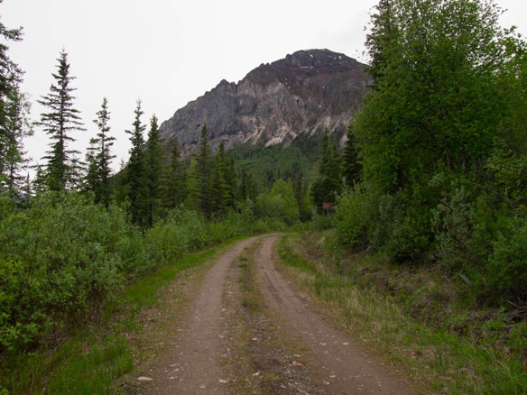
Upon arriving by boat at the Alaska coastline and hiking up and over Chilkoot Pass, fueled by gold fever, there were several ways to Dawson.  Whitehorse was a major stopover along the way for would-be miners and marked the first junction with the mighty Yukon River, at this point only 80 miles from it’s headwaters in the coast range.  To the gold bonanza in Dawson, downriver travel on the Yukon during the ice-free summer months was the best way to prospective riches.  Homemade timber rafts could manage the few rapids along the way and eventually, large wood-fueled sternwheelers were the preferred mode; mostly, the river flows like the Missouri– wide, flat and swift.  In winter, travel on the frozen Yukon is possible, but during the shoulder seasons an overland trail was developed for horse and carriage, dogsled or sleigh, or foot traffic.  The Dawson Overland Trail was the first “road” to connect Whitehorse and Dawson, and was eventually a motorable route.  The White Pass and Yukon Railroad company was contracted by the Yukon government to construct the trail, and they operated mail and freight services to Dawson along the route.  Since that time, a modern road is in place along an alternate, shorter route.  Anymore, the Dawson Overland Route is a rugged section of trail, of ATV and snowmachine width. It has been loosely maintained as a part of the Trans-Canada Route and by a local snowmachine organization.  While signposts suggest travel by horse, bicycle and ski, I suspect that winter travel by snowmachine and dogsled are recommended.  Cross-country skiing and fatbiking in winter might provide relatively simple passage, considering snow conditions.  In summer, it’s a wet muddy mess with plenty of water– a good time for a horse, perhaps.  And with a bike in summer?  Only if you like wet feet and carrying your bike.

2520WP

Aside from an initial stream crossing to access the trail, the route begins plainly enough though classic boreal forests– and relatively tall trees for this area.  Running along at eleven or twelve miles per hour, this was much like Divide riding without the climbing.  A few small stream crossings impressed me enough to photograph, until I’d crossed almost a dozen and quit unpackaging my camera and removing my shoes at every trickle.  I forged ahead with wet shoes, a reality with northland travel.  More often, the water was nearer to my waist than my knees and I was becoming a bit concerned that I might never make it to Whitehorse.  At least, not today.  I’d have to find the rhythm of “overland” travel, as opposed to the humdrum highway riding I’d become accustomed to.

2439WP

2443WP

2441WP

2446WP

2449WP 2

2452WP

2460WP

2465WP

2463WP

2470WP

2469WP

2477WP

2493WP

2498WP

2499WP

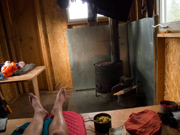
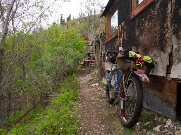
Climbing away from the water table onto small glacial features made for faster riding.  Predictably, every time I dropped back down to the moist grassy two track, water and mosquitoes were close as hand.  Sixty millimeter tires rode surely over saturated ground, and did not suffer from groundsuck, that maddening vacuumous feeling of having your tires stuck in the mud.  Still thinking of reaching Whitehorse in a day, I was relieved to find a small cabin maintained by the Yukon government and the local Klondike Snowmachine Association.  Respite from drudgery and mosquitoes and the theoretical threat of bears– mostly psychological– I retreated for the night into the wild as it felt an actual step back in time.   Grateful for shelter in such challenging terrain, I started a fire to dry my things and to prepare the last of my lentils and pasta; I was out of alcohol for my stove.  I read and washed in the stream and dried myself by the fire and dreamed of living in such a place, at the junction of two small valleys in a tiny cabin.  The views from the outhouse were a thing of fantasy, with distant peaks enshrouded in fog.  The peaks were unfamiliar, not picturesque– simply mountains.  Come morning I’d decided there are too many places to go and I’ve no experience hunting or fishing, so I’d have to move on.

2518WP

2515WP

2511WP

2513WP

2506WP

2507WP

I expected the trail to be more rideable as I approached Whitehorse on the second day, but I was almost immediately knee deep in beaver ponds.  Industrious and intolerant of heavy-handed human engineering, the beavers reengineered their home to include “the trail”.  With their usual sensible approach, beavers build along the contours of the land; humans build straight through it, up and over in a conquest against the land.  Beavers work with the land, no matter if you’ve built a trail through it.  After wading through a shallow pond, the outflow followed the path of the trail, which had become a stream.  Walking downstream with the bike at my side, I followed.  The blue markers found along the trail are from the annual Yukon Quest 1000, an endurance dogsled race from Whitehorse to Fairbanks.  In addition to Trans-Canada markers it was easy enough to find the trail.  Only a few side trails tempted me and I got off course only once, when a Trans-Canada sign had been disrupted and was laying face-down in the dirt.

2519WP

2472WP

2529WP

2530WP

2533WP

2534WP

2537WP

2480WP

2536WP

2541WP

2543WP

Approaching Little River and the Takhini River, the terrain undulates though a sandy substrate interspersed with soggy bottoms.  Water and mud covered bike, rolled in sand results in something akin to a sugared cookie.  There are better ways to treat a drivetrain, but finally sandy tracks turned to a narrow hardpacked road which had seen more recent motorized traffic.  Out of the thick, I sprinted onward with delusions of a quick ride into Whitehorse, which would surely open it’s arms to a weary traveler like me.  Twenty or thirty miles later (how could I have miscalculated?), I was staring down trucks and tourists outside a supermarket where bananas and avocados could be had for just a few dollars.  Not so many miles, but a long way from my cabin I reckoned.  If this is Whitehorse, this will have to do.  Some bananas and avocados and a half-gallon of milk later I was bemused at the swampy smell of my sneakers and the infestation of mosquito bites on the limited real estate of my sunburnt arms.  I am back in town and plugged wirelessly, Google mapping my way down the Cassiar to prepare for the road ahead.  And the cabin and the swamp is behind me, but not without an itch to return.  There is a lot more to explore up in the Yukon.

2540WP

2545WP

2548WP

2552WP

2555WP

Further Yukon explorations:

Dawson Overland Trail, maintained by the Klondike Snowmobile Association

Dempster Highway to Inuvik, the northernmost road in Canada

Canol Road (Charlie Kelly’s Canol Road expedition, 1985); two Yukon cyclists will attempt this route into the Northwest Territories later in the summer, unsupported.

Whitehorse area trails, most trails are well-signed locally.  Over 300km of maintained trails are accessible from town, cared for by four full-time city employees.

Montana Mountain area, near Carcross for some epic mountain bike rides

Roadside aurora

2252WP

The day barely dims to night up north this time of year, so the aurora borealis aren’t in play, but color flares abound on the roadsides in every direction.  The above image is darkened  by wildfires over the Dempster Highway near Dawson.  Incidentally, I’ve ridden from Dawson City to Whitehorse on a section of paved road called the Klondike Highway.  The exception–  for the final two days into Whitehorse I’ve found some of the mythical Trans-Canada Trail, which doubles as the Yukon Quest 1000 Trail (like the Iditarod).  To see what a snowmobile trail looks like in the Yukon in summer, come back tomorrow for the swampy, muddy mess.  Beavers really are industrious creatures, and they’ll have nothing to do with a trail in their backyard.  Rather than petition local governments, they flood the thing.

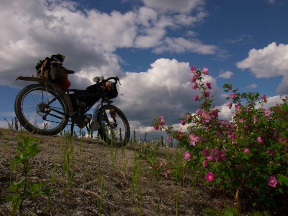
Most of these images come from the Yukon, while a few are remnant memories from my Alaskan adventures.  Persistent headwinds and sunshine have been challenging, namely in definition.  How does one describe a day of riding into stiff headwinds, interspersed with suntanning, swimming and picnicking.  Beautiful day, eh?  Fucking headwinds.

There are worse things to be doing for eight hours a day, and the winds keep the bugs off, mostly.  And from twenty feet away, a lynx stealthily ambles though my camp.

1741WP

1842WP

1823WP

1837WP

1872WP

2238WP

2292WP

2224WP

2281WP

2377WP

2304WP

2319WP

2344WP

2322WP

2285WP

2297WP

A dedicated list of cycletouring links will reside permanently at the bottom of the page.  I’ve populated it with some of the obvious resources for now, but feel free to suggest additions as you find them, or as I’ve forgotten them.  These could include resources on camping and hosting, routes and maps, bikes and equipment, rideshare boards and transportation resources, and helpful forums.

Dave and Sarah

2148WP 2

Just don’t call them Australian.  They’re English, dammit.

Dawson City is a great place to wash off the dirt from the Top of the World and to load up on groceries and supplies for the road ahead–it’s at least four or five day to Whitehorse with only a few small towns in between.  Dawson is also a great place to drink some beer on the solstice and it’s nice to have some new bike friends for the occasion.  David and Sarah flew to Anchorage from England and have followed a circuitous path to Dawson, as I have.  They’re headed south along the Great Divide Route and on to South America over the next year.

It’s also nice to have some new bike friends when you misplace your bike.  Oh yes, by the river.  Just as I left it.

2125WP

And for photographic remembrances.  Trying to get it just right…

2156WP

2157WP 2

Perfect.  Well, good enough.

2158WP

The cyclists I meet get much stranger than Dave and Sarah, but none much nicer.

2179WP 2

They’ll be on the road for the next year on their way to Argentina, riding shiny new custom Robin Mather touring bikes.  David’s got a template in the mail to Scott Felter of Porcelain Rocket for a custom frame bag so that he can send his front rack and panniers home.  It may seem a small matter, but Sarah’s burgundy Mather is wearing some 26 x 1.75″ Schwalbe Marathons, which are my favorite touring tires.  Proof that normal people go cycletouring as well, keep up with them on their humble blogsite 5monthstomexico…?.

The Taylor and the Top of the World

1937WP

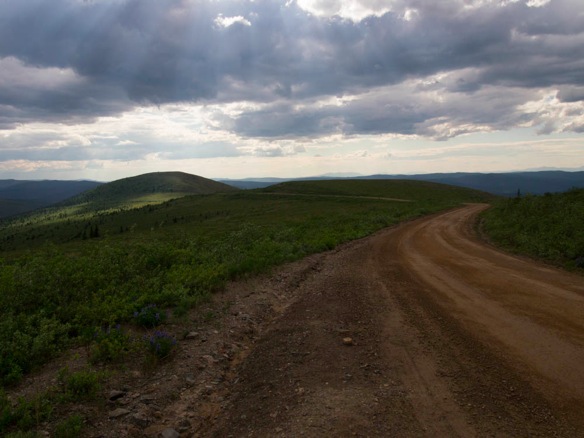
Tok to Tetlin, the Taylor Highway and the Top of the World Highway to Chicken and Eagle and Boundary and Dawson City.  Nonsense are the names of things around here, but there are only two roads into Alaska and this is the one to take.

The Taylor Highway was built to access the rural mining communities at Chicken and Eagle, and to connect them to Tok and the rest of the world.  The Top of the World Highway, once called Ridge Road, connects these and other mines to Dawson City in the Yukon Territory across the border.  Both roads are spectacular.

1980WP

The road from the Tetlin Junction on the Alaska Highway to Chicken is roughly paved, and features some good climbing some long fast descents– it’s a great road ride.  Chicken to Dawson is about a hundred miles along ridgetops and as you approach the border surface water becomes scarce, save for some melting snow.  The road rolls relentlessly atop mountains and is mostly dirt, despite some failing efforts at sealing the surface.  Grunt climb, fast descent to the next climb, BMW motorcycles everywhere and fuel trucks at 90 miles an hour.  A motorcycle rally in Dawson flooded the roads with two-wheelers and friendly motorcycle-style waves: two fingers casually down to the left to an oncoming rider, or skyward with the left hand like a turn signal when passing (or being passed).  Lael loves giving the “motorcycle wave”.

Leaving the bustling Alaska Highway behind for the road to Chicken, the Taylor Highway begin by climbing from the Tenana River valley.  No services for 67 miles.  Perfect.

1858WP

1869WP

1861WP

1867WP

1879WP

1886WP

1881WP

1888WP

1891WP

1896WP

1899WP

Chicken is quite an attraction for summer motorists, although the real story in Chicken is gold.  Mining activity is found up and down every creek, and generators can be heard humming in the bushes to operate equipment.  A real life miner makes his own jewelry for sale as a way to maximize profits.  Even on a bad day of mining, he’ll end with about $500 in flakes.  Maybe gold mining in Chicken is in my future?

1915WP

At Chicken the surface turns to dirt.  Hopscotching drainages, up and down, the road finally turns up toward the US-Canada border to Dawson City.  Superlative, as they say– the views, the road, and the riding.

1918WP

Close your eyes and hold your breath when these things are comin’ down the mountain.  These fuel trucks travel even faster than the motorcyclists as they drive this road every day.

1922WP

1926WP

1927WP

I had come from Chicken and at the Jack Wade Junction, a left turn leads to the end of the Taylor Highway in Eagle.  I stay the course to the Top of the World:

1934WP 2

Just a small dot on the map, there’s not much more to Boundary than an airstrip and this cabin.  Extensive mining can be seen in the valley below.

1944WP

Sunburnt shoulders are evidence that summer has finally arrived.  In my favorite touring shirt, a cutoff cotton Velo Orange t-shirt depicting a 50.4 bcd crank, I grunt and groan up to the Canadian border into headwinds and marble sized raindrops.  Despite their size, thunderstorms developed all around but I managed to stay dry once again.  The Canadian customs agents ask the usual questions.  Dressed in my Sunday best, or my “dirtbag jersey” as I call it,  I give the usual answers:

Anchorage, Alaska.

New York, Washington, Florida, Maryland, Alaska.

To Montana.

Yes, really.

No, I don’t have family or a job in Montana.

Actually, I’m going to Arizona.

Yes.  Really.

It’s a snow bike.

Yes, really.  All winter.

Oh yes, the Germans have lots of stuff.  I swear it’s all here.

This is the tent.

Thirty-nine dollars American, but a couple thousand in the bank.  Well, more than a couple.

Bank statements?  No.  Sorry.

Last time…I entered at the Thousand Islands Bridge and exited Ontario at Sioux St. Marie.  Then again at Wild Horse and Rooseville.

Hmmm, I just like the Canadian countryside.

Ok, bring a bank statement or ATM receipt next time?  Thank you, sir.

Next time I’ll be sure to bring bank statements and Ortlieb panniers full of stuff to facilitate passage.  Maybe some sleeves will help too.

1947WP

Looking back.  They say the Alaska Range is visible on a clear day.  The road reaches a maximum elevation of 4127 ft, which is higher than Maclaren Pass on the Denali Highway.  In fact, this is the second highest road in Alaska.

1932WP

1961WP

1988WP

1996WP

And on the night before the solstice, I camped on Top of the World.  This is all the darkness you get these days, which is a dream on a bike trip.

2003WP

2008WP 2

I’m becoming quite attached to some of the new Revelate gear.  The Gas Tank is quite handy on the bike and the “Pocket”, which I use in conjunction with a waterproof compression sack, is easily detached.  For a quick trip away from the bike the shoulder strap helps keep all my essentials close at hand– Steinbeck’s Log from the Sea of Cortez, a fully-charged can of bear spray and my camera.

The Surly Pugsley hybrid rolls well on dirt roads at about 20psi, although the Big Apples are a bit unsure on pea gravel.  However, the smooth tire rolls like a dream on pavement.  I’m hoping to procure a Marge Lite rim to build a lighter rear wheel.  Absurd wheel weights are killing me and fat-lite is the way to go.  There’s no reason to be riding a forty pound bike with thirty pounds of gear.  I’m not sure of the actual figures, but I can assure you the bike weighs more than my kit.  I’ve sent home three pounds of cold-weather clothing and rain gear from Dawson and I’m tuning the bike for a full summer of lightweight travel.   As much as I’m enjoying Alaska, I’m looking ahead to some of the more challenging riding ahead– I’ve still got the Colorado Trail on my mind and am planning to fit 45North Husker Du tires in Montana.  Is a 65mm singlewall rim such as the Marge Lite suitable for touring on rough surfaces?  Nobody seems to know, but given the quality construction and the doublewall sections in the corners, I think it’s up to the task.  I’ve become obsessed with tire volumes and the weights of things, specifically fatbike wheels.  A 690 gram Surly Marge Lite sounds a treat to my knees.  I like climbing, but I’d like it much more with the Marge Lite.

2016WP

2043WP

2028WP

The bike, the gear, the wheels, the packing, and the food–it’s all getting sorted out after a few weeks on the road.  The legs are coming along too, although not where they were last November.  My kitchen on the road and the Alaskan pantry: raisins, peanuts, oat meal, coffee, lentils, pasta, peanut butter, honey, salt, pepper, garlic and curry powder.  Add fruits and vegetables when available, and cheeseburgers and ice cream in town.  The plastic water bottle is filled with alcohol to fuel the “Penny Stove”.  Fabricated out of beer cans, stainless steel bicycle spokes and aluminum ducting, I’ve been using this design for almost three years.  I’ve built a handful for others, but have only required two for my travels.  The first one was made from the Heineken keg-shaped cans, which are no longer available.  The current stove was made in Steamboat Springs, CO last fall on the Divide.  Trailside, it was made with a small Swiss-army knife.  The blue enameled steel camping mug has been with me since the summer of 2009, and is a personal luxury.  I’ve also begun to fill the 64 oz. Klean Kanteen when surface water is less plentiful or spoiled by mining activities.  Cradled in the Salsa Anything Cage it is held securely even on the most rattling washboarded descents.  Just be sure to tighten those straps!

2053WP

1144WP 2

A final push to Dawson on the third day is rewarded with a long descent to the Yukon River and cold beer in town.  The river is crossed by the free George Black ferry and Yukon Gold brew from Whitehorse flows like water in this real-life frontier town.  This is also the start of the Dempster Highway up to Inuvik.  Some other time.

2056WP

2060WP 2

2069WP

2081WP

2098WP

2106WP

2105WP

Packing the Hooligan

467WP

A week before leaving for Europe, Lael picked up a Cannondale Hooligan 8.  It was a sweet deal and helps that she doesn’t have to borrow bikes in England and Corsica where she is studying and traveling.  The Hooligan is being used for commuting around town this month; next month, it will be touring France and Corsica.  In these few months it’ll find itself on three flights, two ferries, and a handful of trains.  Carving city streets and cruising canal trails are some of what it does best– and whatever else a hooligan on a 20″ wheedled bike can find.

Taken at 3:30 AM the night before her flight, Lael, Greg and I fit the Hooligan into a packable drawstring sack for airline travel.  WIth a few other camping items strategically packed to protect disc rotors and derailleur, it looked a bit like a cello or a bass guitar.  Cables and brakes all remained connected even though the fork was removed; tape and string it all together, then pack it away.  The large cotton sack is intended for moose quarters and I’d have liked a similar bag in nylon so that it would be more packable, but the cotton was all I could find the day before the flight.   Remember Greg from Colorado and New Mexico on the Great Divide last fall?  He’s leading bike trips for Backroads in Alaska this summer and our time in Anchorage overlapped for less than twelve hours.   About thirty pounds: the Hooligan, Revelate and Inertia Designs frame bags, a homemade groundcloth, and Western Mountaineering Summerlite sleeping bag and Hot Sack VBL/bivy make a manageable bundle at the airport and on the road– unencumbered summer travel.

675WP 2

677WP 2

680WP 3

679WP

The bus

1358WP

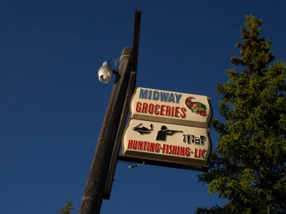
When a motor vehicle dies in Alaska, it does’t go anywhere– there are old trucks and buses scattered all over this land.  This Ford school bus is situated just a mile from the Nabesna Road on the Tok Cutoff (Glenn Hwy) behind the Midway Grocery in Slana, AK.  Jay and Debbie Capps welcome cyclists by the dozen every season, allowing them to camp on their property or spend a night in “the bus”.  Power and propane are luxuries to a touring cyclist; a cassette player, a dinner table and a drip-coffee maker are divine.  With a selection of groceries nearby and a propane stove, creative home-cooked meals are possible and I finally sampled a can of corned beef hash that I’ve been seeing in rural groceries for four years.  Augmented with lentils and curry, it was a treat.  I stayed in the bus the night before my Nabesna adventures and again on the night following.  I drank a lot of coffee; read John Steinbeck’s account “About Ed Rickett’s” who was the real life “Doc” from Cannery Row; and got lost in Neil Young’s Harvest on a worn cassette tape.  I think Neil was a road guy like us.

“Think I’ll pack it in and buy a pick-up
Take it down to LA
Find a place to call my own and try to fix up
Start a brand new day

The woman I’m thinking of, she loved me all up
But I’m so down today
She’s so fine, she’s in my mind
I hear her calling'”

“Out on the Weekend”, Neil Young, Harvest, 1972

1789WP

1354WP

1370WP 2

1368WP

1374WP

1375WP

1386WP 2

1395WP

1356WP

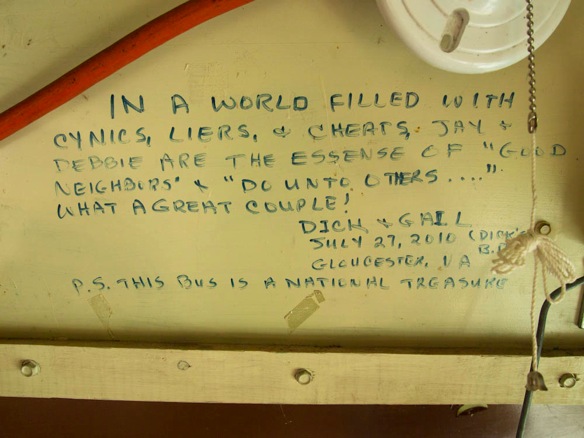
The aura of goodwill and kindness extends to the handwritten notes on the walls:

1360WP

1363WP

1365WP 2

And assorted memorabilia from past bike trips:

1361WP 2

1366WP

1362WP 2

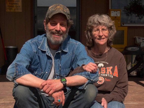
Be sure to stop in Slana at the Midway Grocery.  Our welcoming hosts, Jay and Debbie:

1801WP

The forgotten Nabesna Road

1401WP

Visitors to Wrangell-St. Elias National Park typically visit from the south entrance, which is a 60 mile dirt road ending in the revitalized town of McCarthy and the expansive copper mine in Kennecott.  By most reports, it’s an “adventurous drive” as it is probably as long any most people have driven on dirt in a long time, if ever.  “Check locally about road condition” say all the guidebooks.  I’m sure it’s fine, but be sure to tighten the straps on the canoe on top of your RV and the bikes on the back.  I’d have visited if I had been passing the south entrance, but the flow of tourists deterred me from going out of my way.  I recall visiting Talkeetna for the first time, which is often described as “quaint” and a “town”.  Although people do live in the area, it’s a well-disguised tourist town with unique eateries and gift shops, but it’s not a real example of Alaska.  I suppose this is the Alaska that they want.  It’s also the Jackson, Breckenridge, and Key West that they want as well.  I’d still like to go to McCarthy and Kennecott.

1398WP

From the town of Slana on the Tok Cutoff of the Glenn Highway, the Nabesna Road pierces the park from the north.  The settlement of Nabesna, which is no more than a few private lodges and an airstrip, is located forty-two miles down the road.  The Nabesna and Rambler gold mines are a short distance away.  See my post about the Nabesna Gold Mine.  The road is mostly dirt and quite passable in most conditions.  Only after a rainy week or during the spring melt is travel restricted, although four wheel drive vehicles can almost always pass.  Several stream crossings near mile 30 were as much as a foot and a half deep as I found them, and I was easily able to ford with my bicycle.  I’ve heard about these streams from many miles away when asking about the road.  It’s amusing to encounter a relative trickle.   The first eleven miles of road are sealed; after that, the road is generally well-graded dirt while some spots appear to become a little muddy after a good rain.  Until the three stream crossings near mile thirty, the road is like most dirt roads– passable, but a little bumpy at times.  By bicycle, the road is thus far accessible with almost any bike, although a 32mm tire or larger is encouraged.  A typical touring, hybrid or cross type bike will do, while proper mountain bikes are well suited.  In dry summer conditions, it sounds as if the streams may almost completely dry up and make travel to Nabesna possible in any two-wheel drive vehicle.  On a bicycle, you may get your feet wet.  The remaining ten miles to Nabesna become more scenic as you enter into the mountains, although you lose elevation into Nabesna, with a few short climbs.  Several sections of the road cross stream beds of gravel and cobbles, but were ridable on a larger tire.

To start, eleven miles of sealed roads through boreal forests are following by graded dirt roads.  A few signs of a muddy spring are present, but mostly the road was fast and dry.

1788WP

1418WP

1774WP

1424WP

1426WP

1434WP

1443WP

1458WP

1461WP

The road is largely unregulated, at least in the way you might expect in a National Park and Preserve.  There are many turnouts for camping, including several waysides with pit toilets.  Several campgrounds along the way offer multiple sites although none were in use, owing to the low traffic volumes on the road.  At mile 29, the Sportsman’s Paradise Lodge operates a bar with wireless internet, and has potable water.  I’m not really sure if they do much business; they’re still flying the Palin flag with pride.  When I stopped, Copper River salmon were being prepared –a few hours to dry in the sun followed by a full day in the smoker.  A handful of rocks and a watchperson stands guard against camp robbers– the persistent gray jays.

After the stream crossings, the final few miles to Nabesna become a little more rugged, and scenic:

1467WP

1463WP

1472WP

1475WP

1476WP

1480WP

1491WP

1478WP

Nabesna is a really only an airstrip with a a few homes and small planes.  The Ellis’ Lodge has been in operation for over 40 years, long before the park’s inception in 1980.  The road officially ends here, while several miles of unmaintained road take you to the Nabesna and Rambler Gold Mines.  Either by foot or by bicycle, they are worth a visit.

1508WP 2

1500WP

1509WP

1518WP 2

1522WP

1529WP

1531WP 2

The Rambler Mine is up a 0.7 mile trail that gains about 700 ft of elevation; the trail begins about a mile past the Nabesna airstrip.  A hike to a secondary mine shaft ascends another 700 ft (approx.) to superlative views of the Nabesna River and the surrounding ranges.  Regarding sites of historical interest, both mines are quite raw without printed history on display.  This is real discovery.

1747WP

1748WP

1742WP

1734WP

1635WP

1645WP

1697WP

1705WP

1679WP

1688WP

1727WP

For out of town visitors, a good way to make a day trip to the mines would be to leave a car at the first stream crossing and ride the remaining ten or twelve miles to Nabesna– this is the most scenic part of the road anyhow.  For cycletourists, ask at the Midway Grocery for a place to spend the night before or after riding the road.  Located about a mile east of the Nabesna Road on the Glenn Highway they offer an old school bus, refit to accommodate several people and have ample space for tent camping.  Jay and Debbie are inspiring people, and the bus is wallpapered with warm thanks from travelers.  Their grocery is well-stocked and is the best place to pick up supplies between Glennallen and Tok.  A NPS office is located about a quarter mile down the Nabesna Road.

1391WP

1355WP

Nabesna Gold Mine

1524WP

The color and geometry and antiquity enamored me.  Located on a small tract of private land within Wrangell-St. Elias National Park, the Nabesna Gold Mine is a charicature of frontier industry.  It would never have been recreated this well by historians and set-artists, but the contrast of order and chaos is exactly what it would look like if it had been.  A 42-mile dirt road penetrates the park from the north to the settlement of Nabesna.  There, a muddy two-track takes you the additional four miles to the gold mine at the end of the road, which was abandoned back in 1945.  I tip-toed and shutter-clicked around the decaying structure, careful not to awake any ghosts or critters.  I put one foot forward with half my weight, testing floorboards and stairs and ladder rungs.  And when I was done I walked briskly back to my bike, stopping for a few extra clicks of crusted ferric sediments, a broken window and the orderly disorder of rusting barrels.  The circus left town on this place; I left just as quickly,

One of only two roads into the largest national park in the United States, the Nabesna Road is under-visited, largely due to the rough dirt road and multiple stream crossings which thwart most two-wheel drive cars and larger RV’s when the waters run high.  Additonally, there are no tourist facilities at the end of the road, such as in McCarthy.  By bicycle, the road is quite rideable but offers enough challenges to come home hungry at the day’s end.  There is another small gold mine near the end of the road only a short hike away.  See my post on biking the Nabesna Road.

1533WP

1536WP

1541WP

1545WP

1549WP

1550WP

1551WP

1556WP

1554WP

1557WP

1563WP

1567WP

1570WP

1572WP

1571WP

1581WP

1598WP

1589WP

1591WP

1603WP

1606WP

1609WP

1607WP

1582WP