Picketpost to the end on the Arizona Trail

Nicholas Carman1 5541

Lael on her Specialized Era Expert in the hills around Mt. Lemmon.  The AZT is an incredible resource.  For an alternate cross-Arizona route consider blending the AZT with the Flagstone 500 route which incorporates Sedona, some of the Coconino Loop, and the Black Canyon Trail, thereby avoiding paved detours along the middle section of the AZT.  Both are worthwhile routes through the state.  The Arizona Trail, or more accurately the AZT750 version for mountain bikes, should make every avid bikepacker’s list.  Check out Part I (Utah to Flagstaff) and Part II (Flagstaff to Picketpost) from our travels on the Arizona Trail.

She introduces herself as Corinna.  Asking where she is from, a question which is similarly challenging for us to answer, we receive a short history of her life.  She has recently taken a new job as a librarian in Durango.  She rides a Salsa El Mariachi.  The staff at Velorution Cycles are knowledgable and supportive, she tells us, and this is her first solo bikepacking trip.  This is her third, or perhaps fourth morning on the Arizona Trail.  We’ve been living on the trail for over two weeks, minus a five-day layover in Flagstaff during the rain.  Sitting with legs crossed, mixing Emergen-C vitamin drinks and dining on rice crackers and apples, the first thing I notice at eye level is the pattern of bloody scratches on her shins.  Ours looked the same just a few days ago, although by now the lightly scabbed wounds hardly show.  We inquire, knowingly, about the trail ahead.  We share similar details of the trail north of Oracle: overgrown, hard to find, and prickly.  But we’re happy to report— as we are crossing paths in opposite directions— that she is soon to enjoy the smoothest part of the entire Arizona Trail in the downhill direction.  If she was overjoyed at the good trail ahead, she doesn’t show it, nor do we grimace to learn that more leg scarring thorns lay ahead.  Like choosing to go cycling in England, you can’t hate the rain.  You can’t hate Arizona for rocks and thorns and 90 degree heat.  Most of the time, being here is pure desert bliss.    

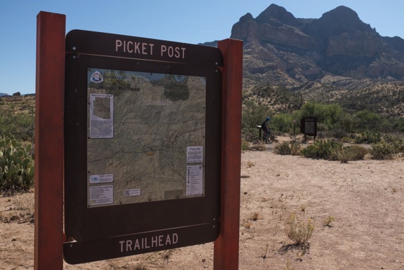
We arrive at the Picketpost Trailhead, the beginning of this section and the end of the long detour around multiple wilderness zones, with great excitement.  From our last time in Arizona in 2013 when we connected from Tucson back towards Phoenix via this route, this section was one of our favorite routes in the state.  The trail climbs several thousand feet along rideable singletrack to a series of high points, tracing high lines on the walls of deep canyons, plummeting down to the Gila River and the lowest point on the entire AZT.  The trail from Hwy 60 (Picketpost) to the small community of Kelvin on the Gila River is the keystone in the AZT, the most recently completed section of trail.  It is also the most stunning ridable section of trail— thereby excepting the Grand Canyon and sections of the Highline Trail.  This section is nearly 100% rideable.

Descending to the Gila River mid-afternoon, we spend more than an hour swimming in the shade.  By the time we are back on the bikes, the sun is low in the sky.  Even though we know better, we’ve miscalculated the remaining distance to Kelvin, where we hope to refill our waters.  The silty Gila River would be fine if treated, although we’re only traveling with a few spare chemical treatment tablets from South Africa with dubious properties.  The remaining 15 or 16 miles are wonderful riding, a little longer than expected, a little more topography than expected, and naturally, a little slower in the dark.  As we close to within 7 miles of Kelvin, in the dark, we both run out of water.  I have been rationing for the last hour and am quickly thirsty.  Without spoken agreement, we begin riding faster, grunting up short steep climbs, trusting the shadows and riding blind around tight corners.  It is an exhilarating ride fueled by desperate thirst.  We arrive without water, although Lael exhumes a small bottle of spirits out of her framebag and we wet our lips like sunburnt cowboys.  For a moment, it quenches the thirst.  We race the final mile to Kelvin for water.  Up the road there is supposed to be a trailer court.  We travel in that direction, into the darkness, but soon return to the glowing yellow lights of the locked ADOT yard.  I climb and squeeze between the gate and load all of our bottles and bladders with brackish, yet potable tap water.  Outside the fence we each consume over two liters while laying in the gravel, enjoying the feeling of mid-summer in October, now at 1600ft in southern Arizona. I return to refill our bottles, tearing the back of my cut-off t-shirt on a piece of barbed wire.  We roll away to camp for the night.

The following afternoon, forty or forty five miles down the trail towards Oracle, we cross a large wash and a low point on our track.  Rain clouds loom overhead, and only a short distance stands between us and our next resupply in the town of Oracle. I reason that we could arrive just after dark, perhaps and hour after sunset, two hours maximum.  Lael is skeptical, fooled one too many times by me, by straight-line mileage, and by the Arizona Trail.  We scout a route down into the valley, where we expect to find a paved road and several towns.  We race down Camp Grant Wash, keeping to the crusted sediments along the edges of the dry seasonal riverbed, avoiding the soft jeep tracks in the center.  We arrive at the railroad line adjacent to the road and ride the remaining miles into Mammoth in the dark.  It is a long detour for food, but since we are traveling without shelter, it also assures some chance of finding cover if needed.  We eat canned beans from the Dollar General and fresh pico de gallo from the new Mexican grocery next to the Circle K.  We sleep in town for the night, on a hill just above the main road.  In the morning we ride back out to the mouth of the wash and back up toward the trail.

Leading the way up the wash without GPS– as I have attached it to Lael’s handlebars for this trip– I miss the turn onto the trail.  I continue further and further up the wash until nothing looks familiar, thinking the trail crossing is still ahead of me.  I push towards rock outcroppings and even a windmill, faint recollections from yesterday afternoon.  But in different light, in a different direction, nothing looks familiar and I am lost. I could go back the way I came, but I feel like the AZT should still be ahead of me, or right near me, and I don’t know how to admit defeat and turn back.  I ride up a well-travelled side drainage toward the south, reasoning that I will at least cross the AZT at some point, but I don’t.  I climb and climb and climb the sandy track, desperate at least to gain some view of something.  By the time I reach elevation, I am hopeless that I can solve this riddle and resolute that I must retrace my steps, all of them.  But by that time I figure Lael will have left the wash, and would have gone back to Mammoth or toward Oracle on the AZT.  We don’t have cell service, nor an obvious meeting place.  I crest the hill and continue along the road.  I cross the Arizona Trail and begin back toward the wash.  But I discover that I am actually headed in the wrong direction, toward Oracle and away from Lael.  I reverse my route and now begin riding toward the wash on the AZT, about two thousand feet below.  The trail climbs and falls over a series of rounded peaks in these folded mountains.  I’m charging around corners at race pace, trying to make the most of my mistake and to find Lael as soon as I can.  Coming down the final rocky ridge toward the wash, I finally spot Lael walking her bike up the ridge.  We’re overjoyed at the encounter, nearly two hours after we split.  She decided, finally, that she would continue toward Oracle.  She left a note at the trailhead in the wash.  I fall to the ground, needing a proper meal.  Lael is crying and laughing.  It feels like a miracle, but we soon pack up and begin toward Oracle, together.

In three days, we’ve run out of water, run out of food, and lost each other.  That’s the price of riding like vaqueros, too confident in our abilities and in my sense of direction.  That, and the final ride to Oracle is a mess of overgrown trail, hard to follow and famously prickly.  That is how our legs came to wear all these scabs and scars, branding from the trail.  That is how Corrina and Lael and I commune upon meeting.  

The rains finally arrive in Oracle, and we seek shelter for the night under cover of $1.50 pints of Miller Lite at the Oracle Inn and a country band with a digital drummer.  We sleep under the pavilion to the side of the post office.  Gusting winds blow the rain sideways and I barricade our exposed down bags by turning several picnic tables on their sides.  In the morning, we resupply and head up Oracle Ridge.  

Oracle Ridge holds great weight around here, much like the Highline Trail and the Grand Canyon—these are the epic obstacles on an otherwise challenging route.  But, Oracle Ridge isn’t as bad as we had expected.  There is some rideable trail, some easy hiking, and some shrubby overgrown trail which could be a lot worse, which is proof that the trail isn’t very good.  The fact that this is still the Arizona Trail is remarkable considering the many sections of trail which receive frequent maintenance, seemingly swept clean on a daily basis.  We reason that even though we are carrying our bikes up 4,000ft, most people wouldn’t be able to ride much of the descent anyway.  About six hours after leaving Oracle, we exit the trail at Summerhaven, 20 miles and 4000ft away from our starting point.

The AZT750 continues along a prolonged stretch of pavement around wilderness, including a long descent, which stings after such a hard-fought ascent.  We enjoy the mellow pedal down Mt. Lemmon and seek shelter for a third night under the overhang of a locked concrete block toilet shelter in a closed campground.  In the night, we rearrange ourselves to avoid pooling water from the rain.  

Our ride resumes as the AZT exits wilderness, on a section of trail between Molina Campground and Redington Road, where it detours yet again around wilderness, channeling us into Tucson for the night.  Leaving Tucson begins a manicured section of trail through Saguaro Nation Park, the Colossal Cave area, across Cienega Creek, and under I-10.  And that’s where we meet Corrina, the only cyclist we meet along the entire AZT.

We tell her that we’re from Alaska, that we work seasonally and spend much of the year riding bikes.  She pauses, and asks our names.  

“Nicholas.” 

“And I’m Lael.”

Corinna informs us that she followed Lael’s Divide rides this summer and that it inspired her to get out and ride the AZT by herself.  

“Don’t curse me when the trail goes to shit”, Lael clarifies, distancing herself from responsibility.  “Mostly, the Arizona Trail makes me want to ride a road bike.”  

We laugh and point our tires in opposite directions.  

——————————–

Resupply, bold is on route: Superior, Kelvin (water), Kearny, Oracle, Summerhaven, Tucson, La Sevilla (water), Sonoita, Patagonia

Superior is 4 mi from Picketpost, Kearny is 7 miles off route, Oracle is 2 mi from the road crossing, Tucson is minimum 1.5 miles to decent resupply.  Kelvin is water, only.  


Download the complete AZT750 track at Topofusion.com.  Get current water date from Fred Gaudet’s site.

——————————–

Leaving the Picketpost Trailhead toward Picketpost Mountain.

Nicholas Carman1 5436

Nicholas Carman1 5438

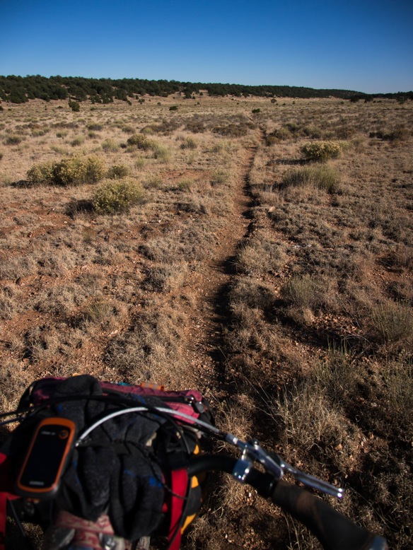
The trail reaches a series of high points.  The jeep track indicates the next high point in the distance, although the trail is hidden along the hillsides to the right.

Nicholas Carman1 5439

Epic AZT.  Rideable AZT.

Nicholas Carman1 5441

Nicholas Carman1 5443

Nicholas Carman1 5445

Nicholas Carman1 5446

Nicholas Carman1 5447

Coming over the third and final high point.

Nicholas Carman1 5449

Beginning the descent down to the Gila River.

Nicholas Carman1 5450

Ocotillo.

Nicholas Carman1 5452

Saguaro.

Nicholas Carman1 5453

Nicholas Carman1 5454

The 15 or 16 miles along the Gila River seem to catch many people off guard.  Don’t underestimate this section.  There is some great riding, but these aren’t free miles.

Nicholas Carman1 5455

Nicholas Carman1 5456

This is the Gila River.  Lael shares with me that on the Tour Divide, she sang the tune of the song “Tequila” to herself in the night while riding through the Gila.  Insert “the Gila” into the song, in place of “tequila”, then repeat the tune over and over and over.  These are the secrets to riding 200 mile days.

Nicholas Carman1 5457

Into the night, out of water.

Nicholas Carman1 5459

Nicholas Carman1 5462

Kelvin is just a dot on the map, no services other than water are available.  Kearny is about 7 miles down the road from here if necessary.  Oracle is another 60 miles of mostly singletrack.

Nicholas Carman1 5463

The Gila River.

Nicholas Carman1 5464

The much-loved Ripsey segment.  Views and high quality ridgetop singletrack.

Nicholas Carman1 5489

Nicholas Carman1 5490

Nicholas Carman1 5491

Nicholas Carman1 5492

Nicholas Carman1 5493

Nicholas Carman1 5494

The Meriwether is at home on many of these trails.  I think less often about full-suspension bikes, as a result.  

I’m happy to see a hardtail revival in the new breed of 27.5+ bikes like the Advocate Hayduke, Jamis Dragonslayer, and Marin Pine Mountain 2, but why are 29” trail hardtails losing steam, especially with the now common wide trail rims?  Even a company like Salsa, who claims the “Adventure by bike” motto, allows their El Mariachi 29er hardtail to languish in mediocrity while chasing esoteric “bikepacking” models?  

I replaced my broken front derailleur in Flagstaff with a Shimano SLX direct mount unit.  

Nicholas Carman1 5495

We’ve learned a lot in the past year, or year and a half.  In that time Lael has learned how to navigate by GPS, she’s ridden three different bikes, and clocked a whole lot of miles and saddle time.  Riding the Specialized Era on the AZT is a really positive experience, and puts her technical skills on a fast track.

Nicholas Carman1 5496

Nicholas Carman1 5499

I cut my rear tire sidewall, a Maxis Ardent EXO casing.  Lael adds stitching sidewalls to her toolbox.

Nicholas Carman1 5497

Nicholas Carman1 5500

At Freeman Rd., a little used trailhead provides a much needed water cache along this 60 mile stretch of trail between Oracle and Kelvin.  A local motel owner in Oracle stocks this cache, and leaves his business card with a welcoming note.  

Nicholas Carman1 5501

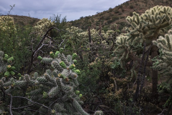
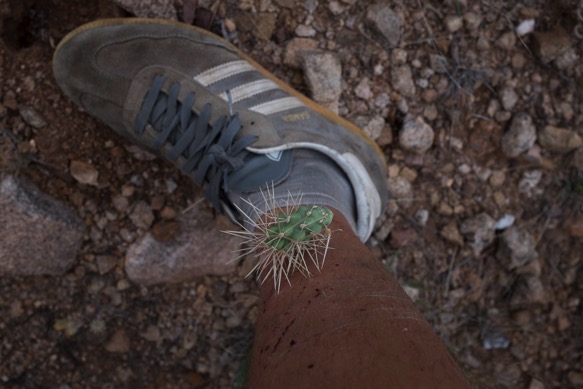
Cholla forests plus wind equal lots of cholla in the trail, lots of cholla in our tires, and lots of cholla in our legs.
Nicholas Carman1 5502

Nicholas Carman1 5503

Windmills and washes.  This section isn’t the most scenic, but the riding is great and old ranching history is abundant.

Nicholas Carman1 5504

Camp Grant Wash, our detour route to Mammoth.

Nicholas Carman1 5505

The threat of thunderstorms leaves little more than a few drops, but an impressive rainbow.

Nicholas Carman1 5507

Nicholas Carman1 5508

In rural Arizona, you can count on Circle K.

Nicholas Carman1 5509

Mammoth.

Nicholas Carman1 5510

Camp Grant Wash features a substantial freshwater seep.  We pulled water straight from the source.

Nicholas Carman1 5511

The remaining trail to Oracle is overgrown with dry grasses, which are losing lots of sharp seeds this time of year.  Acacia thwart low points and drainages.  Cholla pepper the hillsides.  

Nicholas Carman1 5512

Nicholas Carman1 5516

Oracle.

Nicholas Carman1 5517

Oracle State Park, en route to Oracle Ridge.  The first miles out of Oracle are great!

Nicholas Carman1 5518

Mt. Lemmon and Oracle ridge loom in the distance.  Thunderstorms threaten.

Nicholas Carman1 5519

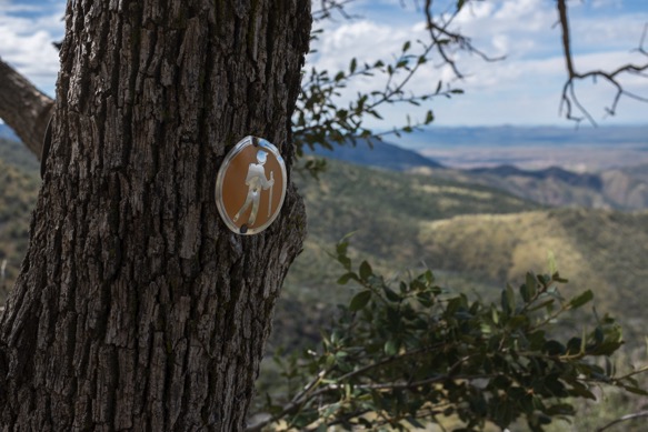
Classic AZT signage.

Nicholas Carman1 5520

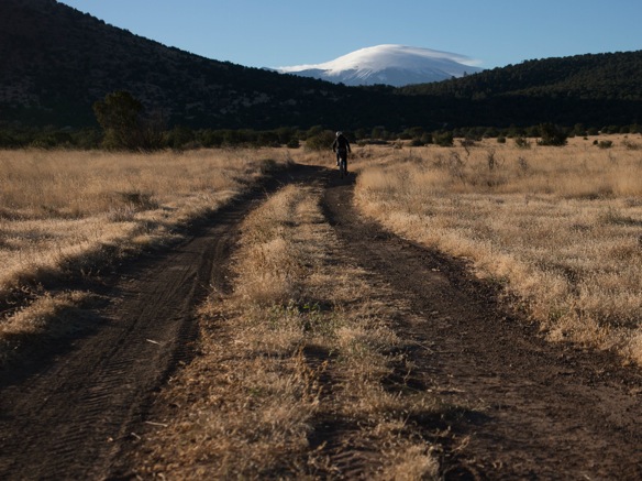
The smoother side of the AZT.

Nicholas Carman1 5521

This is the part where we joke about how pleasant Oracle Ridge is, before the trail turns up, and before the trail nearly disappears.

Nicholas Carman1 5522

Nicholas Carman1 5523

Nicholas Carman1 5524

There are some rideable sections of singletrack, and a substantial section of jeep track in the middle which is rideable.

Nicholas Carman1 5525

There is a trail in there somewhere…

Nicholas Carman1 5527

Looking east over the San Pedro River.

Nicholas Carman1 5529

Rocky, overgrown, but not too bad with the bike.  There is a nicer way to ascend or descend, along the Oracle-Mt. Lemmon Rd., a winding graded dirt road connecting Oracle and Summerhaven.

Nicholas Carman1 5530

Nicholas Carman1 5531

Some riding.

Nicholas Carman1 5532

Ducking and crawling with the bikes.

Nicholas Carman1 5533

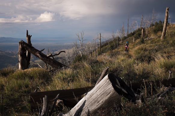
The final section includes some on and off riding, although there are definitely several miles without riding.  We’re happy not to have to fight thorns, at least.
Nicholas Carman1 5534

The paved Catalina Highway takes as back to 5000ft.  This is one hell of a road climb from Tucson.  

Nicholas Carman1 5535

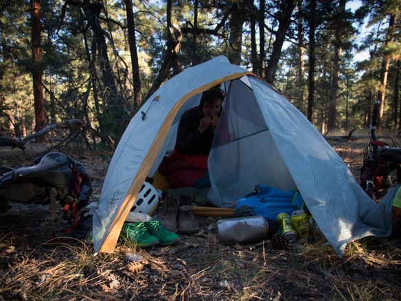
Shelter from the storm.  Mostly, traveling without a tent has been a blessing.  Instead, we brought a simple ground cloth and our sleeping bags and pads.  Lael is using an XS Therm-a-rest Prolite pad, and I’m on a 99cent windshield sunshade.

Nicholas Carman1 5536

Just over the hill from the Molino Basin Campground.

Nicholas Carman1 5537

Nicholas Carman1 5538

Nicholas Carman1 5539

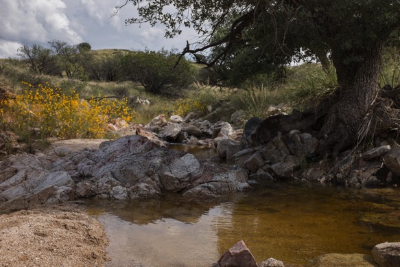
There is a lot of clear freshwater this time of year.  We both bathe and splash for a bit.
Nicholas Carman1 5540

The AZT750 route soon departs the actual AZT again as the trail continues into the Rincon Mountain Wilderness.

Nicholas Carman1 5542

Nicholas Carman1 5543

The AZT750 take a series of rough 4×4 tracks back to Redington Road, an unpaved access road connecting us with metro Tucson.

Nicholas Carman1 5545

Redington Road is all guns, and lite beer, and 4x4s.

Nicholas Carman1 5546

Leaving Tucson, following a pleasant paved section of about 15 miles, we reconnect with some of the smoothest singletrack of the entire route in Saguaro National Park.

Nicholas Carman1 5577

Nicholas Carman1 5547

Nicholas Carman1 5548

Water at La Sevilla Picnic area, between Saguaro NP and I-10.

Nicholas Carman1 5549

We continue south of I-10 on more super smooth trail, trying to finish in time to get back north for an upcoming weather window, which will be essential for Lael’s AZT750 ITT.

Nicholas Carman1 5550

Corinna, from Durango, CO on her Salsa El Mariachi with 1×10 drivetrain and Maxxis Ardent 29×2.4” tires.  She is the only bikepacker we met on the entire trail.  Read Corinna’s story about bikepacking the AZT300 on the Velorution site.

Lael later admits that she is surprised to meet a woman alone on the trail.  I suppose it gives her some perspective regarding all the strange reactions she has gotten while traveling alone.  

Nicholas Carman1 5253

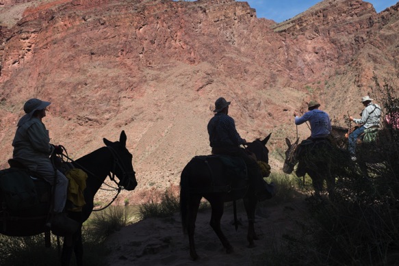
The AZT: hike, horse, and bike.

Nicholas Carman1 5551

We peel away from the trail at Sonoita, needing time to get back north so that Lael can do it all again.  I thus continue a pattern started 8 years ago.  I have never completed a route or trail.  There is always reason to come back.

Nicholas Carman1 5552

Our shins will heal and we’ll be back for more of the AZT.  Arizona will always be one of our favorite places to ride.

Nicholas Carman1 5451


Flagstaff to Picketpost on the Arizona Trail

Nicholas Carman1 5365

The is Part II of a three part series about our tour of the Arizona Trail.  In essence, this section is really two parts: the singletrack ride from Flagstaff to Pine, and the wilderness detour from Payson to the Picketpost Trailhead at Hwy 60.  Check out Part I from the Utah border to Flagstaff, AZ.

There is more to Arizona than a few spare saguaro in an endless desert.  Arizonan topography is more complex than I once thought, including broad plateau, deep cut canyons, and sky islands.  Changing scenery is entwined with variable elevation, from golden aspens at 9000 ft to wide open pine forests at 7000ft, piñon and juniper and scrub oak at 5000ft and classic Sonoran scenery dominated by the towering saguaro cactus below 3000ft.  And in a few places, such as in the Grand Canyon or on Mt. Lemmon, you’ll traverse multiple zones in less than half a day.  The Arizona Trail crosses reliably flowing surface water, in the form of Arizona’s major rivers, in no more than a half dozen places.  As expected, overall, Arizona is a dry state.  

Leaving Flagstaff toward the south, the AZT wanders through spacious pine forests and open meadows, passing a series of shallow wetlands and lakes.  A full day of riding is required to exit the pines, at which point the trail reaches the edge of the Mogollon Rim and drops toward the Highline Trail and the town of Pine.  The quality of riding on the Mogollon Plateau is high, not full of thrills and big views, but mostly smooth with the exception of some rocky trail and tracks battered by cattle in wet weather.  The first miles out of Flagstaff are especially memorable.  There are minor resupply opportunities off-route in Mormon Lake and Happy Jack, although we packed food for the distance from Flagstaff to Pine, without a peanut to spare.  Pine is a great trail town thanks to several local eatieries and a brewery called That Brewery, as well as a nice local grocery store.  

The Highline Trail looms as one of the great challenges of the AZT by bike, a reputation bolstered by the number of times its name is uttered in simple reference to the major obstacles along the AZT, a menacing gang including the Canyon and Oracle Ridge.  But not all challenges are created equal and the Highline Trail is remarkably ridable with high scenic value, an impression gained from our extremely low expectations.  The Highline is a 50-plus mile trail along the Mogollon Rim escarpment, crossing every minor drainage which comes from the cliffs above, although the AZT only follows about 20 miles of that trail.  Sections of the Highline are highly ridable, seemingly taken right out of the Sedona playbook, which sits at a similar elevation not far away.  Southbound riders definitely benefit from some gravity fed assistance overall, although the trail climbs and descends in both directions.

South of Pine, riders continue along a brief sections of the actual AZT before beginning an extended detour around the Mazatzal and Superstition Wilderness areas ending at the Picketpost Trailhead where the route rejoins the AZT.  The bikeable AZT750 continues on a series of chunky dirt roads to Payson where full resupply is possible 24/7, and on graded dirt roads and pavement to the south, including the scenic Apache Trail along the Salt River drainage.  Between Payson and Picketpost, quality roads and frequent resupply make for a quick and easy ride.  

The Apache Trail connects a a series of dammed lakes along the Salt River, each lake taking the place of what was once a great valley or canyon.  The presence of crystal blue water in the desert is stunning, and a welcomed relief on hot days.  The Apache Trail connects us to the furthest reaches of urban Phoenix, to a community called Apache Junction which provides convenient resupply in the form of a Basha’s supermarket on route, as well as other amenities.

Beyond Apache Junction the AZT traces a series of dirt roads, including a final water resupply in Queen Valley, before reconnecting with the Picketpost trailhead at Highway 60.  From this point, the town of Superior is about 4 miles to the east.  From this point toward the town of Oracle, the riding gets really, really, good.

Get GPS data for the AZT750 at Topofusion.com.  Current water resources along the AZT managed by Fred Gaudet.

Resupply notes, bold is on route:

Nicholas Carman1 5407

Flagstaff, Mormon Lake, Happy Jack, Pine, Payson, Jake’s Corner, Punkin Center, Tonto Basin, Tortilla Flat, Apache Junction, Queen Valley, Superior

There are a number of easy water resupply point between Flagstaff and Pine in the form of USFS campgrounds, just off route.  There are several near Mormon Lake and several at the intersection with AZ Rte 87.  There is clear running water along eastern sections of the Highline Trail.

————————-

Riding out of Flagstaff. 

Nicholas Carman1 5352

Regaining some elevation, looking back at the San Francisco Peaks.

Nicholas Carman1 5353

Above Lake Mary.

Nicholas Carman1 5354

Keep gates closed.  Jumping fences often saves time over opening and closing gates, and you’ll grow a massive pair of guns like Lael.

Nicholas Carman1 5355

Without shelter, October nights leave us shivering in our damp sleeping bags until the sun is well above the horizon, at least up above 7000ft.  Lael’s new Specialized Era transforms her riding, making her more confident over technical terrain.  The full-suspension platform also tracks better over rough ascents, improving her ability to climb rocky trail.  Fatigue is also reduced on long days.  There are many challenging technical sections of the AZT which require intense focus, yet there are many mundane rocky sections which aren’t all that challenging, but slowly abuse the rider over the course of a day.  A bike like this especially helps with the latter.  Rear tire clearance is a little tight.  

The proprietary Brain suspension is unique to Specialized bike and reacts to the terrain— firm on smooth trail yet opening to full stroke on bigger hits.  It is a brilliant system and it works marvelously.  I was a skeptic, until the first moment I rode it. 

Nicholas Carman1 5356

I remember a lot of mundane bumpy trail on the Mogollon Plateau, not that challenging, but taxing.  There is also plenty of trail much like this between Utah and the edge of the Mogollon Rim.  Lael and I call this “green circle trail”, and we like it.

Nicholas Carman1 5357

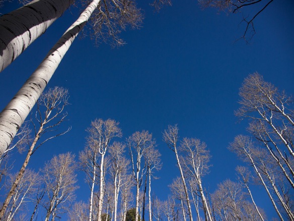
Through old oak groves which feel like they once accompanied a ranch house, amidst a greater ponderosa pine forest.  Northern Arizona is amazing, and most people have no idea.

Nicholas Carman1 5358

Much of the state is fenced to keep cattle in and keep cattle out.  Nick from Rogue Panda describes to me that Arizona is a “fence out” state, which means it is the responsibility of the landowner to prevent grazing cattle from entering their properly, not the other way around.  Nick spent some years doing trail work on public lands in the west.  In many states, it is the responsibility of the rancher to contain their cattle which becomes a financial burden considering the massive land tracts in the west, so the “fence out” principle is pro-ranching.

Here, a fence divides grazing lands on the right and non-grazing lands on the left.

Nicholas Carman1 5359

Pines, volcanics, sunshine, and sweet, sweet singletrack.

Nicholas Carman1 5360

Nicholas Carman1 5363

General Springs.

Nicholas Carman1 5367

General Springs Cabin.

Nicholas Carman1 5231

At the edge of the Mogollon Rim is a brief section of trail called the Pipeline Trail, a several hundred foot scramble up, or down in our case.  Our first impression was, “so, this must be the rim”.

Nicholas Carman1 5368

Aside from the Colorado River we cross the first flowing water on the Arizona Trail just below the rim.  Naturally, we splash in a knee-deep pool.

Nicholas Carman1 5369

Nicholas Carman1 5370

Nicholas Carman1 5371

Tarantula.

Nicholas Carman1 5373

Nicholas Carman1 5372

Some chunk, but lots of great trail.  There are large sections which require hiking, but the overall experience in positive.

Nicholas Carman1 5374

The trail crosses many drainages which means lots of fresh water, and lots of short climbs and descents.  This is some fine technical riding.

Nicholas Carman1 5375

Burn.

Nicholas Carman1 5388

Juniper.

Nicholas Carman1 5396

Shred.

Nicholas Carman1 5377

Nicholas Carman1 5392

Newer AZT signage on the right, older Highline signage on the left.  The Highline Trail is a classic in Arizona.  The descent down to the Geronimo Trailhead—southbound, remember— is awesome!

Nicholas Carman1 5393

Nicholas Carman1 5240

Nicholas Carman1 5394

Nicholas Carman1 5397

We finish the night by descending the final 800ft into Pine in near darkness, an exciting and frightening challenge at the end of a proper full day of riding.  Lael still doesn’t have the guts for such stuff, but my new pink bike nails it.  The geometry of the Meriwether, the Pike fork, a fresh pair of Ardent tires– they let me do things I shouldn’t.

Nicholas Carman1 5399

The following day we ride through Payson, stopping to dip in the East Verde River.  Surface water in Arizona is a precious resource.  I am sure to swim in all of it.

Nicholas Carman1 5400

Descending from Payson, adjacent to the Beeline Hwy.

Nicholas Carman1 5401

Jake’s Corner.

Nicholas Carman1 5404

Resupply in rural Arizona.  Okocim beer was a staple from our time in Poland.  This is the first time I have seen it in the US, at a small grocery in Tonto Basin, AZ.  Reminds us of our time with Przemek in Poland and Ukraine.

Nicholas Carman1 5405

Rural America is beautiful.

Nicholas Carman1 5406

Theodore Roosevelt Lake, collected from the upper Salt River drainage.

Nicholas Carman1 5409

This dam marks the point where the Salt River convenes into a narrower drainage, most of the way to Phoenix.  Along the way the river is collected in a series of lakes which are partly responsible with providing water to the greater Phoenix area.  The Colorado River picks up the slack.  The unpaved Apache Trail, eventually a paved road nearer to Phoenix, is a great ride bounded by wilderness to the north and the south, highlighted by a brilliant strip of water.

Nicholas Carman1 5410

Nicholas Carman1 5234

Migrating retirees treat this area much like migrating birds, stopping for a few weeks in spring and fall while traveling between their summering grounds up on the Mogollon Plateau and wintering grounds to the south in places like Slab City.

Nicholas Carman1 5236

Nicholas Carman1 5411

Leaving pavement for a bit.  This 150 mile road detour, both paved and unpaved, certainly shortens the time is takes to cover the 750 mile route.

Nicholas Carman1 5413

Nicholas Carman1 5414

We find ourselves camping on a sandy beach for the night, just a few steps away from clear freshwater.  I would have never expected this in Arizona.

Nicholas Carman1 5415

Nicholas Carman1 5237

Our campsite is on the beach in the foreground.

Nicholas Carman1 5416

The Apache Trail is an old stagecoach route from Tonto Basin to the Greater Phoenix area, which follows human trade and travel routes along the Salt River which have been in use for many centuries.  Theodore Roosevelt, who was president at the time of the construction of both the dam and the road, says, “The Apache Trail combines the grandeur of the Alps, the glory of the Rockies, the magnificence of the Grand Canyon and then adds an indefinable something that none of the others have, to me, that is most awe-inspiring and most sublimely beautiful.”  

Nicholas Carman1 5417

The western portion of the road is now paved, the eastern portion alternating between wide graded sections and narrow pieces of dirt, clinging to rocky mountainsides.

Nicholas Carman1 5418

Nicholas Carman1 5419

Nicholas Carman1 5420

Nicholas Carman1 5422

Tortilla Flat.

Nicholas Carman1 5238

Nicholas Carman1 5423

Nicholas Carman1 5424

As near as you’ll get to Phoenix on the AZT750.

Nicholas Carman1 5425

The AZT750 passes a Basha’s grocery in Apache Junction, the last good resupply until Oracle.  If touring northbound, the four mile detour to Superior might make sense.  Picketpost (the trailhead at Hwy 60, near Superior), is about 90 miles from Oracle.  

En route to the Picketpost Trailhead from Apache Junction along a powerline road, with a brief stop in the rural retirement community of Queen Valley.  There is a diner and a very small store there.

Nicholas Carman1 5426

Picketpost Mountain, a welcomed sight guarding the nicest section of the AZT.  From here to the Gila River is a newer piece of trail worthy of Theodore Roosevelt’s description of the Apache Trail.  If only TR rode a mountain bike…

Nicholas Carman1 5427

Rejoin the AZT, duck under Hwy 60.

Nicholas Carman1 5429

Picketpost marks the end of the annual AZT300 race, an event which predates the hefty AZT750.  The AZT300 begins near the Mexican border (lopping 14 miles of dirt road riding from the actual border), and includes a high volume of singletrack, excepting some detours around wilderness in the Tucson/Mt. Lemmon area.  The 300 miles route has been ridden in as little as 45 hours and 7 minutes by Kurt Refunder.  We’ll certainly take much longer, enjoying the majesty of Arizona.

Nicholas Carman1 5430

Rogue Panda Designs and Flagstaff, AZ

Nicholas Carman1 14

Nick Smolinske is Rogue Panda Designs, in Flagstaff, AZ.  Check out the Rogue Panda website for product and ordering information, or the Rogue Panda Facebook page for news and monthly deals.  Don’t forget, I keep a fairly accurate list of all known bikepacking bag makers from around the world.  Please send corrections and submissions!

I once wrote that I thought every town should have a baker, a brewer, a framebuilder, and a bag maker.  Flagstaff has all of these, in addition to a nice slice of the Arizona Trail and some of the most pleasant fall weather in the country.

Nick Smolinske is Rogue Panda Designs.  Nick has been designing and making bikepacking equipment for years, and blends his passion for lightweight backpacking and bicycling at the helm of his sewing machine.  His business recently outgrew his bedroom, his spare room, and his Etsy retail space.  Earlier this year, Nick quit his job to invest in full-time bag manufacturing and design.  He moved his equipment into a rented garage across town, a building which once acted as a horse stable with a few dusty corners to prove it.  Rogue Panda Designs debuted a full-featured website at the same time with an active retail portal featuring in-stock products and a custom ordering process.

Rogue Panda offers most of the now-standard bikepacking designs, but a few products stand out from the rest.  The Picketpost seatbag is designed to maximize the space behind the seatpost on a hardtail bike, preferring a more vertical orientation that also serves to stabilize the bag on technical trails.  Several companies are working to improve the stability of the modern seatbag, with varied approaches to solving the problem.  

The Oracle downtube bag is a small zippered pouch meant to hold tools, tube, or other dense items which don’t need to be in a framebag.  It attaches to the downtube or any other part of the bicycle via non-slip straps, with an integrated compression strap.  

Lastly, Rogue Panda’s custom framebags stand out for the detailed and bold designs which are offered.  Nick is most proud of the radiant Arizona state flag designs, yet regularly offers bags with the New Mexico, Colorado, and Wyoming state flag logos.  If you live in a state or country with a simple and preferably geometric flag, you could wave it proudly on you bike.  I’m thinking Israel, South Africa, Sweden, and Macedonia would be great candidates for a country flag.  Texans, you know you need Texas themed bikepacking kit.  Check out the time-lapse video of an Arizona flag framebag in production.

Most Rogue Panda products are named after sections of the Arizona Trail.

The name Rogue Panda originates from a local prank in which an electronic traffic sign was hacked, and the banner was modified to warn motorists of a “ROGUE PANDA ON RAMPAGE”.  Nick is not responsible for the prank, I don’t think.

Every town should have a friendly bike shop like Flag Bike Revolution.  The bike shop shares an old industrial building with an artisan Neopolitan-style pizzeria with a subtle bike theme called Pizzicleta, and the Mother Road Brewery, named for the famous Route 66.

Nicholas Carman1 16

Our friend James manages Pizzicleta and bakes the best bread in Flagstaff, as a way to use remnant heat from the previous night’s fire. The bread bakes each morning while James preps for the day.  In the evening, the tiny eatery is packed with guests who share a single large table.  We gave Lael’s blue Raleigh XXIX to James while in Flagstaff.  We also gave Lael’s old green Surly Long Haul Trucker to his girlfriend Deja several years ago.  Since, Deja has traveled to Italy with the LHT.  

James reports that the rusty blue hardtail has been repaired– he discovered a hole in the frame while preparing for paint– and the frame now wears a new coat of white paint with metal flake.  A brand new RockShox Reba fork rounds out the build, along with a new framebag and seatbag.

Nicholas Carman1 15

Building and customizing Lael’s Specialized Era at Flag Bike Rev.  She will be moving to a new hardtail in the coming months.  Anyone looking for a great full-suspension cross-country and bikepacking rig?

Nicholas Carman1 17

A visit to Rogue Panda headquarters reveals a colorful array of bikepacking gear, and a few innovative designs.

Nicholas Carman1 6

The Picketpost seatbag, mocked up on my Meriwether hardtail.  The two lower plastic loops are used to connect the bag to the seatstays for added stability.  This design also maximizes the total volume of the bag, without forcing a load beyond the rear axle.

Nicholas Carman1 7

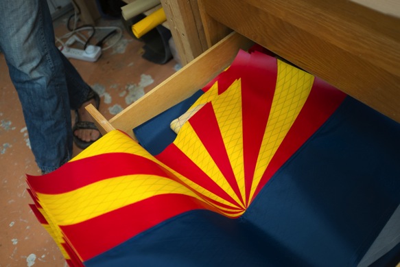
Nick has prepared a drawer full of Arizona flag panels, awaiting fabrication into complete framebags.  All framebags are custom and pricing starts at $125 for state flag bags, or $95 for single color and single compartment bags.

Nicholas Carman1 10

This custom two-compatment bag is headed on tour in New Zealand on Brian’s Surly Cross Check.  Logos represent local businesses who have helped him prepare for his trip, and the text at the bottom is in memory of his parents.  James gave this bike to Brian, we gave a bike to James, the world is a better place.  Nick prefers a photograph of the bicycle with a measuring tape or meter stick in the image, rather than a hand-drawn pattern.

Nicholas Carman1 11

Once the bag has been ordered and a pattern provided, the star is located on the drive-side panel.

Nicholas Carman1 19

Handlebar bags are mostly standard designs, including sealed seams and a multi-purpose daisy chain which enables secure attachment to Jones Loop bars.

Nicholas Carman1 13

Later, Nick joins us for a ride on the Flagstaff Loop Trail and a brief section of the AZT.  Our friends Lucas and Monica, once of Anchorage, Alaska, also roll through town while we are in Flagstaff.

Nicholas Carman1 4

This mural by Cosmic Ray, now on display at Cosmic Cycles, depicts the local trail system.  The text in the bottom right reads “Copycats will ride Huffys in Hell… (Full Wald Gruppo!).

Nicholas Carman1 3

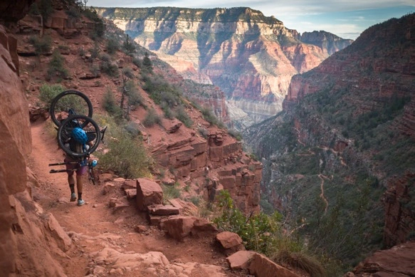
Lael on her first dirt ride on the Specialized Era, also her first ride with a backpack.  She successfully used this Osprey Raptor 14 pack to haul her bike through the Grand Canyon. 

Nicholas Carman1 5344

Nicholas Carman1 5

Nick is proud of his dirt cheap custom bikepacking rig.  The frame is a Bikes Direct freebie from around town, a simple coil suspension fork, custom luggage, Thudbuster seatpost, with platform pedals.

Nicholas Carman1 5345

An early prototype of the Oracle downtube bag.

Nicholas Carman1 5346

Fresh bread!  Thanks Deja.

Nicholas Carman1 5351

Route 66 lives in Flagstaff.

Nicholas Carman1 5347

Pizzicleta is highly regarded for thin crust pizza, although I just like knowing that the pizza man rides a bike.  James treated us to an exceptional meal at “Pizzi”, as he calls it.  

Nicholas Carman1 5349

To come: A series of posts about the rest of the Arizona Trail, and some more insight into Lael’s AZT ITT and her future with ultra-endurance racing.  Lastly, in the next few weeks I plan to roll out a series of posts from our time in the Middle East this spring, including time spent in Jordan, Israel, and Palestine riding with Julian, Christina, and Klaus.  Lots of fresh stories coming soon.  

We will be in the Phoenix area over the next few days, then back to New York State to visit my family.  We will be in Northern and Central New York, NYC, and even the Washington D.C. area in the next few weeks if anyone wants to meet for a beer or a ride.

 Nicholas Carman1 2

Lael Wilcox Arizona Trail 750 ITT

Nicholas Carman1 5230

Lael is at it again!  She left the northern terminus of the Arizona Trail at the Stateline Campground along the Utah/Arizona border on Monday October 26th at 5:24 AM.  She intends to ride the length of the Arizona Trail- – specifically the bikeable AZT750 route— as fast as possible.  This individual time trial (ITT) will take more than a week, and requires that she portage her bicycle through the Grand Canyon, strapped to her back.  At the time of writing, only 23 hours after starting at the Utah border, she has exited the Grand Canyon at the South Rim and is en route to resupply in Tusayan.  She hopes to reach Flagstaff by the end of the day.

The Arizona Trail is a nearly 800 mile cross-state hiking, mountain biking, and equestrian trail from the Utah border to the Mexican border, ranging in elevation from 1500ft to 9000ft, from shady ponderosa pine forests to scorching Sonoran deserts.  Several wilderness areas require dirt and paved road detours for cyclists, and the established AZT750 route is the version in use during the group time trial informally known as the Arizona Trail Race, held every April.  There is also an established detour north of the Grand Canyon from the North Rim to Jacob Lake along pavement, as snow typically lingers along this section of trail in the spring.  Lael followed this detour, with prior approval, as most AZT750 records have been set along this version of the route.  We toured this section of trail several weeks ago and in the context of a tour, it is highly recommended.

Our tour of the Arizona Trail ended several days before Lael’s ITT commenced.  We toured every inch of the trail from Utah to Sonoita, lopping off the last day or two of riding to get north in time for a weather window. This time of year, in an El Nino season, dry trails up north are hard to come by.  There is a risk of wheel-sucking mud north of Payson, mostly in the section between the Mogollon Rim and Flagstaff.  Long nights will also be a challenge, although a full moon will help light the night.  

Several hours of rain accompanied us on the night before Lael’s departure.  Despite freezing temperatures at elevation and the saturated earth, she passed the first section of trail to Jacob Lake with haste.  From the Stateline Campground the trail begins with a series of switchbacks to ascend well over a thousand feet.  I watched her headlamp disappear onto the Kaibab Plateau.

For this ride, Lael is a riding a new Specialized Era Expert, a 100mm travel full-suspension bike.  She is using custom Revelate Designs luggage, K-Lite dynamo lighting, and some other exciting new equipment.

Follow Lael’s AZT750 ITT at Trackleaders.com.

My Pink Meriwether Adventure Bike

Nicholas Carman1 5214

Everything I need to have fun and survive, all wrapped in pink.  Not shown here are a tent, computer, or a front derailleur, which broke after a year and a half of adventure.  For the AZT, we’re traveling without a tent.  The 11″ MacBook Air has rejoined the packlist and fits nicely in the Revelate Viscacha with a certain packing procedure (clothes and groundcloth packed first).

The basic details are that it carries everything I need to survive and have fun including 4 liters of water, clothing and camping gear, durable 2.4″ tubeless tires on wide carbon rims, a useful range of gears, 120mm of seriously plush front suspension, a wide handlebar, all time lighting and USB charging, and the same saddle which has adorned every bike I have ridden since 2009, likely over 75,000 miles of touring and commuting on its bent steel frame, still as comfortable as ever.

The important details are 434mm chainstays, a low but not too low bottom bracket, a long but not too long top tube, a portage handle, a 68.5 degree head tube angle, and the aforementioned 120mm Rock Shox Pike fork with 51mm of offset.  All other parts come directly from my Surly Krampus and are designed to be world touring friendly, including a threaded BSA bottom bracket and the option for standard QR wheels via replaceable Paragon dropout plates and of course, a different fork.  As always, the bike is designed for big tires and a ton of extra clearance.  

The Meriwether handles singletrack better than the Krampus, descends better than the Krampus, climbs better than the Krampus, and pedals more comfortably than the Krampus.  But that’s only because I rode the Krampus for a year– and during that time it was a great bike– but I was paying attention and figured out how to make a bike better for me.  Whit Johnson of Meriwether Cycles is the catalyst and the confidence for this project who massaged my ideas into digital lines and degrees in BikeCAD, and manufactured our ideas in steel, willingly coating his handiwork in a pink blanket of paint.  Some call the color theft-protection, but honestly, it is the only color I wanted.  I did consider a muted lavender hue, but settled on antique pink, as I like to call it.

The bike easily finds the center of the trail, and doesn’t have the tendency to oversteer or understeer as other bikes I’ve ridden.  I can look further down the trail and know that my tires will take me there, not into the weeds.  On flowing serpentine trail, I sit down and position myself between the wheels, which are properly weighted for the front tires to cut a line and the rear tire to follow aggressively.  Riding this bike through corners– thanks, for certain, to the lower bottom bracket which I initially resisted– is like waterskiing.  The harder I dig, the harder it turns.  

The bike climbs.  Shorter chainstays result in a more direct power transfer to the rear wheel, even through Whit was concerned that his drive-side half yoke would be flexible.  It is not.  The low bottom bracket changes my relationship with only the tallest, most menacing obstacles while climbing, resulting in more frequent pedal strike on technical trials-like climbs.  In all other situations, the 60mm BB drop is a feature, and within a week, pedal strike is minimized through experience.  I might adjust the BB drop to 55mm if I had the chance to do it again, but that is a very personal consideration because I love climbing chunky stuff.  But the bike doesn’t try to tip over backwards on steep climbs and the shortened top tube allows me to approach long ascents in a seated position, while out of the saddle efforts are directly rewarded.  I recently spend much of the Highline Trail in Arizona either hiking alongside my bike, descending behind the saddle, or ripping climbs in a 34-34 gear combination.  It is a stand-up and hammer gear combination on any steep mountain bike trail, but chain retention is good and it forces me to hit the gas.  Sometimes a little extra gas is what you need for the next ledge or rock in the trail.  Soft-pedaling through challenging trail usually results in walking.  And yes, the portage handle is awesome.  I now have three useful hand positions for hauling the bike, each for a different kind of hike-a-bike.

Descending is unlike any hardtail I have ridden.  The Krampus gave me much of the confidence I sought over the classic geometry of the Raleigh XXIX and its 80mm fork.  Add to that more modern geometry, including the 68.5 degree head tube and the 51mm fork offset on a remarkable 120mm fork, and this bike is seriously confident going downhill.  Again, a little lower bottom bracket helps to keep my center of mass behind the front axle, reducing the feeling of going over the bars on steep trails.  I’ve taken to descending almost every section of trail I can find, save for most of the Pipeline Trail off the Mogollon Rim and a couple rocky drops on the way into Pine.  But, I rode most of the last section of the Highline into Pine at dusk, and loved it.  Happy to be on 2.4″ Ardents, for sure.  And the Pike, get a Pike!  To be fair, I’ve ridden some MRP Stage forks which also feel phenomenal, and some other modern RockShox offerings have impressed me on test rides, including the new Revelation and SID forks.  But for the same weight as a Revelation (which has 32mm stanchions) and the same price as a SID (yes, kind of a lot), you can have the Pike which boasts 35mm stanchions with premium RockShox internals.  The concept of using more fork offset with a lower head tube angle results in a bicycle with improved descent characteristics yet which preserves mechanical trail and handling on neutral trail sections and on climbs– it descends better without any drawbacks. 

Contact Whit Johnson at Meriwether Cycles if you have any custom bicycle needs.  He specializes in mountain bikes with character, built for adventure.  He likes short chainstays, fat tires, and extra attachment points.  He has recently built several gorgeous custom forks for internal dynamo wiring to accompany custom frames and has pushed the boundaries with his fatbike and plus-sized bikes for the past few years.  I really enjoyed working with Whit on this project.  He quickly understood my ideas and converted them to numbers, to visual impressions of a bicycle, and ultimately into a sweet ride.  Check out Meriwether Cycles on Instagram, Flickr, and on the Meriwether Blog.  He is located in Foresthill, CA and has relatively short lead times.  Pricing starts at $1200 although a frame similar to mine would cost about $1500.  

If you are interested in stock bicycles with a similar character to my pink bike check out the Advocate Hayduke, Jamis Dragonslayer, and Marin Pine Mountain.  

Nicholas Carman1 5208

Build details:

Meriwether Cycles custom steel frame for 29/27.5+

RockShox Pike RCT3 120mm, 15mm TA, 51m offset

Chris King headset and BB

Shimano Deore crank, 34/22T rings

Shimano SLX direct mount front derailleur with Problem Solvers clamp, XTR GS rear derailleur

Shimano XTR 9speed rear shifter, front friction thumb shifter on Paul Thumbie

Shimano XT 11-34 cassette and SRAM PG-951 chain

Specialized 75mm stem

Race Face SixC 3/4″ riser carbon handlebar, 785mm wide

Salsa Regulator Ti seatpost, zero setback

Ergon GP1-L grips

Brooks B-17 Standard

Avid BB-7 brakes and levers, 160mm rotors

Derby HD 35mm wide carbon rim to Hope Pro 2 Evo rear hub

Light Bicycle 35mm wide carbon rim to SP PD-8X dynamo hub

Maxxis Ardent 29×2.4″ EXO tires, tubeless

Redline Monster nylon pedals

Supernova E3 Triple 2 headlight, E3 Pro taillight with custom brackets

Sinewave Reactor USB charger, top cap mount

Revelate Designs custom ziperless framebag, Viscacha seatbag, Gas Tank, small Sweet Roll and small Pocket

Randi Jo Fab Bartender bag, Bunyan Velo logo

Salsa Anything Cage HD and 64 oz. Klean Kanteen

Salsa stainless bottle cages on fork attached via hose clamps, 32 oz bottles 

Nicholas Carman1 5216

Nicholas Carman1 5217

Nicholas Carman1 5218

Nicholas Carman1 5219

Nicholas Carman1 5221

Nicholas Carman1 5222

Nicholas Carman1 5239

Through the Grand Canyon: Utah to Flagstaff on the AZT

Nicholas Carman1 5123

Sweaty palms hooked under the headtube and the right fork leg of the bicycle, I heft the load higher onto my back.  The textured brass headbadge of my Meriwether frame keeps the painted pink steel from slipping from my right hand.  Who said headbadges have no place on a bikepacking bike?  Concerning a well-designed backpack and a reasonable load, the weight of the pack is meant to be shared by the hips and the shoulders, the remaining pack resting against the back.  Only a few miles down the canyon and our 50 pound packs have already agitated both hip and shoulder.  Mine is an old EMS backpack purchased ten years ago in New York which has never been backpacking– neither have I– yet has been in regular use as an in town-hauler, akin to a pick-up truck to a commuting cyclist.  It knows the weight of a gallon of milk and a bag of apples and a twelve pack of beer, swimming in a week of other foods.  It may not be ideal for the job of carrying a bicycle, but the fault may lie in the fact that the bicycle is a stout steel hardtail packed for a comfortable month-long trip across Arizona.  By conventional bicycle touring standards it is a lightweight.  Shedding my tent and full-size sleeping pad in favor of resting on a 99¢ windshield sunshade under the stars, this bikepacking rig still measures as a middleweight.  By packbiking standards, it is a tank.  If there is a graceful way to carry a bicycle through the Grand Canyon, it doesn’t start with a 50 pound pink steel bike.

Lael is no better situated.  Her pack– I only realize once we’ve exited the canyon at the South Rim– boasts features which mimic those found on high-end packs, yet it sits too high above the hips, the straps dig into her shoulders, and the “suspension” system pokes into her shoulder blades.  The hip belt buckle is broken and she ties the strap around her waist.  This pack is borrowed from Bill and Kathi in Hurricane.  We’re grateful for a solution which costs no more than return postage to Utah and a postcard.  As bad as it seems, this might be about as good as it gets.  Carrying a bike through the Grand Canyon isn’t easy.  I can’t really blame the pack, nor the bicycle.  

One foot in front of the other for 25 miles, 6000 feet down, 5000 ft up, we walk.  We drop into the canyon a few hours before dark as visitors are exiting toward coin-operated showers or the luxurious dining hall of the Grand Canyon Lodge, precipitously located at the edge of the biggest cliff in the hemisphere.  Past dark, Lael stumbles not once, but six or seven times.  I demand that we stop to rest.  She won’t admit that she is tired or that her shoes are inadequate, but promises not to do it again.  Instead, I attempt to prove through some late-night logic that we need to stop and sit for a minute, that descending a cliff’s edge in the dark with bicycles on our backs is as much hazard as I am willing to accept.  Missteps will only make it worse.  We sit for our first break just before Manazanita Rest, almost 3000ft below the rim.  This is the only time we will hike more than 2 miles at a time without removing the packs to rest and to refresh.  We continue to the stock area at Cottonwood Camp for the night, the only available permitted campsite available when we applied at the backcountry office mid-afternoon.  Our visit with the ranger was brief and professional.  Ten minutes and twenty dollars later and we have a tag indicating a place to stay and the right to remain in the canyon for the night.  The remainder of our hike to Cottonwood is without missteps.

The next morning, we rise before dawn to avoid the heat of the day.  The previous night’s hike had been no more than 8 miles, although about 4000ft down from the rim, which towers above 8000ft.  On this day, we continue downstream for eight miles along Bright Angel Creek to Phantom Ranch before contacting the mighty Colorado River and the main vein of the canyon.  Thereafter– either by the South Kaibab Trail or the Bright Angel Trail– we will ascend 5000ft from the river up to the South Rim, a distance of about 10 miles by our chosen route along the Bright Angel Trail which affords a series of water and shade stops along the way.  The longer route is more popular with day hikers and is used by mule trains serving Phantom Ranch.  It rises less dramatically from the river, then tips skyward in the last five miles to gain 3000ft at once.  Working our way along the North Kaibab Trail in the morning and up the Bright Angel Trail in the afternoon, we crest the South Rim just after dark by way of headlight and headlamp.  Lael is ahead of me by one switchback and she screams, from just above my head, “This is the end!”  We hug and high five in the dark, like the end of a pointless challenge on a reality TV show.  What was once monumentally important is behind us, and now seems irrelevant except for sore calfs and shoulders and the abrasion which marks Lael’s hips.  We haven’t showered since Las Vegas.  

If anyone asks about carrying our bikes through the canyon, I’ll say, “It isn’t easy.”  But it is possible.  It is worth it.  And we did it.  Unstrapping the packs from the bikes and reinstalling the front wheel and the left pedal to the bike, we ride from the Bright Angel Trailhead to the General Market just before close.  By morning, we’re snaking through pine forests en route to Flagstaff. 

The history of carrying one’s bike through the canyon is barely a decade old.  While on their groundbreaking AZT-by-bike scouting mission in 2005, Scott Morris and Lee Blackwell of Tucson secured permission from Grand Canyon National Park rangers to carry their bikes through the canyon, through a 25 mile trail corridor.  Considering the arterial Grand Canyon trails are not wilderness, where possessing a bicycle would be expressly prohibited by federal law– still open to interpretation, says Casey Greene, who argues a disassembled bicycle is no more than a collection of bicycle parts– rangers decided on a “wheels must not touch the ground” approach to permitting bicycles in the canyon during Scott and Lee’s 2005 ride.  A sign at each major trailhead clearly states “No Bicycles”, thus referring to bicycles which intend to be ridden.  A disassembled bicycle, packed to one’s back, where the wheels do not touch the ground is legal (i.e. not prohibited, as has been decided in other parks).  Just don’t try to ride the bike anywhere in the canyon.  Park rangers aggressively enforce this rule, such as in the case of the Sedona 5 or the Riding the Spine crew.  
Why would anyone want to carry a bicycle through the Grand Canyon?  The nearly 800 mile Arizona Trail connects the Utah border with the Mexican border in a ribbon of singletrack and dirt roads, crossing directly through the Grand Canyon.  North of the canyon are 80 miles of the the most pleasant forested trail in the whole state of Arizona, the Kaibab 101 Trail.  South of the canyon are another 90 miles of trail to Flagstaff, and another 550 miles to the Mexico border.  If you wish to ride the whole trail you can detour a great distance on paved roads around the canyon, pay a shuttle service to transport your bike, or hike your bike through the ditch and roll away at the other end.  We’ve been in this position once before– wondering how best to enjoy the trails north of the canyon– and our solution was to skip the canyon and the Kaibab trails and start riding at the South Rim.  This time we wished to visit the Colorado River and to start from the border of Utah.   

From St. George and Hurricane, UT, Lael, Skyler, Panthea and I connect to northern Arizona via Colorado City and Fredonia, to Jacob Lake.  The initial plan is to ride back into Utah via Kanab to meet the north end of the Arizona Trail at the Stateline Campground via the unpaved House Rock Valley Road.  We soon realize that we can access the trail sooner by riding up to Jacob Lake on pavement, which further enables us to enjoy the singletrack descent to the Utah border.  

Arriving at Jacob Lake in the afternoon, Lael and I shoot for the border via the AZT, arriving just past dark.  In the morning, we loop back to Jacob Lake via the House Rock Valley Road along the Vermillion Cliffs National Monument, climbing back onto the Kaibab Plateau on paved route 89A.  From Jacob Lake, we begin our southward trajectory toward the Grand Canyon about 50 miles away.

Further reading and planning:

For information visit Scott Morris’ Topofusion page dedicated to Cycling the AZT, link to forum discussions about the AZT750 and 300 time trial events (Google search for archived discussions), and read Scott’s recent account of touring the AZT with Eszter on his blog Diary of Scott Morris.  

The Kaibab Plateau is part of the larger Colorado Plateau, shown here extending from the Utah border in the north to the Grand Canyon in the south.  The AZT begins at the northeastern edge of the forested plateau in the narrow valley between the Kaibab and Paria plateau (top right).  Trail 101 north of the Grand Canyon is one of the oldest sections of the AZT.

Nicholas Carman1 5146

From Jacob Lake to the northern terminus of the AZT the trail slowly loses elevation from 7800ft down to 6500ft.  The last few miles of trail quickly meet the border at about 5000ft in a series of switchbacks.

Nicholas Carman1 5150

Nicholas Carman1 5149

Nicholas Carman1 5152

Descending to the Stateline Campground, the Utah border, and the Vermillion Cliffs at sunset on the AZT.

Nicholas Carman1 5120

The beginning or the end at the Stateline Campground, depending upon which direction you travel.  There is no water at the campground, although primitive sites and pit toilets are available.

Nicholas Carman1 5153

By morning, we look up at the descent which concluded the night and decide on a mellow dirt road ride back toward Jacob Lake.

Nicholas Carman1 5154

The ride takes us along the Vermillion Cliffs, now famous for the repopulation of California condors which has succeeded in the area.  Kaibab Plateau on the left, Paria Plateau on the right.

Nicholas Carman1 5155

The Jacob Lake Inn features a small grocery, a nice diner, and water.  We enjoy two mid-day rests at Jacob Lake on consecutive days.  Going south, there is also a good grocery at the North Rim of the Grand Canyon in the main campground. 

Nicholas Carman1 5147

The AZT north of the Grand Canyon is dreamy, alternating between wide open pine forests and newer aspen growth, the result of logging or fire.

Nicholas Carman1 5156

On the heels of a heat wave, clear nights begin cooling toward freezing.  Lael and I are willing to travel without a tent in such conditions, sleeping out on a ground cloth, minimal sleeping pads, and bare sleeping bags.  The Buffalo Trick Tank is full of water, contained in a giant steel cylinder.  Check our Fred Gaudet’s water resource for current water data on the AZT.

Nicholas Carman1 5157

Nicholas Carman1 5158

Nicholas Carman1 5161

The Grand Canyon Lodge is a marvelous artifact from a time past.  The current concessions operated by Xanterra likely pale in comparison to the grandeur of yesteryear.  Still, the structure is remarkable and the setting unimaginably grand.  Visitors– even unregistered guests– are invited to sit in this windowed room or out in the open air at the edge of the canyon.

Note, there is a good grocery store, coin operated showers, and a laundry at the campground.  Walk-in sites are available for $6 per person and wi-fi is available at the grocery and the laundry. 

Nicholas Carman1 5160

There is a first time for everything.  Until reaching the rim of the canyon I’ve never carried a bike on my back and never gone on an overnight hike.

Nicholas Carman1 5163

About two hours before dark, we descend with relative haste.  The next morning we repack our bikes with experience, improving load balance and clearance.  On this first evening it seems my rear tire scrapes every ledge overhead, my fork touches every cliffside to my left, and my 785mm handlebars clang against every rocky step.  We became quickly experienced at hauling our awkward loads, although it never gets easier.

Nicholas Carman1 5164

Trail construction in the canyon is incredible.  The engineering and execution of the North Kaibab Trail is remarkable, a jewel of trail design.

Nicholas Carman1 5124

Meriwether Cycles socks.  Under the laces the socks read, “Now go get lost!”  

Nicholas Carman1 5166

Nicholas Carman1 5167

Night at Cottonwood Camp, and a pre-dawn start to the day.

Nicholas Carman1 5168

The trail between Cottonwood and Phantom Ranch follows Bright Angel Creek without significant elevation change, a distance of about 8 miles.  This is the only major temptation to ride the bike in the canyon.  Most of the rest of the hike would be conventional hike-a-bike.

Nicholas Carman1 5169

Nicholas Carman1 5170

The Trans-Canyon Pipeline burst on the days we travelled in the canyon, forcing us to source our water from Bright Angel Creek.  Taps at rest stops and at Cottonwood Camp were under pressure, but without water.  This break in the line was the source.  Helicopters circled within hours.

Nicholas Carman1 5171

Phantom Ranch offers respite from mid-day heat, just over 100F on this day.  Pre-arranged meals are served inside to registered guests and campers.  Cold drinks and snacks are available for purchase to the passing hiker, for a reasonable charge considering they were hauled here my mules.  A beer costs $5, a energy bar about $2.50, and an apple just over $1.

For our efforts the clerk offered our coffee for free, which we enjoyed from our small enameled steel cup. 

Nicholas Carman1 5173

The North Kaibab Trail descends from the North Rim into the Bright Angel Creek drainage, on the right side of the map, crossing the Colorado River to connect with either the South Kaibab or Bright Angel Trais to the South Rim.

Nicholas Carman1 5172

The black bridge in the distance connects to the South Kaibab Trail, which features more open views of the canyon, but without any substantial shade or water along the way.

Nicholas Carman1 5174

The silver bridge connects to the Bright Angel Trail.  We cooled ourselves many times in various streams along the way.

Nicholas Carman1 5175

Tourist train.

Nicholas Carman1 5176

The Silver Bridge was constructed in the 1960’s, the Black Bridge dates from 1928.

Nicholas Carman1 5178

Nicholas Carman1 5179

Mule train, packing supplies into Phantom Ranch and packing garbage out of the canyon.

Nicholas Carman1 5177

From the Colorado River up to Indian Gardens.

Nicholas Carman1 5180

From Indian Gardens, the trail turns sharply upwards.  We never knew how or where the trail would exit the canyon, which seems impossibly walled on all sides.  The trail always finds a way, easier seen from above.

Nicholas Carman1 5181

The Bright Angel Trail receives a lot of traffic, and is loose and dusty in places, compared to the surface of the North Kaibab Trail.  

Nicholas Carman1 5182

By late afternoon, we enjoy shade beneath the South Rim.

Nicholas Carman1 5183

The trail always finds a way.  

Nicholas Carman1 5184

Nicholas Carman1 5185

And just as the sun sets, we reach our final water and rest stop on the Bright Angel Trail at the 1 1/2 Mile rest house, and old stone shelter adjacent to a water tap and pit toilets.  From the Colorado River there are three official tap water sources on the Bright Angel Trail, a welcomed resource which enables us to travel without more than a few sips in our bottles. 

Nicholas Carman1 5128

At dark, we crest the rim and reassemble our bikes, riding directly to the grocery store and a bivy under the stars along a nearby section of the AZT.  Elk bugle loudly through the night.

Nicholas Carman1 5186

Resupply is easy at the South Rim village or in Tusayan, just outside the park.  Each community has a proper grocery, although Tusayan boasts more commercial eateries as it is outside the park.  The post office in the park at the South Rim offers full services during the week, including General Delivery shipments.

We rely on a GPS track, but when following the trail, it would he hard to get lost.  Several wilderness detours in the south require deviation from the actual AZT, which is where the GPS becomes especially valuable.

Nicholas Carman1 5187

Bikes+AZT

Nicholas Carman1 5188

Grandview Lookout Tower, looking south toward the San Francisco Peaks above Flagstaff.

Nicholas Carman1 5189

North to the Grand Canyon.

Nicholas Carman1 5190

This section of the AZT is well signed and smooth.  After Tusayan, clean water sources are limited, although we have twice sourced water out of the Russell Tank.

Nicholas Carman1 5191

Russell Tank, like many systems in the area relies on a natural catchment area, a large steel container, and a method to dispense water to cattle via a trough.  Our water came from the smaller covered tank adjacent to the trough.  The large main tank, seen in profile to my right, is empty for the season.

Nicholas Carman1 5193

Nearing Babbit Ranch, a large private land tract which allows the AZT to pass via a series of doubletrack roads.

Nicholas Carman1 5195

Power from one of the two major dams on the Colorado River.

Nicholas Carman1 5194

Nicholas Carman1 5197

Nicholas Carman1 5196

Nicholas Carman1 5199

Nicholas Carman1 5200

Nicholas Carman1 5202

At the start of each major trail section is a steel Arizona Trail sign like this one, showing a map of the route through the state and an invitation to hikers, equestrian, and cyclists to enjoy some or all of the route.

Nicholas Carman1 5203

Nearby is an official volunteer-supported water cache.  We see unofficial caches along much of the route– usually one or two gallons of water under a tree or near a road crossing, or next to a fence.  We try to leave water for hikers, who require more time to connect reliable water sources.  We each pull a liter or two of water from this cache for the remaining distance to Flagstaff.

Nicholas Carman1 5131

Leaving Babbit Ranch, back into the forest.

Nicholas Carman1 5204

I’m using a Sinewave Reactor USB-charger to power my Garmin e-Trex 20 GPS.  I’ll need to add a small in-line battery so that the device remains powered when I stop.  So far, the steerer tube mounted charger has provided power without fail, and is out of the way of mud and other contaminants, unlike the B&M USB-Werk which I stored on the side of my down tube near my front wheel.  The wiring for the Sinewave Reactor comes through the steerer tube and is a welcomed answer to the consistently flawed Supernova Plug charger, which has seen several failed iterations.

Nicholas Carman1 5205

Humphrey’s Peak, 12,637 ft.

Nicholas Carman1 5206

My new enduro-endurance bikepacker on the Arizona Trail, where it is right at home.  The RockShox Pike fork is amazing.  The geometry of the bike feels much more natural than the Krampus with the Fox Talas fork.  I’m happy to be back on 2.4″ Ardent tires.  

Nicholas Carman1 5207

Rising again above 9,000 ft, we rejoin aspen groves near the Snowbowl.

Nicholas Carman1 5210

Nicholas Carman1 5223

Nicholas Carman1 5140

Nicholas Carman1 5211

Here, we connect to a network of trails enjoyed by Flagstaff locals, and a famed descent into town.  Signs like these…

Nicholas Carman1 5213

The trail is well traveled and smooth at times.

Nicholas Carman1 5224

Elsewhere, more rocky and technical.

Nicholas Carman1 5225

Nicholas Carman1 5143

Nicholas Carman1 5226

Leaving the Coconino National Forest for Buffalo Park and the Flagstaff Urban Trail System, we connect rocky singletrack to crushed gravel and pavement.  A bike path along Route 66 and the BNSF railroad line takes us to a plethora of coffeehouses, breweries, and supplies.  

Lael and I have spent time in Flagstaff in the past, making a home here for a few days two years ago in the fall.  Get a cappuccino at Macy’s, a beer at Mother Road Brewing, and fix your bike at Flagstaff Bicycle Revolution which offers a public-use repair stand. 

Nicholas Carman1 5144


Leaving Las Vegas, NV for the AZT

Nicholas Carman1 5115

Post-Interbike exodus out of Las Vegas.  While everyone raced to the airport on Friday night and Saturday morning, we met friends Skyler and Panthea at the baggage claim, arriving from British Columbia.  We assemble bikes, eat on the sidewalk, and roll into the desert for the night.  The following day, after some additional preparations, we leave town on a series of paved roads, bike paths, and BLM dirt tracks.  Our search for dirt only lasts a day until the 100 degree heat pushes us onto pavement in search of St. George, Hurricane, Colorado City, Fredonia and the AZT.  

There are some options for dirt routes between Vegas and St. George, and most of the way to the AZT.  A month later in the season might make it easier.  Some of the riding between Vegas and St. George gets soft and sandy, less of an issue on Skyler’s 29+ Surly Krampus and Panthea’s Soma B-Side+.  Anyway, the heat rules the day.  We’re excited for the pines of the Kaibab Plateau and the cool nights up toward the North Rim of the Grand Canyon at over 8,000ft.  

Riding to the start gives us the opportunity to acclimate to the heat, to the elevation, and to riding loaded bikes again.  All but Lael require this transition.  Now that she is fully recovered from her second Divide ride, she’s ahead of all of us and still goes running every day (and jumping rope, and swimming when possible, and she does planks and push-ups in front of the grocery store when I’m inside).  We’ve downloaded GPS tracks for the actual AZT race route on Topofusion.com, and have printed map sections from the Arizona Trail Association website, as well as current water data from Fred Gaudet’s site.  Be sure to join the AZTA and donate!

Reassembling bikes at the airport with Skyler and Panthea, Lael prepares dinner on the sidewalk.

Nicholas Carman1 5103

Camping 10 miles from the strip, about 200 yards from the nearest house.

Nicholas Carman1 5094

Out of Vegas.

Nicholas Carman1 5095

Nicholas Carman1 5104

Nicholas Carman1 5097

I-15 Travel Plaza, slot machines, fireworks, cheap cigs, booze, and snacks.

Nicholas Carman1 5098

Skyler cut a sidewall on his Gravity Vidar tires before leaving the city.  His tube seems magnetically attracted to the steel wires which litter the roadside, remnants of worn truck tires.  Lael naps.

Nicholas Carman1 5099

Into St. George, over Old US 91.

Nicholas Carman1 5101

Southern Utah towns are real nice– well planned and maintained with nice public spaces.

Nicholas Carman1 5102

The best available tire option for Skyler is a 29×2.5″ Maxxis Minion DHF, a great tire for this part of the country, although not quite the volume he is accustomed to.  He’ll try these for a bit, then mount some of the new Surly 29×3.0″ Dirt Wizard tires in Flagstaff.  We selected the 60tpi tubeless ready Dirt Wizard for a more durable sidewall.  The two tires share a similar tread pattern, although different volume and casing construction.  He is using an Easton ARC rim with a 45mm internal width, about 50mm outside. 

I left Anchorage on undersized used tires, remnants left from repairs at The Bicycle Shop, and quickly realized my mistake.  I find some 29×2.4″ Maxxis Ardent EXO tires in St. George. 

Nicholas Carman1 5093

Near Hurricane, UT we reconnect with Bill and Kathi Merchant, whom we first met at Interbike a few days prior.  Bill and Kathi have organized the Iditarod Trail Invitational since the early 2000’s and have hosted both a 350 mile race to McGrath and a 1000 mile race to Nome every year.  Bill and Kathi have lived outdoors for years in the Arctic, in the Southwest, and elsewhere.  

Kathi is currently organizing a Fatbike Expo to precede the start of the Iditarod Trail Invitational this spring in Alaska.  The Fatbike Expo will take place in Anchorage with an indoor exhibition at the Egan Center as well as a series of rides and other events.  Look for the Big Fat Ride which will include hundreds, perhaps even a thousand fat bikers riding together through Anchorage’s wide groomed trails.  The Fatbike Exop and the start of the ITI would be a perfect time to visit Anchorage.  Come enjoy local groomed trails and winter singletrack, check out the first miles of the Iditarod course, and if conditions allow, you can even ride to the Knik Glacier or over Resurrection Pass!

The Fatbike Expo happens February 26-28 in Anchorage and the ITI takes off on Sunday 2/28.

 Nicholas Carman1 5119

Virgin River.

Nicholas Carman1 5105

Rockville, UT, just outside of Zion National Park.

Nicholas Carman1 5106

Nicholas Carman1 5107

More soon on my new pink Meriwether frame and the RockShox Pike fork.  

Lael and I are each carrying standard mid-size backpacks on our handlebars.  It is legal to possess and transport a bike through the Grand Canyon, so long as the wheels don’t touch the ground.  Alternate routes around the canyon are long and complicated, and shuttling bikes and equipment is expensive.  When given the option of a 190mi paved detour and a 25 miles hike– with our bikes on our backs– we packed backpacks.  I’ve carried mine since Vegas, which I brought from Alaska.  Lael is borrowing one from Bill and Kathi, which we will return via mail from Flagstaff.

Okay, the paint is incredible, the details of the frame are nearly flawless, and of course, it fits like a glove.  More from Flagstaff once the bike has a few trail miles under its tires.  

Nicholas Carman1 4997

Green salsa and shade.  

Nicholas Carman1 5109

Lael and I have been joking a lot about the Tour Divide, mostly because I can’t keep up with her.

Nicholas Carman1 5110

Riding and pushing out of Rockville, we connect with a dirt route for a place to camp and to avoid the narrow paved climb out of Hurricane.

Nicholas Carman1 5113

Sleeping at the edge of a cliff, Lael calls this “Hollywood desert”.  The dirt is good, most of the plants are friendly, and there is shade when needed.

The forecast looks good for weeks and we’ve sent our tent ahead.  I’m sleeping on a 99¢ sunshade and Lael is using her XS Thermarest Prolite which she used on her two prologue rides this summer.  Nights are warm and dry.

Nicholas Carman1 5114

With a moment of sadness, we pass the turn to Gooseberry Mesa, a famous mountain bike trail system.  The day will soon be too hot and we continue on toward the cool pines of the Kaibab Plateau.

Nicholas Carman1 5116

Dead rattler.

Nicholas Carman1 5117

Off to Arizona and the AZT.  Flagstaff in a week.

Hope to catch up with James and Deja, Cosmic Ray, Stefan, Joe M., Nick from Rogue Panda, and anyone else in the area.

Nicholas Carman1 5118

Farewell Arizona: Tucson to Phoenix, via AZT

NicholasCarman1 638

Our many-month ramble across counties and countries and continents always had an end.  A seasonal end to our travel is an inevitability from the start, much like the few months that we spend working each year will eventually end with the beginning of another round of travel.  By now, we’re both back in Alaska, working towards our next trip, next summer.  

After a few days in Tucson— before and after the marathon– we point towards Phoenix to prepare for our flight north to Alaska.  With a few days between here and there, we take the advice of Scott Morris and connect a premier section of the AZT near the GIla River en route to Phoenix.  The route prescribed should take only a few days–connecting us to our flight in time– but features some of the best that Arizona has to offer.  Being so close to Phoenix, this ride makes a perfect getaway during winter months, especially when ridden as a loop, as defined in Scott’s Gila River Ramble route.  However, do your best to avoid a week of rain as Cass, Gary, and Joe found earlier this year.

There has already been some discussion about passing the winter in Tucson next year.  The weather, the trail access, and the Mexican food can’t be beat.  Alternating winters between the Southwest and Alaska– between full-suspension big bikes and fatbikes– would be satisfying.  

The ride out of town retraces a familiar stretch of pavement– this is the way we rode into town, and this way I traveled out and back to watch Lael run her marathon.  I’m becoming quite familiar with Oracle Road.

NicholasCarman1 563

About 35 miles from the center of Tucson, we connect with the Willow Springs Rd near the town of Oracle.

NicholasCarman1 599

A brief section of singletrack breaks up what we expect to be a full day of dirt road riding towards Kelvin.  This piece of trail is part of the 24 Hours in the Old Pueblo course.

NicholasCarman1 566

A cool, cloudy day in southern Arizona surprises us, as we bundle up in down jackets for much of the day.  Rural signage keeps our interest.

NicholasCarman1 567

NicholasCarman1 568

While we disobey a few warnings to shortcut a large private tract.

NicholasCarman1 569

Eventually, we find the sign we are looking for.  The trail begins as a scenic ‘green-circle’ section of trail.  Tailwinds help to move us along.

NicholasCarman1 570

The entire region is characterized by decomposed granite, resulting in the granular ‘kitty litter’ soil common in the southwest.  The smaller knobs on the 29×3.0″ Knards don’t bite as well as the taller knobs on Lael’s On-One tires.  With a more aggressive tire like the upcoming Surly Dirt Wizard, 29+ could be the perfect rigid touring platform.  The experience reminds me of riding the Surly Endomorph tire on my Pugsley for the first half of the winter season in 2011-2012.  I was grateful that it got me around town, but once I tasted the traction of the Nate tire, I couldn’t go back.  

NicholasCarman1 572

The trail alternates between singletrack and derelict doubletrack, as the sun begins to fall.  A few jeep tracks are seen in the distance, but otherwise, there’s nothing out here.  A few ranch houses likely inhabit distant drainages.  Cattle munch of woody desert vegetation.

NicholasCarman1 575

Looking back towards Oracle, and Tucson beyond.

NicholasCarman1 576

Looking forward towards the town of Kelvin, and the Gila River.  This is wide open Arizona.

NicholasCarman1 579

he setting sun filters through cholla cactus.  One of the last Arizonan sunsets of the season.

NicholasCarman1 603

Certainly one of the last featuring the spires of saguaros, which are soon to be replaced by the spires of scraggly black spruce, capped in snow.

NicholasCarman1 604

Reaching towards the Gila River near Kelvin on the Ripsey Segment of the AZT, the trail descends several thousand feet, before rising again to elevation, then finally descending to the river..

NicholasCarman1 605

Descend in the evening.

NicholasCarman1 606

Ascend in the morning.  Life on the AZT is easy, even if it challenges our legs.  

NicholasCarman1 617

The quality of trail being built for the AZT is some of the best anywhere, and is designed for bicycles as much as hikers and horse.  The trail surface is most often broad and durable, carving switchbacks up relatively shallow grades.  Not that it is always easy…

NicholasCarman1 619

At the top, the trail follows a ridge, before diving down towards the Gila River.

NicholasCarman1 620

NicholasCarman1 624

NicholasCarman1 623

There are very few water sources out here.  Near the trailhead in Kelvin, a water cache is offered to passing thru-hikers.  Local residents– one variety of a diverse breed of trail angels— refill 1 gallon jugs to keep up with the trickle of demand for water out here.  We found a spigot at the ADOT yard in Kelvin to fill our bottles and bladders.  The Gila RIver flows all year and is another reliable source in the area.  Otherwise, local intel is essential, as is a large water bladder.  The GPS marks a few springs or tanks in the area, but these aren’t always reliable sources.  More frequently, as I’ve learned, they are only possible water sources.  The search for water is another reason that GPS is an invaluable resource in Arizona.  

NicholasCarman1 626

NicholasCarman1 625

With the capacity to carry 14 liters of water– at maximum capacity between the two of us– we can make it through a day and a half this time of year.  Much more water would be necessary spring through fall.  It is December 11th already, and clear skies relieve us of wearing our down jackets on this day.

 NicholasCarman1 629

Leaving Kelvin, the AZT rambles up and down along the banks of the Gila River for nearly ten miles.  This section of trail is the keystone to Scott Morris’ Gila River Ramble route.

NicholasCarman1 683

NicholasCarman1 686

Singletrack trails hanging above cliffs.

NicholasCarman1 632

Long sightlines in the desert allow the eye to follow trail up, and down.

NicholasCarman1 633

NicholasCarman1 614

NicholasCarman1 637

Of course, I went for a swim.

NicholasCarman1 640

NicholasCarman1 641

The trail meanders in the lowlands along the river, green from recent rains.  Lael particularly liked this section as it varied greatly from the Sonoran deserts capes we’ve enjoyed for the past few weeks.  

NicholasCarman1 687

NicholasCarman1 643

NicholasCarman1 645

Decomposing granite.

NicholasCarman1 646

As the sun begins to fall again, we climb away from the river for the last time.  The map shows several thousand feet of climbing ahead.  We hope to bite a chunk out of the climb before dark.

NicholasCarman1 642

NicholasCarman1 647

NicholasCarman1 688

NicholasCarman1 650

Our final night is warm and clear.  We make a fire of dry ocotillo twigs to warm quesadillas.  Our food supplies are low, but our bodies are now efficient machines after a full summer of riding.  We are happy with smaller meals than we required at the beginning of the summer.  The first few weeks of touring are usually marked by ravenous appetites.  After weeks and months on the road, our bodies decide on moderate meals, yet they are capable of more and more.  Lael is thinking about racing fatbikes this winter.

Awake to Arizona for one last time.

NicholasCarman1 689

Awake to the AZT for the last time, until next year.

NicholasCarman1 652

NicholasCarman1 653

The sun breaks the cool morning, as jackets come off.

NicholasCarman1 655

NicholasCarman1 654

We continue ascending.  The river sits at 1600ft; we climb up towards 4000ft.  See if you can follow the trail, etched out of the mountainsides.  The first major push:

NicholasCarman1 658

NicholasCarman1 685

NicholasCarman1 684

NicholasCarman1 667

Over the top, another world presents itself.  The trail continues to cut the mountainside, all around this basin, stabilizing around 3600ft before climbing over the top.

NicholasCarman1 690

NicholasCarman1 669

Finally, the trail turns down.  Running tight on time, we hope to connect with a dirt road– the Telegraph Canyon Road– into the town of Superior.  There, we will pick up some food and hit the pavement into Phoenix.

NicholasCarman1 670

Down, down, down– this is a great piece of trail.  Although, descending the trail back down to the Gila would be even better.  The ascent from the river stands as one of the most incredible climbs of the summer.  Fare well Arizona, we’ll be back.

NicholasCarman1 671

Back on doubletrack, we are quickly on our way to town.  

NicholasCarman1 672

Quickly, kind of, as the road traverses the stream bed more than a few times, and climbs and descends several stair-step sections.

NicholasCarman1 711

Finally, within view of Superior, a classic Arizonan mining town.  

NicholasCarman1 674

Superior is home to mountains and mining, and meth.  In some towns, it is hard to ignore.  

NicholasCarman1 676

These 29×3.0″ Surly Knard tires are wearing thin, but a new pair await in Anchorage to replace them.  With a set of Rabbit Hole rims and fresh tires, I am hoping that the ECR will shuttle me around the city of Anchorage for part the winter until I save enough money to buy a fatbike.  While I think that 29+ would be enough to get around on the roads most days, to access the snowy multi-use paths and singletrack trails, a proper fatbike will be necessary.  A real fatbike will also make commuting safer and easier on many days, even on roads.  Anchorage is a messy city in winter. 

These tires have been set-up tubeless to Stan’s Flow EX rims for three weeks without issue, although the rim profile is not nearly wide enough for my taste.

NicholasCarman1 677

As you may expect, Knards also roll nicely on pavement.  But at $90 per tire, even for the less-expensive 27tpi version, designing a long-distance tour around this tire isn’t ideal.  Replace it with a normal 29″ tire if needed?  Sure, it is possible, but the BB will be much lower, as on a traditional road touring bike.  In this configuration, the ECR is not quite a mountain bike anymore.  More tire options between 29×2.5-3.0″  would be nice.

The ride into Phoenix is much more pleasant than our last experience riding out of town, back in 2009.  The city is nearly 60 miles across, but with some patience, a route composed almost entirely of canal paths and bike lanes is possible.

NicholasCarman1 678

Bike boxes, fresh from the dumpster, are hauled to our temporary home over the shoulder.  A few extra gear straps make a functional over-the-shoulder sling.  

NicholasCarman1 682

Thanks to Steve for the limo ride to the airport.  

NicholasCarman1 713

Off to Alaska for the winter!

NicholasCarman1 552

That’s it!– thanks for coming along this summer.  

NicholasCarman1 716

Flagstaff-Sedona-Flagstaff (-Sedona)

NicholasCarman1 200

Daily, we focus on moving forward.  Not that we are working hard toward an end destination, nor are we riding particularly fast or far in a single day, but we are always going somewhere, eventually.  On this occasion, with the opportunity to ride for a few days with our friend Jeremy, from Santa Fe, NM, we opt for something a little less directionally purposeful.  Rather, we set out to enjoy riding and camping for a few days, even if we return to same place from which we are to begin.  As is often said, “it’s the journey”.  

He head out of Flagstaff with a loose sense of tracks and trails in the area.  The AZT immediately shuttles us south of town.

NicholasCarman1 100

NicholasCarman1 101

Alternating soft and rocky conditions are no match for Jeremy’s well-used Surly Pugsley.  I chase his tracks– a pair of Surly Nate treads, one of which I passed on to him last spring.  He’s thinking about a more trail specific 29er, or 29+; most likely rigid, ideally with a truss-style fork; definitely steel.  He’s nearly got all the details of his dream bike dialed, now how to get his hands on it, exactly?  A custom frame, a stock Jones frame with truss fork, a Surly?  Inevitably, many of our conversations lead back to ‘the frame”. 

NicholasCarman1 102

The ten miles of AZT south of Flagstaff is dreamy.  Sculpted from the land, the riding is easy, and surefooted– and fun.

NicholasCarman1 104

NicholasCarman1 105

The trail rises onto a rocky mesa for the next few miles, before descending down to Lake Mary Road.  

NicholasCarman1 106

NicholasCarman1 107

Beautiful views from up here.  Aside from some crumbly volcanic rock, the trail is also well-travelled by cattle in the summer.  The riding is not bad, but a bit bumpy.

NicholasCarman1 110

The San Francisco Peaks slowly disappear behind us.  Including the tallest peaks in the state, they remain visible from a long way off.

NicholasCarman1 111

Crossing Lake Mary Road, we return to forested singletrack, similar to the trail south of town.  Pine needles soften the ride.  

NicholasCarman1 117

NicholasCarman1 112

We find camp for the night in an open meadow, and set up our tents in anticipation of a cold night, and the morning sun.  Jeremy procures a large piece of deadfall to burn.

NicholasCarman1 118

We enjoy a dinner of root vegetables, including beets, turnips, and potatoes– Jeremy’s usual trail food.

NicholasCarman1 120

By morning, the tent is glazed with frost from the inside– frozen exhalations of two people from a long fall night.  Nights are getting even longer.  By the time we arrive in Alaska, the days will be gaining light, nearly.

NicholasCarman1 123

The fire restarts with some stirring of last night’s coals.  We misjudged the sun by a few degrees, so are thankful for a fire in the morning.  

NicholasCarman1 121

Packed up by 9:30 or 10AM, typical of this time of year.  

NicholasCarman1 125

The AZT follows an old section of railroad (c.1923), tasked with hauling timber from the area.  

NicholasCarman1 126

We encounter a long-distance hiker, out to enjoy a few weeks of the trail.  We offer a couple of fresh apples.  We know what it is like to be on the other side of someone’s questions.  If you ever catch yourself grilling a hiker or cyclist about their travels, offer some food or hospitality in trade.  We all wear a look that says, “Will trade stories for food”.

NicholasCarman1 127

Digressing from the AZT, we connect a series of forest service roads towards Sedona.  I plug the Coconino Loop into the GPS to navigate this section of our route.  Mostly, we’re following routes and tracks from Bikepacking.net.  Thanks to Scott Morris for the tracks, and for making the resource available to all of us.

NicholasCarman1 128

NicholasCarman1 129

Under I-17.

NicholasCarman1 132

On our way to Sedona.  Schnebly Hill Road is a rough route near town, on;y 12 miles from here.  For less capable vehicles, some alternates are suggested– good news for us.

NicholasCarman1 134

It begins rather innocuously.

NicholasCarman1 135

Changing, as we near Sedona, and a 2000ft descent.

NicholasCarman1 137

NicholasCarman1 136

NicholasCarman1 138

In lieu of the rough descent down Schnebly Hill Road, we drop into the Munds Wagon Trail for an even more challenging singletrack descent towards town. 

NicholasCarman1 139

NicholasCarman1 140

NicholasCarman1 144

The trail parallels the road, and offers a few chances to get on or off the trail, and to lose Jeremy along the way.

NicholasCarman1 143

NicholasCarman1 145

In town, we shoot for the healthy foods store.  There are more than a few choices in Sedona.

NicholasCarman1 147

We head for the trails, and for the hills, for a place to lay our heads for the night.  Technically, there is no camping anywhere in or near town.  However, there is lots of open space about town, amidst the city’s hundreds of miles of multi-use trails.  

NicholasCarman1 148

NicholasCarman1 149

By morning, we decide on an approximate plan for the next few days.  We’ll make some loops around Sedona, then will head back towards Flagstaff.  Without a map, we begin by connecting back to the Coconino Loop Route, beginning the day with a hike-a-bike on a section of the Lime Kiln Trail.

NicholasCarman1 150

Eventually, the trail mellows, and we cross through Red Rock State Park.

NicholasCarman1 153

Connecting trail down to Oak Creek for a refreshing dip in its clear waters.  Cool clear surface water is unusual in Arizona.

NicholasCarman1 155

NicholasCarman1 158

With our sights set on some trails south of town, we ride back into the afternoon sun.

NicholasCarman1 157

NicholasCarman1 159

NicholasCarman1 161

NicholasCarman1 160

On a cliff next to Cathedral Rock is one of several locations where energetic, spiritual vortexes are claimed near Sedona.  Some weird people hang in around this town.  Spend a few hours at the healthy food store to see what I mean.  

NicholasCarman1 162

The only vortices we encounter are the snaking and circling singletrack trails.  Sedona’s system of trails is one of the best anywhere.

NicholasCarman1 164

The trails are incredibly well built, making rideable terrain out of the undulating, rocky desert.  Features such as armored gullies ensure a durable surface under the tires of thousands of riders to come.

NicholasCarman1 168

NicholasCarman1 170

NicholasCarman1 173

Slickrock trails are reminiscent of Moab’s famed routes.  

NicholasCarman1 174

NicholasCarman1 178

WIth two days of local exploration under our belts, we turn back up Schnebly Hill Road, to retrace our steps back to Flagstaff.  On pavement, the two towns are less than thirty miles apart.  This route is more like 40-45mi.

NicholasCarman1 179

NicholasCarman1 180

NicholasCarman1 181

Atop Schnebly, we catch our final glimpse of Sedona.  Memories of red rocks are caked around our hubs and rims.  

NicholasCarman1 182

Now told as stories around the campfire.  Sedona has left a strong impression.

One last camp, and one final campfire with Jeremy before the short ride back to Flagstaff.

NicholasCarman1 183

NicholasCarman1 186

NicholasCarman1 187

NicholasCarman1 188

Jeremy will surely be back to Sedona, and the AZT.  We’ll be back in Sedona sooner than later.

NicholasCarman1 191

Back within close range of the San Francisco Peaks, nearing Flagstaff.

NicholasCarman1 192

Sandstone canyons, just south of town.

NicholasCarman1 193

And the beautiful wastewater effluent pond, under the interstate, that marks the connection of the city’s Urban Trail System to the AZT.  Flagstaff is a great place to spend another day.  We’re glad to be back.

NicholasCarman1 194


Flagstaff notes:

Cheap gear repair is available on San Francisco St., including basic stitching and zipper repair.  Look for the sign below.

NicholasCarman1 198

NicholasCarman1 196

Amtrak runs from Los Angeles to Chicago, and many places in between.  Tickets aren’t as cheap, as they used to be, but it is still an easy way to travel with a bike.  Jeremy took the train from ABQ to Flagstaff for about $60, and a few extra dollars for the bike.  Tickets increased for his return trip home, so after a few hours on the roadside, he caught a ride home.

NicholasCarman1 195

I’ve been using these Velo Orange Grand Cru Sabot pedals for about a year, on a variety of bikes.  The platform is huge, with a slight concavity that improves grip and comfort.  On the Raleigh, with a high bottom bracket, pedal strike is rarely an issue, as I’ve experienced on other bikes.  However, I managed to bash the pedals in Sedona more than a few times, and the pedal body has held up well  The bearings still spin smooth, with very little play.  I dripped some lightweight lube into the bearings of one pedal several months ago to silence a slight creak.  After a reluctant start a year ago, I’ve grown quite fond of them.

NicholasCarman1 184

NicholasCarman1 185

We’re headed back to Sedona for another few days of riding.  Incidentally, a certain Alaskan framebag maker will also be there for a few days, so I hope to catch up with him for a ride.    

 NicholasCarman1 163


AZT: Grand Canyon to Flagstaff

NicholasCarman1 12

The Arizona Trail is one of the newest additions to the scene of long-distance hiking and bikepacking routes.  Originally conceived by Flagstaff resident Dale Shewalter in 1985, it was officially completed in 2011 with many volunteer hours and the assistance of federal National Scenic Trails funding.  Dedicated signage is now present from the northern terminus at the Utah border, to the southern terminus at the Mexican frontier.  Counting nearly 800 miles of trail along the way, the trail will continue to change as trail designers and trail crews sculpt better routes across the rugged Arizonan backcountry, including more durable singletrack trail with greater natural and scenic value for all user groups, including hikers, cyclists, and horseback riders.  The trail is technically done, although it will continue to change and improve.

For cyclists, the Arizona Trail is not as straightforward as if hiking the route.  Aside from some tough climbs and technical trail, several logistical challenges affect cyclists.  Wilderness sections of trail must be circumnavigated, as bicycles are prohibited; the Grand Canyon stands in the way as either a long hike-a-bike or a multi-day paved detour from the North Rim to the South Rim; and several challenging sections of trail promise additional hiking and pushing.  Add the challenges that all trail users face, such as sourcing food and water along the way, and the AZT becomes an epic undertaking.  Section riding lessens the challenge, and is a good way to enjoy a slice of Arizona and the AZT.

There is no single, definitive resource when planning to bikepack the AZT.  First published in 2002, Andrea Lankford’s book Biking the Arizona Trail suggests one possible route, which favors rideable dirt roads in place of the actual AZT at times.  To experience the state of Arizona on rideable off-pavement routes, this would be a great place to start.  More cavalier cyclists, with ultralight loads and racer’s legs, often choose to stick to the actual AZT as much as possible.  Back in 2005, Scott Morris and Lee Blackwell set off to ride, hike, and push through as much of the route as possible, bringing home valuable perspectives and GPS data for the rest of us to ponder.  Scott had previously ridden Andrea’s route in 7 days, while this effort consumed 25 days.  As a part-time Arizona resident with a handle on conditions of the changing trail, including newly-built sections, Scott says:

No one AZT trip has been the same. New sections are built, old ones rerouted, and the biggest question an AZT thru-rider should ask themselves is, “how much do I want to stick to the trail?”

There are two extremes of this route choice. Staying with the trail can lead to some long hike-a-bikes (but also amazing terrain). The other extreme is the route described by Andrea Lankford’s book, which is often comprised of dirt roads.

The current recommendation is to go with a route that is somewhere between the Lankford route and the “trail-no-matter-what”. There are several key sections of beautiful trail that simply weren’t built when Lankford wrote her book. There’s no need to spend so much time on dirt roads.

As such, we set out from the South Rim of the Grand Canyon last week to take a look for ourselves.  Along the way, we’ll follow some of the actual AZT, the best recommendation for cycling routes around wilderness, and on occasion, we’ll choose the easier of several options, especially to avoid prolonged hike-a-bike.  Our intention is to experience the state of Arizona by bike, for the first time.  As always, our intention is to live well and have fun.  In the coming weeks, we hope to bring more transparency to cycling the AZT.

The best resource for history, inspiration, and routeplanning a tour of the Arizona Trail is Scott Morris’ website Bikepacking.net, with a page dedicated to riding the AZT.

NicholasCarman 1 12

At the Grand Canyon, we pick up a package shipped to us General Delivery by Big Agnes.  Our first night in the Fly Creek UL2 proves our new shelter to be a cozy place to spend a 19 degree night.

NicholasCarman 1 13

In the morning, Lael looks for a way to keep her fingers warm.  She slides some spare sil-nylon stuff sacks over her wool mitts.

NicholasCarman 1 14

Setting off for good from the town of Tusayan, south of the Grand Canyon Village, we enjoy an afternoon ride along meandering singledoubletrack along the Coconino Plateau.  The trail is well signed, and makes for a pleasant afternoon on the bike.  Carpets of pine needles and dappled sunlight are most of the reason we came to ride in AZ.  Riding amongst Arizona pines has been alluring for a long time.

NicholasCarman1

NicholasCarman1 2

NicholasCarman1 4\

NicholasCarman1 3

NicholasCarman1 5

NicholasCarman1 6

Signage on this section of trail indicates distances to trailheads and major road crossings, as well as stock tanks along the trail, which are potential water sources in season.  Lots of tanks are dry by this time of year in the high country.

NicholasCarman1 13

From atop the firetower, overlooking the Grand Canyon to the north, at sunset.

NicholasCarman1 8

NicholasCarman1 10

NicholasCarman1 11

The next morning, we rise to more rideable singletrack.  There are a few short pushes, especially as we acclimate to loose, rocky Arizona riding.  As a matter of habit, I will not mention these short periods off the bike, as they are a natural part of bikepacking.  Longer, more memorable pushes, however, will receive attention.  All nice riding here.

NicholasCarman1 14

The GPS track downloaded from Bikepacking.net indicates a waypoint, with text: “Sign says walk bicycles, but rideable”.  These little nuggets of information are invaluable when staring at a 2 1/2 inch LCD screen, chasing a pink line across the state.

NicholasCarman1 15

These high county forests are cattle country, with numerous cattle gates of various designs.  This one gives me a photographic perch as Lael rides beneath.

NicholasCarman1 16

Fire also plays an important role in these seasonally dry pine forests.  While mature ponderosa pines typically survive the fires, the understory remains open and airy as a result.

NicholasCarman1 17

NicholasCarman1 18

Not here, but almost anywhere else.  Camping on the AZT is a dream.

NicholasCarman1 19

Only a day away from a proper grocery store, with generally cool weather, we enjoy fresh vegetables along the trail.  A bag of washed kale makes for a hearty salad trailside.

NicholasCarman1 20

Stock tanks come in many shapes and sizes, containing water from nearby surface water collection ponds.  When the ponds flood, gravity forces water through underground piping to fill the tanks with water.  Many tanks are fully-contained to limit evaporation to the atmosphere.

NicholasCarman1 21

The large tanks can then be used to fill water troughs for cattle.  Almost no water is present at this tank, called the Russell Tank, except for some lightly-frozen water in the smaller covered reservoir.  It smells alright, and we treat several liters with our UV pen.

NicholasCarman1 22

The central section of the route from the Grand Canyon to Flagstaff includes a series of dirt roads, some of which trace an old wagon route to the Canyon.  Just before 1900, the ride cost $20 and took about 12 hours.

NicholasCarman1 23

Out of the forests and into more open country.

NicholasCarman1 24

Crossing a large private land tract.  Gaining passage across such properties is essential to the success of long-distance routes such as the AZT, or hiking routes such as the PCT.

NicholasCarman1 25

Federal funding is also essential, in addition to countless volunteer hours.  Join the Arizona Trail Association to support the trail and to gain access to guides and trail resources.

NicholasCarman1 26

Open country en route to the San Francisco peaks above Flagstaff.  The route south of the Grand Canyon makes its first major climb up to 9000ft along the flanks of the Snowbowl ski area north of town.  The highest point, Humphrey’s Peak, reaches to 12,633 ft, the highest point in Arizona.

NicholasCarman1 30

Fast dirt road riding comprises about 30 miles of the AZT across the Babbit Ranch.  A nice place for a sunset ride.

NicholasCarman1 31

NicholasCarman1 33

Shooting for some cover from the wind, we ride back onto USFS property.  Trail signage commemorates the official completion of the trail in 2011.

NicholasCarman1 35

Arizona promises memorable sunsets, clear nights, and warm days, even into November.

NicholasCarman1 37

And crisp mornings.

NicholasCarman1 40

Clear skies all around, save for some lenticular clouds looming over the San Francisco peaks.

NicholasCarman1 41

Back into the pines, we find some cover from strong winds this morning.  At singletrack speeds, winds are not a huge issue.  Still, a calm day makes for better picnics.

NicholasCarman1 45

Up into aspens above 8,000ft, better cover from the wind and some meandering sections of trail marked “new AZT” on the GPS are worth writing home about.  This is one of the nicest, most durable sections of trail anywhere.  With such high standards of trail building, the AZT is soon to be a premiere long-distance bikepacking route.

NicholasCarman1 47

We’ve just missed the golden hues of fall, as these trees now await frosty mornings and snow.  Looks a little like Anchorage in the winter.  We’ll be there soon enough, just in time for Christmas and the fatbiking season.

NicholasCarman1 48

Out of the aspen and back into the pines, we top out near 9000ft before beginning a nearly 15 mile descent into town– all on singletrack.

NicholasCarman1 51

Mexico, only 611 miles away.  Gone are the days of touring a hundred miles a day on pavement.  Bikepacking on singletrack is a whole other world.

NicholasCarman1 53

A bit of snow up high reminds us to keep moving south.

NicholasCarman1 55

Down, down, down…

Not a bad place for big tires, or suspension.  For those contemplating the new 29+ (29×3.0″) tire platform available on several new Surly models, Andy (aka Big Dummy Daddy) has written a thoughtful ‘reckoning’ of the E.C.R. from a recent ride aboard one of these bike camping beasts at a Surly-sponsored bike camping event in Colorado.  However, trails like this lead me more to the higher bottom bracket and descent-oriented geometry of the Krampus.

NicholasCarman1 61

Lael lands hard on the sharp edge of a rock– on her rear tire, that is– pinching a hole in the thick rubber of her 2.25″ On-One Smorgasbord tire.  A few minutes and some Stan’s sealant do the trick.

NicholasCarman1 60

Singletrack all the way into Flagstaff.  This is a great introduction to any town.

NicholasCarman1 63

We find a home for the night with Cosmic Ray, a local cycling legend and Warmshowers.org host.  Ray publishes a series of mountain biking and hiking guides throughout Arizona.  He has been riding and touring for decades, recently making passage along the EuroVelo6 Route across Europe.  Note, the TA 50.4BCD chainring in the mobile.

NicholasCarman1 64

Details from drafts of the 24th edition of his mountain biking guide.

NicholasCarman1 65

An airstream trailer houses the two of us for the night, plus a particular tattooed Pugsley rider from Santa Fe.

NicholasCarman1 66

Ray has been at it for a minute, having co-owned a bike shop in town back in the 80’s.  These days he rides, and edits his guides, which are updated annually.

NicholasCarman1 67

A nice collection of bikes mark various points in his cycling life.  This repainted Ritchey is a gem.

NicholasCarman1 68

Although he also spent a lot of time on an early Stumpjumper, back in his bike shop days.  He claims to have modified balloon-tire cruisers with gears and brakes prior to mass-produced models.  Marin, Crested Butte, Flagstaff…

NicholasCarman1 70

Now, his tourer and daily rider is a custom Coconino Cycles frame.  Macy’s coffee shop in Downtown Flagstaff is his usual morning hang, and a great place to enjoy an espresso in the morning.  It is a great place to get a feel for Flagstaff as well.  Thanks Ray for the hospitality, and the intel on Arizona Trails.  Check out the legendary “Cosmic Ray” guides at bike shops all over Arizona, or online at Amazon.

NicholasCarman1 71

Leaving Flagstaff towards Sedona, Jeremy joins us from Santa Fe for a few days of riding.  Step number one when leaving town on a fatbike, let some air out.  We plan to ride some AZT, and some of the Coconino Loop route towards Sedona for a few days in the sun down near 4000ft, before returning to Flagstaff.  Be back soon!

NicholasCarman1 72

News and updates:

The computer:  Moving on from the financial heartbreak of a waterlogged computer, I replaced the old machine with a new one.  Apple quoted $800 for repairs, and was unclear about whether data recovery would be possible.  There are a few days of photos that weren’t backed up anywhere else, although most of my files are safe.  Best Buy was offering the computer for $50 off the full retail price, although the price listed in the store (from last week’s sale I presume), was a full $100 off the full price.  I jumped at the chance, they honored the price– I insisted– and then put some of the money saved towards a full warranty against drops and spills for the next year.  I am handy with used bikes, free camping, and cooking healthy food on the road for cheap.  Computers, unfortunately, have been an expensive habit.  I’m learning; I promise to do better.  Time to move on.

Bunyan Velo: Bunyan Velo is offering a stack of stickers for $5.00.  Issue No. 4 is due out in January.  A printed anthology has been discussed, in addition to more affordable printed goods in various formats.  Support the future of Bunyan Velo with a few stickers.  Other BV paraphernalia coming soon.

Zippers, zippers, zippers!:  Zippers are dying everywhere, mostly from extended use and now, from gritty southwest sand and clay.  Framebag zippers are joining the fate of windbreakers, layers, tents, and rain jackets.  There is an inexpensive repair shop in Flagstaff that repairs zippers.  The result isn’t pretty, but it is cheap– a six-pack of beer and “at least five bucks” was the charge.  I offered $23 for two new sliders, one new zipper with slider, and some basic stitching on Lael’s torn sleeping bag.  Look for the small shop on San Francisco St.

This winter:  We plan to return to Anchorage for the winter.  As soon as we get back, we’ll be looking for work, fatbikes, and friends.  Any help is appreciated.  Due back mid-December, most likely.  Wanna ride fatbikes?

This color dirt only found in Sedona…

NicholasCarman 1 8

NicholasCarman1 81