Baja Divide- Published!

Nicholas Carman1 447

The Baja Divide, done.

Nine months since crossing the border at Tecate and committing to a route project in Baja California, MX, the Baja Divide is done!

From San Diego, CA, USA to San Jose del Cabo and back to La Paz, BCS, MX, the route is 1700 miles (2735 km) long with 92,000 feet (28,000 m) of climbing and is expected to take about six weeks to complete. The route is conceptually divided into four chapters: Northern Sierra, Valle de los Cirios, Missions, and Cape Loop. These groupings provide convenient distances for riders seeking shorter trips, ranging from 1-2.5 weeks, and each of these chapters can be reached by public transportation (plane or bus). In total, the Baja Divide is divided into 20 shorter sections, each beginning and ending at major resupply points and almost always on a paved road. These sections range in length from 44 miles to 167 miles and are largely defined by access to food and water, which is a frequent consideration for the Baja Divide traveler.

The Baja Divide route and equipment guide covers a variety of topics and is our best effort at providing the information needed to properly prepare for a ride on the Baja Divide. The Overview page is the best place to begin browsing the new site, while the route History page provides insight into the development process, including the many challenges to routing in Baja.

Each route section is described in detail including distance, notes, resupply points, and a narrative which prepares you for the the rigors and rewards of that section. Full-screen images also provide a flavorful impression of each section. Of the four route chapters, the Northern Sierra (306 mi) and Cape Loop (283 mi) are the shortest and most accessible. The Northern Sierra begins in San Diego and provides about a week of riding to Vincente Guerrero at MEX 1, where a bus will quickly return the rider to Tijuana, which is only a short bike ride back to San Diego and the airport. This section is the most accessible on standard 2.25″-2.5″ mountain bike tires. The Cape Loop is easily accessed by flights into La Paz or San Jose del Cabo and provides about a week of riding.

The mapping page features a simple Google-based interactive map of the route. For more advanced web-based viewing visit the Baja Divide on Ride With GPS, which features elevation profiles and multiple map layers. A series of downloads is available from a Baja Divide Google Drive folder including GPX tracks, a resupply and distance chart, as well as a waypoint file indicating resources along the route. GPX files are available in multiple configurations, including a full-resolution file, a downsized 10K version for smaller and older devices, and individual files for each chapter of the route (Northern Sierra, Valle de los Cirios, Missions, Cape Loop). The resupply guide and distance chart is a two-page PDF which could easily be downloaded onto a smartphone or printed onto a single sheet of paper.

The “Lael’s Globe of Adventure” Women’s Scholarship is offered to one female rider who plans to ride the Baja Divide in 2016-2017 and posesses an interest in international travel and global cultures, has some off-pavement bicycle touring experience (or substantive paved touring, backpacking, or travel experience), and is willing to share her ride on the Baja Divide through writing, photography, visual art, or music. The winner will receive an Advocate Cycles 27.5+ Hayduke or Seldom Seen, a complete Revelate Designs luggage kit, and a $1000 community-supported travel grant (minimum amount). Applications are due November 11, 2016. The recipient will be expected to provide one substantial written piece each to Advocate Cycles, Revelate Designs, and the Baja Divide website. Once a recipient is selected we will launch a crowdfunding campaign in their name to finance the travel grant. Spread the word!

We are proud to announce Revelate Designs and Advocate Cycles as sponsors of the Baja Divide. We have given months of our lives to route research, writing, editing, and publishing to produce this massive new resource. To show their support, these companies have pledged to offset transportation expenses and are donating generously to the women’s scholarship. Their financial support will also enable the development of a printed map and resupply guide and will support some expenses associated with the January 2, 2017 group start.

Revelate Designs produces the highest-quality bikepacking equipment in the world and is committed to creating durable goods, minimizing waste, and innovating a better riding experience. Eric Parsons has experience bikepacking on several continents, from the Himalayas and the Andes to the Iditarod Trail in Alaska, and has supported the Baja Divide since the beginning. Lael and I have been using Revelate equipment since 2011 for both long-distance tours and ultra-distance races.

Advocate Cycles innovates steel and titanium bicycles and donates 100% of profits to bicycle advocacy organizations such as Adventure Cycling Association, People for Bikes, NICA, and IMBA. Their 27.5+ models– the Hayduke and the Seldom Seen– are perfect for the Baja Divide. Lael was one of the first riders to put a steel Hayduke to long-term test in Mexico while investigating the Baja Divide. Tim Krueger contacted us early in the development of the Baja Divide and offered to support the route in any way.

The group start on the Baja Divide scheduled for January 2, 2017 is nearing capacity and “registration” is now closed. To maximize rider enjoyment and minimize impact on small communities and the natural spaces of Baja California, the group start will be limited to about 100 riders. If you have expressed interest in the ride via e-mail or a comment on the blog, you will receive an e-mail soon inquiring about your intent to ride. If you have already made plans to start the route on January 2 but have not contacted us, please e-mail Nicholas Carman at bajadivide@gmail.com. We will share a rider list once the details are finalized.  Note, the route is open to ride at any time!

The Baja Divide is going to Interbike! The Revelate Designs booth (21070) will be dressed in a wall-sized map of the Baja Divide route with images from our ride, while Lael and I will be there to chat about the route. Visit the Revelate Designs booth on Wednesday at 4PM for a brief presentation about the Baja Divide.

Finally, we’re excited to move past this phase of this project, just a month before the Baja Divide season begins. Once tropical storms have passed for the season we look forward to seeing and hearing about your experiences on blogs, Facebook, and at #bajadivide on Instagram. If you wish to share impressions or reflections on the Baja Divide site, please contact us at bajadivide@gmail.com. We will be updating the “News” page on the site over the next few months to share other tips and insights from our experience on the route. A “Baja Riders” series will survey a half-dozen riders from the 2015-2016 season and my inspire you to carry a small guitar, ride a singlespeed, or not to get a steel fatbike with a Rohloff.

After Interbike, Lael and I will be riding in AZ, NV and CA for the rest of the year. We are interested in presenting details of the Baja Divide in communities around the region, including Sacramento, the Bay Area, Los Angeles, and San Diego.

Enjoy the new site and the Baja Divide!

-Nicholas Carman

Baja Divide Update; Presentations in San Diego, CA on 2/4 and 2/5

Nicholas Carman1 5707

Attention San Diego area riders! Lael, Alex and I will be presenting about the Baja Divide on two consecutive nights, describing the routebuilding process, the rewards and challenges of touring in Baja, and more information to help plan a self-supported tour of the Baja Divide next season.  Sponsored by the San Diego Mountain Biking Association, we will be at Border X brewing in Barrio Logan, San Diego on Feb 4, and in Escondido on Feb 5.  Both events are at 5:30PM and more information can be found on the SDMBA Facebook Events page.  Small donations to the project will be accepted to help fund immediate expenses.

The Baja Divide route is taking shape.  Since December 8th, 2015, we have ridden well over 2000 miles from San Diego, CA to San Jose del Cabo, B.C.S., MX, including several loops in the southern cape.  Several friends have joined our routefinding efforts on a diverse range of bikes, arriving from from Missoula, MT; Anchorage, AK; and Fort Collins, CO.  These are the first riders to experience the Baja Divide, although at this phase that still includes a few dead-ends, a bit too much sand, and a lot of tacos and beer.  

However, there are several gaping holes in the route and many smaller details which require honing.  As such, Lael and I, accompanied by our friend Alex, have returned to San Diego.  We are planning a few days to reorganize ourselves and tune our bikes before crossing the border at Tecate for another month of riding in Baja.  All three of us will fly to Anchorage in early March to catch the last month of winter and the best month of fatbiking.   

I’ve had many considerate offers from supporters of the Baja Divide project offering professional expertise, encouragement, and money.  At this time, I have plans to build a proper website this spring, with help.  I’m still considering the details of a printed resource, although I consider it an essential part of the project as a way to enable broad scale planning and to communicate with locals along the route, especially to share such basic concepts as where you are going and where you have come from.  To follow the route, a GPS will be required.  Lastly, I am not accepting any individual donations to the project at this time.  Once the route file is complete and the new website is live, I aim to seek corporate sponsors for the project whose business and ethics reflect those of the Baja Divide.  As such, though our efforts and their expense, the route is meant to be a gift to the bikepacking community, and all digital information will be available for free.  Currently, Lael and I are funding the project, with limited in-kind assistance from Revelate Designs, SRAM, Advocate Cycles, Sinewave Cycles, The Bicycle Shop of Anchorage, Cal Coast Bicycles in San Diego, and SDMBA.

If anyone in the cycling, outdoor, or travel industry is interested in supporting the Baja Divide, please contact Nicholas at bajadivide@gmail.com.

 ————————————–

Alex arrived in Loreto with his expedition-grade Surly Pugsley, built with a Rolloff hub, Gates Carbon Belt Drive, and packing a small Martin Backpacker guitar.  He is a close friend from university in Tacoma, WA, now working summers as a fisherman in SE Alaska, originally from Fort Collins, CO.  He speaks excellent Spanish, having spent considerable time in Ecuador, Argentina, and Mexico.  He has touring by bike in the USA, Baja, and Ecuador.  Language skills aren’t essential to ride in Baja, although while developing the route it is incredibly helpful.  The Pugsley is well suited to soft-conditions, although the weight of this particular build is burdensome on the more technical sections and on prolonged climbs. 

While in San Diego, Alex is sending his portly Pugsley back home and replacing it with an XL Advocate Cycles Hayduke.  After two months in Baja, we’ve decided that 3.0” tires are the preferred tire size, while a suspension fork makes the riding more safe, comfortable, and fun.  The “sombrero casco” is a custom creation.   

Nicholas Carman1 5927

Erin also joined us in Loreto for three weeks, and flew out of San Jose del Cabo.  She is a close friend from university in Tacoma, WA, originally from Ketchikan, AK, now residing in Missoula, MT.  She has ridden the length of Baja by mostly paved roads in the past, and has also toured the Idaho Hot Springs Route.  Erin rode her secondhand Trek X-Cal 29er with 2.4” and 2.3” tires on relatively narrow Bontrager Mustang rims, which required a little engineering to ensure a secure tubeless system.  Her bike was well suited to all of the hardpacked riding, although she struggled in soft conditions more than the rest of the group as she was riding the narrowest tires.

Nicholas Carman1 5837

Christina joined us in San Jose del Cabo for a sun-soaked ten day ride, escaping the cold, dark winter in Anchorage, AK.  Christina and I first met while working at The Bicycle Shop in Anchorage, although she now manages the Trek Store of Anchorage.  She is originally from San Fransisco, CA.  She is an experienced mountain biker and road rider and is signed up for several endurance fatbike races this winter including the Susitna 100 and the White Mountains 100.  She met us last year to ride in Israel for ten days, enjoying the worst weather in our three months in that country.  We promised sun in Baja, and Baja delivered.  Christina rode a Trek Farley 9.6 with 27.5×3.8” Bontrager Hodag tires on TLR Jackalope rims.  Her bike excelled in soft conditions, over rough terrain, and while climbing, thanks to a lightweight bike, big wheels, and a minimal load.

Nicholas Carman1 5913

Lael continues to enjoy her 27.5+ Advocate Cycles Hayduke.  The tires are wide enough that at lower pressures, she can ride through all but the deepest sand, which the Baja Divide route intends to avoid.  The modern geometry and the RockShox Reba suspension fork make technical descents a breeze.  The bike climbs well and the tires maintain traction well on steep climbs, perhaps better than a fatbike in some cases.  Ultra-wide tires have a tendency to sit atop rocks and gravel, loosing the connection to the ground.  Expect a complete review at Bikepacking.com later this month.

We plan to service both of our forks in San Diego, as well as replace her chain and rear tire.  Aside from those wear parts, her bike has performed flawlessly over Baja’s diverse roads and tracks.  

Nicholas Carman1 5815

My pink Meriwether Cycles custom has become a trusted friend.  For riding in Baja my wide 35mm rims and 2.4”/2.5” tires do well, although even I am often wishing for a proper plus bike.

I was planning to convert the bike to 27.5+ with a new wheelset and tires, but have decided that the design is best suited to 29” wheels.  Compared to the 29×2.4” and 2.5” tires I am using, a 27.5+ wheelset would lower the bike by about a centimeter.  In fact, I like how it sits and how it rides right now, so I’ll save myself the expense and simply mount a bigger tire to the rear, a 2.5” Maxxis Minion DHF.  These tires are more aggressive than I need, although the tire volume and durable casing are excellent.  

I’m also looking forward to trying a SRAM 11-speed group soon.  For the steep rolling terrain we often encounter, I find myself forcing shifts from the big ring to the little ring with haste, which occasionally gets ugly with a worn drivetrain (i.e. chain suck).  A single chainring system reduces the number of shifting permutations, and focuses my efforts in a simple upshift-downshift pattern.  I’ll be using a combination of parts, including a steel narrow-wide 28T chainring and a steel 1150 10-42t cassette.  Can a SRAM 1×11 drivetrain be a durable touring group?  Now that the technology has spread around the globe and to lower pricepoints, this will be a more frequent consideration.

We are all using tubeless wheel systems and between the five of us and two months time, we haven’t had any flat tires.  Correction, Lael was carrying a 2” thorn in her tires for weeks, until it finally poked through her rim strip and flatted her wheel.  The tire was fine, so we removed the tire and repaired the rimstrip with a small square of tape.  The tire reseated easily and we were on our way.

Nicholas Carman1 5683

Our time in Baja has been restful thanks to great weather and long nights under the stars, but since dedicating ourselves to the Baja Divide project, our commitments have grown and life is now quite busy again.  We plan about six days of work and preparation while in San Diego, crammed into about three and half days.  We cross the border back to Tecate this Saturday, February 6, and plan to arrive in La Paz by Mar 6 to catch a flight back to Alaska.  That distance, and the amount of work we have in between, will be challenging.

Even so, life is good in Baja.  We’ll be certain to enjoy our time here and we look forward to sharing it with others.

Nicholas Carman1 5657

Nicholas Carman1 5659

Nicholas Carman1 5680

Nicholas Carman1 5691

Nicholas Carman1 5698

Nicholas Carman1 5682

Nicholas Carman1 5748

Nicholas Carman1 5727

Nicholas Carman1 5856

Nicholas Carman1 5843

Nicholas Carman1 5830

Nicholas Carman1 5846

Nicholas Carman1 5835

Nicholas Carman1 5717

Nicholas Carman1 5845

Nicholas Carman1 5849

Nicholas Carman1 5838

Nicholas Carman1 5851

Nicholas Carman1 5861

Nicholas Carman1 5867

Nicholas Carman1 5872

Nicholas Carman1 5875

Nicholas Carman1 5879

Nicholas Carman1 5882

Nicholas Carman1 5910

Nicholas Carman1 5909

Nicholas Carman1 5863

In other words, from AK to ZA

Nicholas Carman1 2491

Dundee is a gorgeous town in the Battlefields region of the KwaZulu-Natal province.  The air is humid, the land green; trees are a growing resource for shade after weeks in the veld.  The city is an unusually un-segregated mix of black and white, bustling with small town commerce, equal parts derelict and shiny new.  A lack of abandoned storefronts is a feature in a rural town in South Africa, as in America.  The Dragon’s Spine route has ushered us through the open roads of the karoo and over the mountain highlands of Lesotho, and back into South Africa.  Leaving the country for two weeks and arriving in another province and another climate is startling and exciting.  The South Africa we left behind is different than the South Africa we discover in the Free State and KwaZulu-Natal, but not altogether different.  We rode about 30km of gravel railroad service roads yesterday from Elandslaagte to Dundee.  In Dundee we’ve just been interviewed by the local newspaper, the Northern KwaZulu-Natal Courier.  The woman at the local tourist office phoned a correspondent from the paper.  We stand in front of our bikes outside the office for a photo.

In spite of the recent drought on the blog, several outlets have published materials originating from our mad traveling contraption.  Soon, we return to your regularly scheduled program.  Enjoy!

The Salsa Cycles Blog has published “Riding to a Glacier” about an impromptu ride from our front door in Anchorage, AK to the Knik Glacier.  While the events have been documented on the blog, this is an original adaptation, featuring Lael, Christina, and the inimitable Carp, who can ride through waist-deep water.  Thanks to Mike Riemer for sharing our home-brew adventures with the Salsa community!

Screen Shot 2014 12 08 at 2 14 43 PM

The Revelate Designs Blog features “A Letter from South Africa”, in which I complain about white people who complain about being white in a country where being white is still a great privilege.  But we meet some of the loveliest people in the karoo, “these people have hearts the size of Africa.  It is money and politics which lack heart, I suppose.”  There are details about broken carbon, a failed $90 tire, more dead zippers, and a USB charging device that quit after a month–  a must read for curious gear heads.  There are details about the groundbreaking luggage designs in use on our bikes.  Thanks to Eric Parsons for epically creative luggage and the chance to speak candidly about life on the road.

Screen Shot 2014 12 08 at 2 15 02 PM

The new Routes page on Pedaling Nowhere is a growing resource of established routes and creative additions to our community.  It brings detailed and visual route information to one place, including inspiring images, essential stats, and route descriptions.  There are many ways to find and design routes, but this resource has a lot of potential to connect more people with more riding.  I’ve shared three routes from our European adventures alongside classic rides from Cass Gilbert, Joe Cruz, Logan Watts, Tom Walwyn, and more.  Thanks to Logan Watts for the visual and technical expertise to create such a powerful site.  Just don’t follow any of his bikepacking tips— as always, drink real beer!

Screen Shot 2014 12 08 at 3 20 57 PM

Another great place to discover routes is Bikepacking.net, one of the oldest resources of its kind.  There is a growing list of bikepacking routes, an active forum, and an user-supported database of gear reviews, trip reports, and tech.  I recently added the Bike Odyssey race route in Greece to the page.  Sign up to become a member of the forums or to add content to the page.  If you haven’t yet heard of Scott and the mammoth bikepacking scavenger hunt he and Eszter completed this past summer on the Continental Divide Trail (not the Great Divide Route!), you should also write to thank him for the concept of a bikeable Arizona Trail (AZT), and for the Coconino Loop, the Gila River Ramble, and other SW-area routes.  He’s also the guy behind Trackleaders.com and Topofusion mapping software, and has inspired riders to carry their bikes for over ten years.  A veteran bike adventurer and computer programer, I crown him “The Wizard” of bikepacking.  Thanks Scott!

Screen Shot 2014 12 08 at 3 20 12 PM

Bikepackers Magazine, in collaboration with Bikepacking.net, has compiled a resource called the 2014 Bikepacking Year in Review.  Lael and I are featured among a list of accomplished racers and riders, including Mike Hall, Kurt Refsnider and Jay Petervary; Scott Morris, Eszter Horanyi, Cass Gilbert, Kurt Sandiforth, Bjorn Olson and Kim McNett.  Bikepackers Magazine is a top resource for bikepacking news.

Screen Shot 2014 12 09 at 5 20 37 PM

Lastly, the Anchorage Dispatch News published an article about us just before we left town in July, entitled “Bike-work routine allows couple to take long cycling treks”.  Lael and I lived in Anchorage for the winter and organized an event called “The Art of Bikepacking”.  Held at The Bicycle Shop on Dimond, I shared a series of photographic prints from our travels in Europe; Eric Parsons of Revelate Designs spoke about the history of his company; and Dan Bailey shared professional tips for amateur adventure photographers like us.  Thanks to Erik Hill for the exposure in the ADN.

Screen Shot 2014 12 08 at 3 25 24 PM

Into South Africa: Cape to the Karoo

Nicholas Carman1 2364

Cape Town- Table View- Wellington- Worchester- Robertson- Montagu- Anysberg Reserve- Vleiland- Gamkaskloof- Prince Albert

Squinting into the sun on the edge of a continent I hadn’t expected to visit a month ago, we depart Cape Town and the coast.  The first few days– like the first days of our first bike tour back in 2008– are spent spinning circles with our legs, waiting for this place to say something.  There is no ceremony, only a hurried effort to pass city limits and not stop at the shops on the way, for fear that we’ve forgotten something.  It will all make sense in time.  

Some hours and miles down the road, we’ve got a goal for the day and a feel for the place.  The maps make sense, the heat of the sun is real, and the anxiety of the days and months ahead turns to excitement and understanding.  

Our arrival in Cape Town is not the result of long-term planning and anticipation.  On the occasion that Lael makes major decisions, the cart often finds its way in front of the horse.  But for anyone that has jumped into icy waters or nervously asked for a date– or left on a bicycle trip– that’s often the only way.

Immediately out of Cape Town we connect to a series of sandy farm roads and local tar.  First, we must learn to ride on the left side of the road, refer to trucks as bokkies, and paved roads as tar roads.  The cape region is folded with mountains and fertile valleys in between.  Fields of finely sorted fruits and fields of black laborers waving gleefully send us into a tailspin of speculation about the politics and economy of South Africa, and all of Africa, topics which I’ve hardly ever considered.  I don’t know anything about Africa.  We agree that the wine really is excellent.  The sun is hot.

Nicholas Carman1 2323

Nicholas Carman1 2324

Wine grapes are abundant through the first few days of riding.  Quality wines range in price from $2-$5.  A few cubes of ice in a glass of wine are not uncommon on a hot day.  

Nicholas Carman1 2325

We focus our efforts at discovering some of the Freedom Trail, the basis for the annual Freedom Challenge, an adventure mountain bike race across South Africa that is growing in popularity.  The format of the race is similar to something like the Divide where the clock runs non-stop, although food and lodging are provided at points along the way, usually at farmhouses or villages.  Notoriously, there are several challenging portages and frequent tall game fences or shorter livestock fencing to surmount.  Add to that the challenge of traveling across the country in June, which is winter in this country, and the requirement to travel solely with paper maps and a compass, no GPS.  

Most riders engage the Freedom Trail during the annual race, but the route can be ridden in any season, although summers may be extremely hot and winter can be cold at elevation.  However, the route is not open to tour at any time without prior arrangement.  It is not a wholly public route– making essential connections across private farms and game preserves– although it does rely heavily on public roads for most of its distance.  Contact the Freedom Challenge organization several weeks in advance to arrange a ride on the Freedom Trail.  An itinerary will be provided based upon your intended per diem mileage.  A fee is required to cover permitting, as well as food and lodging in remote areas.  It is possible to tour the route with nearly complete food and lodging arrangements, enabling ultralight travel.  Not all of these details are clear on the website.  

The Freedom Trail begins about a day’s ride out of Cape Town near Wellington with a short dirt road section followed by the famous Stettynskloof portage.  We opt to cross the mountains through historic Bain’s Kloof Pass, a gorgeous tar road.   

Nicholas Carman1 2327

As sunset, with winds howling along the face of the mountain, we shoot up a dirt track within the nature preserve.  Thus far much of the country is fenced, singed, and guarded.  Looking for flat ground, I spot a small building away from the road.  I approach slowly.  The structure is recently abandoned, apparently of some former official pedigree.  It makes fantastic cover for the night.

Nicholas Carman1 2329

Nicholas Carman1 2330

Nicholas Carman1 2332

Nicholas Carman1 2333

Across the mountains we enter the Breede River Valley and enjoy the towns of Worcester, Robertson, and Ashton, before passing Kogmankloof poort (Cogman’s Kloof).  The Breede Valley is an especially productive wine region.

A quick lesson is Afrikaans assists map reading skills greatly.  A kloof is a valley; a vlei is a swamp; a poort is a low pass through the mountains, often a water gap; veld refers to a field, usually the wide open grasslands or brush of the karoo.  Oh, and the karoo is the great stretch of land away from the sea known for small towns, a semi-arid climate, and big sheep farms.  Karoo kitsch culture, much like the culture exploited in parts of the American midwest, seems to be in full swing.

Worcester provides the opportunity to ship some things home and finalize GPS tracks and maps.  Francois at Manic Cycles provides us a with a GPS track of a pleasant gravel route through the Breede Valley toward Ashton and Montagu, where we plan to connect with a section of the Freedom Trail. 

Nicholas Carman1 2335

Nicholas Carman1 2336

Abandoned tar, thanks to Francois.  He was recently contracted to design a route for the upcoming Cape Epic mountain bike race.

Nicholas Carman1 2338

Kogmanskloof poort, between Ashton and Montagu.`

Nicholas Carman1 2345

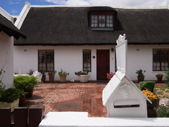
Montagu is a pleasant town, a few days from the pace and influence of Cape Town.  The region is home to a productive industry of dried fruits and nuts.  Cape Dutch architecture melds local materials with styles imported from Holland.  Fresh white paint is the color of choice to reflect the intense sun at thirty something degrees south.

Nicholas Carman1 2346

Further afield, the land opens up in a familiar way.  Many roads inland of here are gravel, except for the main connections between towns.

Nicholas Carman1 2349

Ouberg Pass invites us with a climb immediately out of Montagu.  Keith, whom we met in town, meets us at the top of the pass to say hello.  He runs a local guide operation called Langeberg MTB.  You can call him Mr. MTB.  Mountain biking is growing in popularity in the country.

Nicholas Carman1 2351

Open roads for miles.  We camp near the road in a small gravel pit, and awake at sunrise.  It is nice to restart the pattern of rising early and riding longer days.

Nicholas Carman1 2353

The route passes high quality gravel roads, connecting to less traveled farm roads, and onto a mellow 4×4 track into the Anysberg Reserve.  

The nature reserve contains notably more wild game than elsewhere.  After recent rains, the rivers and streams attract animals of all kinds.  Most stream beds are dry most of the year.

Nicholas Carman1 2357

Cats or dogs?  A lynx, perhaps.

Nicholas Carman1 2356

A scenic doubletrack leads through the preserve, antelope springing away from the stream as we pass, including springbok, kudu, eland, and gemsbok.

Nicholas Carman1 2358

Nicholas Carman1 2393

Nicholas Carman1 2398

Highly folded layers give the Cape Fold Mountains their name.

Nicholas Carman1 2399

Nicholas Carman1 2396

We take shade for an hour or two to enjoy lunch and fill our bottles at the ranger’s station.  We’re carrying 4 and 5 liters or water each, with two cages taped to each side of the fork.  Four cages times 800ml each is just over three liters on the fork.  Lael has a bottle mounted to her stem top cap, a simple and unique mount available from King Cage out of Durango, CO.  I’ve got two more liters under the downtube in a Klean Kanteen cradled by a Salsa Anything Cage.  

Nicholas Carman1 2374

Nicholas Carman1 2400

Nicholas Carman1 2370

Signs and fences are the rule in South Africa.  It is claimed that some gates are illegally placed across roadways on large tracts of land to deter livestock theft and other crimes, and to contain animals.  It is impossible to know which signs indicate private property with the legal right to pass, and which rightfully and legally exclude the right to pass on a private road through private property.  

Famously, mountain bikers in South Africa are pictured tossing their bikes over gates and game fences up to 3m high.  I’m not advocating trespassing on private property, but you will encounter fences if traveling anywhere off the main gravel roads.    

Nicholas Carman1 2390

Tubeless tires are essential for off-pavment travel.  This is the most common tree in the semi-arid regions of the Western Cape.

Nicholas Carman1 2402

Abandoned.

Nicholas Carman1 2406

Unlocked.

Nicholas Carman1 2408

Water sources come in the form of stock tanks, farmhouses, and mountain streams.  

Nicholas Carman1 2409

Gate jumping techniques improve with time.  Game fences– about 3m high– are always a challenge.

Nicholas Carman1 2410

South Africa has some of the best wide open dirt roads that I’ve seen.  They may be less densely woven than in parts of the US, where USFS and BLM offshoots often lead in every direction, but the roads are wide and nicely graded.  The riding is perfect for day long conversations side-by-side.  I call these Fargo roads, in reference to the dirt road hungry Salsa Fargo.

Nicholas Carman1 2414

Camping along the gravel roads is possible once out of town, although most people in the country will warn that it is unsafe, something you may hear in any country.  We find a quiet spot for the night below a quiet road partly concealed by a shrub.  There are fences everythwhere along the road, and I’ve been told by farmers that it shouldn’t be problem to hop a fence to camp in most places.  However, individual farmers may think otherwise.  Best to ask at a farmhouse if possible, a common practice around here.  You’re likely to get more than a patch of dirt for the night.

Nicholas Carman1 2415

It is quite possible to self-design a dirt route across the country once away from the reaches of the city. 

Nicholas Carman1 2416

Vleiland is just a little dot on the map, but surpassed us with a small community center with alibrary, and an aging store nearby.  The store stocks bread, cold Coca-Cola and Stoney ginger beer, along with a few other dusty items.  Lael looks with wide eyes and remarks that we could easily resupply in this place, despite mostly bare shelves.  Amazing what changes after a few years on the road.

Nicholas Carman1 2417

Nicholas Carman1 2418

Nicholas Carman1 2307

This section of the Freedom Trail from the Anysberg Reserve to Gamkaskloof and Prince Albert follows the scenic backside of the folded Swartberg Mountains.  

Nicholas Carman1 2422

Following the Freedom Trail further, past Seweweekspoort Pass, we continue on towards a famous donkey trail down into Die Hel, or The Hell.  Dutch settlers reportedly entered the idyllic valley and rarely left.  The trail is named De Leer, or The Ladder.  

The route passes into the Bosch Luys Kloof, a private nature reserve bisected by a public road.  Then, it connects to a private 4×4 track called “To Hell and Back”.  We dial the the number listed on the sign to ask permission to travel this track, which connects to De Leer.

Nicholas Carman1 2423

Nicholas Carman1 2424

Nicholas Carman1 2427

Nicholas Carman1 2429

In about 11km, the track ends at a steep mountainside overlooking the Gamkaskloof.  The ladder into the hell begins here, but not before a quick snack .

Nicholas Carman1 2432

Nicholas Carman1 2435

Nicholas Carman1 2439

Nicholas Carman1 2438    

This connection, among others along the Freedom Trail, requires prior arrangement to pass.  I had contacted the Freedom Challenge organization several weeks prior while in Cape Town but did not receive a response, the result of a communication mishap I have come to learn.  

There have been ongoing issues with some of the landowners at the base of De Leer, culminating in a situation where event organizers cleared a mess of razor wire at the base of the trail in 2013, which had been illegally installed by landowners.  They re-opened the route just in time to enable the leaders to pass during the Freedom Challenge.  Read all about it and the resulting citizen’s arrest on the South African bike forums page, The Hub.

The ride through the Gamkaskloof is followed by a steep climb up Eland’s Pass to eventually meet the famous Swartberg Pass from the west.

Nicholas Carman1 2443

On our third day in insistently intense sun, we take every chance to submerge in cool mountain water.

Nicholas Carman1 2446

Protea is the national flower of South Africa and also the name for the national cricket team.  This is Protea eximia.

Nicholas Carman1 2448

Swartberg Pass.

Nicholas Carman1 2471

Nicholas Carman1 2449

While descending the pass, a stream of sealant sprays from my rear tire.  It eventually seals, thanks to a gob of latex and dirt which fuses to the outside.  I later learn that an internal lamination is compromised, as  knobs are also tearing away from the outside of the tire.  

Nicholas Carman1 2458

Near the base of the pass, en route to Prince Albert.  A cold stream crosses the road.

Nicholas Carman1 2452

After three days in the sun, we immediately seek shade at the supermarket in Prince Albert.  A large glass bottle of Stoney ginger beer cuts the thirst.  A two rand deposit is required for the bottle, to ensure it is returned for future use.   

Nicholas Carman1 2453

In town, I check the weather, maps, and e-mail.  A glance at Warmshowers.org indicates a host in town.  I call.

Nicholas Carman1 2454

Johann is a veteran volunteer and friend of the Freedom Challenge.  He imparts knowledge of routes in the karoo and about South Africa in general.  He invites us into his home, a unique straw-bale constuction with an open floor plan.  

Nicholas Carman1 2455

Nicholas Carman1 2457

There won’t be any opportunities to purchase a tire between here and Johannesburg, so we head for Oudtshoorn the next day, a century ride which crosses twice over Swartberg Pass.

Nicholas Carman1 2460

Nicholas Carman1 2461

Nicholas Carman1 2462

Nicholas Carman1 2463

Nicholas Carman1 2464

Nicholas Carman1 2465

Nicholas Carman1 2467

A 29×2.2″ Vittoria Saguaro tire with a tough TNT casing fits the bill.  I’ll miss the volume of the Hans Dampf, but this is a great replacement for now.  There were quite a few 2.2″ tubeless tires to choose from.  Repeatedly, the salesman tried to sell me 2.1″ Maxxis Crossmarks, one of the most popular tires in this country.  The same happened at the other shop in town, even though I introduced myself by stating that I was looking for the largest volume tire available.  “Really, the Crossmark is quite nice”, he insists.

Nicholas Carman1 2389

Back home to Prince Albert, four thousand feet up and over.  Lael loves shopping, bit only when it involves such a ride.  We spend a few more days in the vicinity of Prince Albert.  Every day. every morning, she rides to the top of the pass while I am still sleeping.

Nicholas Carman1 2468

Johann prepares a braai of lamb chops.  Do not miss the opportunity to eat lamb or sheep in this country.  It is exceptional.

Nicholas Carman1 2474

Homemade olives.

Nicholas Carman1 2477

Nicholas Carman1 2480

Johann also shares with us a new dirt route across the country called the Spine of the Dragon, designed by friends David Bristow and Steve Thomas  The route is detailed in this guide entitled Riding the Dragon’s Spine, including a 58-day itinerary from Cape Point to the border of Zimbabwe, via Lesotho.  The route relies exclusively upon public thoroughfares.  The language of the guide and the associated websites is inspiring and inclusive.  GPS tracks of the entire route are available for free download from the Dragon Trax website.  In exchange, a donation to a charity of your choice is recommended.  This is an exciting find.  

Thanks for everything Johann!

Nicholas Carman1 2478

We’ll be using the Spine of the Dragon Route as a backbone for our travels in the coming weeks.  Off into the karoo toward Lesotho.  

 Nicholas Carman1 2484

European Bikepacking Routes

Bicycle Times Bikepacking Europe1 28Luxembourg, GR5/E2 trail

Two years ago I wondered about bikepacking routes in Europe.  After eight months of riding, researching, and blogging from Amsterdam to Sevastapol to Athens, this resource is the culmination of our efforts.  Europe is a great place to explore by bike, off-pavement, and self-supported.  Eat great food, visit fascinating cultural and historical places, and learn new languages, in between bike rides.  In Europe, there are rides and routes for every interest and skill level.  Use the search function or the archives on this page to learn more about our rides in Europe through the Netherlands, Belgium, Luxembourg, France, Czech, Slovakia, Poland, Ukraine, Serbia, Montenegro, Albania, Kosovo, and Greece.  Read more about our adventures across Europe in the Bicycle Times article Bikepacking Europe: North Sea to the Black Sea.

This is an incomplete list of European bikepacking routes.  These routes are either mapped, signed, and/or available as GPS tracks.  Many routes originate as self-supported off-pavement endurance races, multi-day stage races, or challenging routes for solo ITT.  Some are government tourism projects.  Others are the creation of avid riders or cycling organizations to promote the riding in their home country.  Lastly, some routes suggested here are repurposed walking routes, which may be done in sections or as a whole.  One route is currently planned, but is incomplete.  Additional rouetplanning resources include online retailers of maps and guides, or digital trail-finder resources.  The basic concept of this project is to awaken the world to the breadth of bikepacking possibilities in Europe, despite the lack of a single superstar route such as the Great Divide Route, Colorado Trail, or the Arizona Trail.  Bikepacking is a global phenomena, born of the passion to ride somewhere, off the beaten path, self-supported.

Use these links as a springboard to do your own research and riding.  Some routes may be easy with significant paved sections, non-technical terrain, and uncomplicated logistics.  Others are extremely challenging, with a large component of hike-a-bike.

Any assistance to improve the list is welcomed, including relevant comments about any of the listed routes and new route suggestions with links.  When possible the routes are linked to the most informative or relevant webpage, which most often originates from the route organizer or creator.  In a few cases, routes are listed without an official webpage or an official GPS route, such as The Red Trail in Poland, but the route is known to exist on the ground, is signed, and is indicated on Compass brand maps (and others).  To keep this listing simple I have chosen not to indicate the distance, difficulty, or source of route guidance (map, GPS, signs).  These features may come in the future, and if anyone wishes to host this list in further detail, contact me directly.  Start dreaming and get riding!

Please use the comment form below and check back in the future as this page develops.  Special assistance is needed to include routes from many countries, including: Finland, Sweden, Norway, Iceland, Denmark, Austria, Portugal, Slovenia, Croatia, Romania, Bulgaria, Hungary (The Countrywide Blue Tour?), Serbia, Kosovo, Estonia, Latvia, Lithuania, Ukraine, Belorus, Russia, the Netherlands, and Luxembourg.  Israel is not in Europe, but is included due to a growing bikepacking scene.  Surely, there are many more routes in the countries listed.  Tell your friends.  Share it online.

Spain: TransAndalusTranspirinaicaTransiberia, Camino de Santiago, Camino del Norte, Transcantábrica, Via de la Plata, Camino del Cid; GR 48, Transnevada.   Many Spanish route maps and guidebooks available from labiciteca.com.

Portugal: Rota Vicentina, Via Algarviana

France: Traversée du Massif Vosgien, Traversée du Jura (maps), Traversée du Massif Central, GR5/E2 trail; VTTrack.fr for interactive MTB trail map of France

Belgium: GR5/E2 walking trail (general info); also, some images and info about the section in the Ardennes Mountains

Germany: GST: Grenzsteintrophy

UK: Bearbones 200England-Wales-EnglandLakeland 200, Pennine Bridleway, Ridgeway Double, South Downs Double, Coast to Coast, Trans Cambrian, Welsh Coast to CoastDevon Coast to Coast (Westcountry Way).  All routes and links thanks to selfsupportedUK.net.

Scotland: Scotland Coast to Coast, Highland Trail 550, West Highland Way, Cairngorms Loop

Italy: Italy Coast to CoastTuscany TrailSan Remo-Monte CarloMyLand Non-Stop (Sardinia), Alto Adige-Südtirol Extreme Bike TrailDolomiti TrailItalia TransmountainsThe Fat River (fatbike route), Transardinia.  Most routes courtesy of bikepacking.it.

Switzerland: Navad 1000National TrailsAlpine Bike #1Panorama Bike #2Jura Bike #3; Alpencross; National website for Mountainbiking in Switzerland

Sweden: Kungsleden

Poland: The Red Trail (Sudecki and Beskidzka, basic info only).  Compass brand maps show all hiking trails and cycling routes, including the long-distance red trails.  Note, the red trail is not a single trail across Poland, but a series of trails with lesser trails marked with painted blazes of other colors.  There is a route most of the way across the country E-W, mostly along red trails.

Czech/Slovakia: 1000 Miles Adventure

Croatia: Adriatic Crest

Montenegro: Top Biking Trail 3: Eastern Enchantment

Greece: Bike Odyssey

Israel: Holyland Bikepacking Challenge, Israel National Bike Trail (in progress), Israel National Trail (hiking)

Other resources: Footpaths provide the basis for many routes in Europe, most of which have developed over the past century.  Generally, these routes allow bicycles, with local exclusions, but they do not exclusively travel singletrack trails across wild lands and will pass towns, farmland, and paved sections.  The European Rambler’s Association (ERA) aims to complete a long-distance international trail system of footpaths throughout Europe, with numbered routes from E1-E12 currently in various phases of completion.  Most routes are assembled from pre-existing local and national trails. Each country may provide more detailed resources in the native tongue via dedicated websites or guides about national trail systems, such as the GR5 listed in France and Belgium, above.  Most often, printed regional trail maps can be found at local touristic centers, and commercial maps and guides may also be available.  Detailed roadmaps are also suitable for broad-scale navigation, and often show more detail than typical road maps in the USA.

Also worth mentioning is the EuroVelo network of cycling routes, fashioned much like the ERA, with international cross-continental routes numbered 1-12 in various stages of completion.  EuroVelo routes are generally ridable on a trekking bike, hybrid, or rigid mountain bike, and in some places are not recommended for a tire less than about 40mm.  Check out the EuroVelo6for the popular route from the Atlantic Ocean to the Black Sea.

If you wish to submit a route, please provide a link to the best source(s) of information and a brief description of your experience on that route, if any.  To qualify a multi-day off-pavement route for this listing, consider that it must be documented in detail, like the routes listed on Pedaling Nowhere-Routes or Bikepacking.net.

Bicycle Times Bikepacking Europe1 72

Poland, The Red Trail

Bicycle Times Bikepacking Europe1 48

Czech, Sumava National Park

Bicycle Times Bikepacking Europe1 102

Ukraine, Polonina Borzhava

Bicycle Times Bikepacking Europe1 37

France, Traversée du Massif Vosgien, Château Bernstein

Nicholas Carman1 800

Ukraine

Nicholas Carman1 1184

Serbia

Nicholas carman1 588

Slovakia, 1000 Miles Adventure

Nicholas Carman1 1715

Greece, Bike Odyssey

Bicycle Times Bikepacking Europe1 33

France, TMV

Nicholas Carman1 2107

Greece, Bike Odyssey

Wpblog001 1263

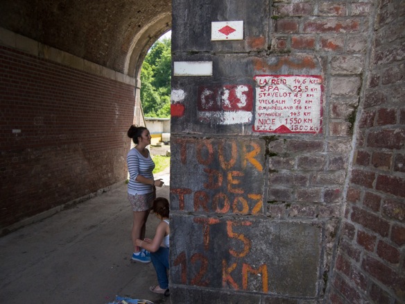
Luxembourg, GR5/E2 trail
Wpblog001 1192

Belgium, GR5/E2 trail

Bicycle Times Bikepacking Europe1 3

Guidebooks for routes in Spain.

Bicycle Times Bikepacking Europe1 74

Poland, The Red Trail: one of many PTTK resources for hikers and cyclists available in the mountains, often serving hot food and cold beer.

Nicholas carman1 467

Maps in a Slovakian supermarket.

Bicycle Times Bikepacking Europe1 25Belgium, GR5/E2 trailNicholas Carman1 1789Albania

To Slovakia!–nothing not to like

Nicholas Carman1 453

It has been a long time coming, our return to Slovakia.  We grazed the border of Slovakia on several occasions last summer.  Once, en route to meet Przemek for the first time, we rode through Slovakia for part of a day.  Unwilling to participate in yet another currency, we starved ourselves for the afternoon and raced into Poland to begin our ride on the red trails of southern Poland (Note: they use Euros in Slovakia, we started the day with Czech kroner and ended with Polish zloty).  On another occasion, we detoured from the red trails in Poland to spend a few days writing for Bunyan Velo,  We crossed the border a few times in two days, curious about the pace of life in Slovakia.  Poland is a dreamy place, as long as you are in the woods.  On the roads and in town, the energy is high.  Slovakia, like Czech, is relaxed and kind.  We liked it, but the trails, and Przemek, were in Poland.

The country is crossed with mountains, and farms, and relatively few people.  The beer, as in Czech, is cheap.  The mountains, as we are coming to find, are laced with roads and trails, accessible by a plethora of hiking and cycling routes.  These things are always easier to discover in country.  The women– I promise I won’t let this become a place to review the women of the world– have long legs and have obviously spent the summer outdoors doing things they enjoy.  Seriously, Lael agrees, and we marvel at the discovery of Slovakian women– they are beautiful and healthy.  It’s like they’ve never outgrown the age of 12.  We find this to be an interesting social and cultural marker.  The men?  Well, they mostly look like sunburnt farmers.

When crafting a plan for this summer while back in Alaska, the far eastern part of Europe invited us once again.  I want to spend more time in Ukraine, and the other half of the Carpathian Mountain chain in Romania.  Lael wants to learn some Romanian, and bulk up her Ukrainian vocabulary.  We both want to ride bikes in the countryside and mountains in places that are habitable and arable, but not yet overcome by the hypermodern life we know.  Slovakia, Ukraine, and Romania.  Slovakia, Ukraine, and Romania.  That’s the plan for now, at least as much of a plan as there will ever be.  Beyond that?  Greece and Macedonia?  Spain and Corsica and Morocco?  There are many opportunities further afield, but we’ve really just begun.  Its not fair to this end of the trip to focus on that end of the trip.  We’re focusing on this side of Slovakia for now, trying not to look too far forward.

We took advantage of the Condor Airlines flight over the pole, which runs nonstop all summer from Anchorage to Frankfurt for about $500.  To hone our eastern aspect, we chose a connecting flight to Vienna, which is only 40 miles from Slovakia.  While I am reading maps, Lael is honing her Euro style.

Nicholas Carman1 314

Look who met us at the airport in Vienna– Przemek!  He came bearing gifts for Lael’s birthday, including homemade currant liqueur and a small loaf of his mother’s bread.  I’m not supposed to tell, but he also made the three hour drive to the airport the day before.  Upon returning home, deflated, he realized that we had departed on the 22nd, but would not arrive until the 23rd.  Thanks for coming back a second time.

We may have the chance to spend a few more weeks with him later this summer.  Our tentative plan is to rendezvous in Romania in late August or early September.  He’s currently living in Slovenia for work.  He still does a very good impression of a Polish man, in English, for our benefit.

Nicholas Carman1 305

We’d planned a Warmshowers.org host in Vienna, although a delayed arrival and the time it took to reassemble our bikes meant it would be too late to ride into the city.  Neither of us had much interest in the big city, for now.  Rather, we pedaled towards Slovakia.  Head east!

Nicholas Carman1 356

We connect to a bike path adjacent to the road, only a short distance from the airport.  We ride through several small towns, over the autobahn, and onto a signed hiking route on a small dirt road.  This leads to a dirt track along the Danube River, dotted with rustic fishing cabins.  We slept well on our first night, on a dirt road, alongside a river, only three miles from the airport.  Even the passing “dinner and dance” barges from Vienna didn’t bother us.

Nicholas Carman1 357

Awake early, without a plan, we pedal.  Several hours later, barely 7:30, we realize we must have been up before 5AM.  This never happens, although we appreciate the extra hours.

Nicholas Carman1 358

What time is it?

Nicholas Carman1 363

Immediately, our eastward route intersects the EuroVelo6 route, from the Atlantic to the Black Sea; the local St. James Way, which eventually leads to the local Camino de Santiago route in Spain; and a plethora of local walking and cycling routes along the Donau (Danube).

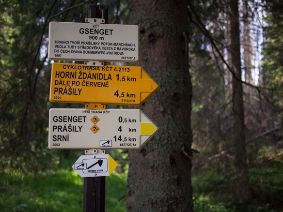
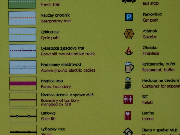
Signposts are stacked with signs and maps covered in colored routes.  The pathways are in constant use by a steady stream of riders, runners, rollerbladers, and walkers.  Many cycling routes incorporate graded gravel farm roads or unpaved cycling paths.  Most routes utilize existing facilities.  Creating bikeable routes is sometimes as easy as providing maps and signage.  Rest stops like this one are also welcomed, which include drinking water, a bike rack, a detailed map, a covered picnic area, wooden reclining chairs, and some green space.  These are luxuries to a cyclist on a long ride.

Nicholas Carman1 364

Nicholas Carman1 365

Nicholas Carman1 366

The red and white signage indicates a hiking route.  The shell signifies the way of St. James, whose terminus is in Santiago de Compostela, Spain.  The most prominent portion of the route is in Spain, although routes and signage begin much further afield.

907 must be the hiking route number.  We’re not in (907)Alaska anymore.

Nicholas Carman1 367

A short way down the river, Bratislava comes into view.  The capital city of Slovakia borders both Austria and Hungary.  Of the three countries we choose Slovakia, although the long-distance “blue trail” in Hungary is enticing. It claims to be the oldest long-distance footpath in Europe (c. 1938), and comprises part of the modern E4 route across Europe.
Nicholas Carman1 368

We find easy entrance into the city on paved trails.  Some public maps suggest an off-pavement exit.

Nicholas Carman1 370

Nicholas Carman1 371

Nicholas Carman1 372

Nicholas Carman1 373

Nicholas Carman1 374

Nicholas Carman1 375

Nicholas Carman1 377

Nicholas Carman1 380

Nicholas Carman1 379

Large Soviet housing projects are common in these eastern cities.

Nicholas Carman1 381

Europe is full of signed and mapped routes for walking and cycling.  Many walking paths are great fun to ride.  Some cycling routes include mellow dirt tracks, although most prefer pavement.  Dirt routes begins immediately outside the city, climbing into the Malé Karpaty mountains.

Nicholas Carman1 383

Nicholas Carman1 384

Nicholas Carman1 382

Nicholas Carman1 385

The park includes many features benefitting activity and community.  The greater area includes routes for miles, trending northward through the mountains.

Nicholas Carman1 387

Dirt, right out of the city.

Nicholas Carman1 386

Nicholas Carman1 388

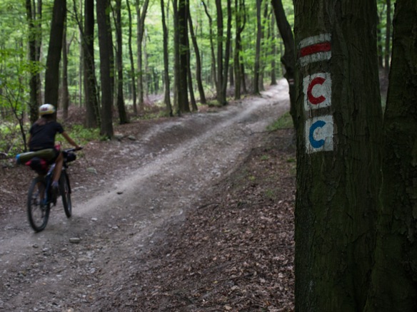
The red and white is a walking route, the colored “C” routes are cycling routes.  They diverge, and converge, in this case.

Nicholas Carman1 389

Along the way, we find dozens of picnic tables, gazebos, and grassy areas.

Nicholas Carman1 390

And plenty of signage.  Lots of signage.

Nicholas Carman1 391

Nicholas Carman1 392

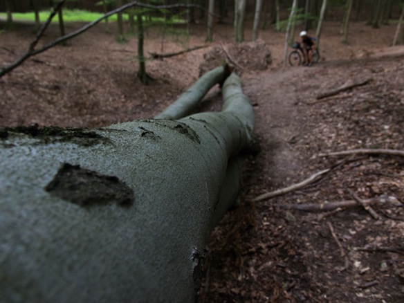
Segments of genuine singletrack are exciting, through managed forests dominated by beech trees.

Nicholas Carman1 393

Nicholas Carman1 395

Nicholas Carman1 396

Nicholas Carman1 397

Some of our route convenes with the race route of an upcoming series.

Nicholas Carman1 398

Nicholas Carman1 399

Even some hike a bike on day one.  Not bad, considering we don’t have a plan.

Nicholas Carman1 401

22-32.  This one gets a lot of use.

Nicholas Carman1 402

Nicholas Carman1 403

Nicholas Carman1 404

Further from the city, the moutnains grow taller and all the cycling routes descend into the valley.  We continue for a time on walking routes, with some pushing.

Nicholas Carman1 405

Descending from the mountains, we direct ourselves north and east.  A near goal is to get to Ukraine, although there is plenty of riding in Slovakia to keep us busy for years.  We’ll sample some along the way, including some of the 1000 Miles Adventure Route, which crosses Czech and Slovakia.

Nicholas Carman1 406

Nicholas Carman1 407

Nicholas Carman1 409

Fruit falls onto the roadways.  Camping is abundant.  Nothing not to like.

Nicholas Carman1 414

Swimming.  Once a day keeps the stink away.  Public laundromats don’t exist where we’re going.

Nicholas Carman1 415

More cycling and walking routes in the mountains.  So many options.

Nicholas Carman1 417

The beech forests!–generouslly spaced trees, filtered sunlight, singletrack.

Nicholas Carman1 419

Nicholas Carman1 420

Nicholas Carman1 422

Nicholas Carman1 423

Dobra Voda.

Nicholas Carman1 424

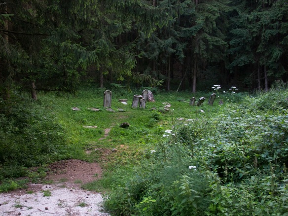
Descend to Dobra Voda.  Ascend from Dobra Voda, through a cemetery.

Nicholas Carman1 425

Nicholas Carman1 426

Nicholas Carman1 427

Nicholas Carman1 428

Nicholas Carman1 429

Nicholas Carman1 431

Nicholas Carman1 432

To a castle.  We didn’t expect a castle at the top of this hill.  Not that this is the fist castle we’ve seen in this corner of Slovakia.  There are dozens.

Nicholas Carman1 433

Nicholas Carman1 434

Nicholas Carman1 435

Nicholas Carman1 436

Nicholas Carman1 437

Nicholas Carman1 439

Nicholas Carman1 440

A short distance away, we make camp at the top of the mountain, along the red trail.  Red trails are most often major routes, which cover longer distances.

Nicholas Carman1 441

Nicholas Carman1 443

From the top, we descend through more scenic beech forests to town.  Slovakia is a new favorite.  Nothing not to like.

Nicholas Carman1 444

Nicholas Carman1 445

The E8 walking trail, like the E4 and the E2, crosses the European continent from Ireland to Turkey.

Nicholas Carman1 446

This map locates all the castles, in reference to cycling routes.

Nicholas Carman1 447

Searching for chain lube, we go looking for small town bikes shops.  It seems WD-40 in spray cans is preferred.

Nicholas Carman1 448

We choose pavement for a few days to make some distance north, and east.  When possible, we interject mellow dirt routes chosen from local signage.  A forecast for heavy rain will keep us off the dirt for a few days.  Much of the dirt riding ahead of us promises to be steep, as we enter higher mountains.  Lael also has a nagging ankle injury that likes to ride a bike, but not to push bikes up steep grades.

Postcard Slovakia: Soviet housing, sunflowers, rolling hills, and blue skies.

Nicholas Carman1 450

Tidy houses, forested hills, small farm plots, and fruit trees.

Nicholas Carman1 452

Swim in a cold stream, a castle on the hill.

Nicholas Carman1 455

Slovakians love to ride.  There are often families and groups of riders on the weekends.  Through the week, people commute to work and ride to the store to get what they need.  Most often, older men and women ride vintage step-through frames with 24×1 3/8″ tires and rider bars, perfectly practical for this kind of riding.

Nicholas Carman1 457

Nicholas Carman1 458

Nicholas Carman1 460

Nicholas Carman1 416

Nicholas Carman1 461

Proper bike shops are infrequent, although bikes from the past several decades are still riding alongside newer bikes.  It is not uncommon to see a 30 year old bike with patina and signs of use, still exhibiting smooth operation.  This is what happens when you value the things you have, and take care of them.  The values of our grandparents are still alive here.

Nicholas Carman1 469

Aside from maps and signs by the roadside, detailed guidebooks and “Active” maps for hiking and cycling are available from local bookstores and supermarkets.  This book details cyclings routes around Slovakia, concentrated in the southwest corner, nearby much of the country’s population.  This book includes paved and unpaved routes, and many routes which combine the two.

Check our this digital resource for all the walking routes in Slovakia.  Cycling routes are all here.  An Android App called Hiking Map Slovakia is also useful, and is currently installed on Lael’s Nexus tablet.

Nicholas Carman1 464

Look for these maps as well, in country or online.

Nicholas Carman1 467

Cycling signposts also include directions to local attractions such as castles, swimming pools, and this BIKEPARK.  Mountain biking is increasingly popular here.

Nicholas Carman1 470

Cycling routes are surprising in Slovakia, ranging from busy two-lane roads to this levee singletrack.  A mountain bike makes a versatile touring bike in this county.

Nicholas Carman1 471

As anywhere, it ensures the right tool to avoid busy roadways.

Nicholas Carman1 473

Nicholas Carman1 474

Nicholas Carman1 475

Nicholas Carman1 476

Much like in Czech, beer is everpresent.  When we order kava at 7AM, it is not uncommon to see a table of townspeople talking over tall glasses of beer.  At about 4%, a beer or two in the morning is like a strong cup of coffee with sugar, right?

Hops and wheat, from which beer is made.  Slovakian lowlands are filled with fruits, vegetables, and grains.

Nicholas Carman1 477

Nicholas Carman1 456

We’ve had such good luck finding campsites all over Europe.  As a rule, as night falls, find a small road and ride uphill.  Ride past the last house, ride onto dirt, and soon, the place will appear.  In this case, as we ascended a dirt road we passed several mountain bikers coming down, including several young boys with full face helmets.  We ascended to find an historic logging railbed.  We camped alongside a picnic table in the woods several kilometers from the nearest town, 500ft down in the valley.  Nothing not to like about the touring life in Slovakia.

Nicholas Carman1 478

Nicholas Carman1 480

The best part is that every morning, sooner or later, we descend to a town.  A period of rest each day, including kava and pivo and ubiquitous free WiFi, encourages enough energy to pull out the maps and plan another day’s ride up and over something.  Our immediate goal is to explore some of the 1000 Miles Adventure route, which is an adventure race route organized by Czech racer Jan Kopka from the border of Germany and Czech to the other edge of Slovakia, on the border of Ukraine.  The mixed terrain route promises some significant challenges, but also a largely pedalable route across the country.  Incidentally, I met Jan this winter before the Iditarod Trail Invitational.  He and Greg came over from Speedway to buy all of our fatbike tubes at the shop.  If Lael’s ankle cooperates and the weather is not too wet, we’ll follow as much of this route as we want across the country.  Soon enough, some time in Ukraine is also a priority.  And Przemek will be waiting at the Romanian border in another month or so.

Nicholas Carman1 482

We’re trying not to make plans.  Mostly, were trying to do a lot of this, if we can find it.

Nicholas Carman1 481