
Electronics:
11″ MacBook Air with soft case
Western Digital 300GB external hard drive
Olympus E-PM1 digital camera, 14-42mm lens
basic cell phone
chargers and cables: phone, camera, iPod, data transfer
USB thumb drive


Paper resources and reading:
Colorado Trail Data Book (borrowed)
Colorado state gazetteer, relevant pages only (from Andy)
Great Divide map, Platoro, CO to Pie Town, NM (borrowed from Gary Blakley)
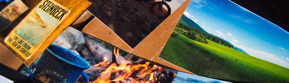
The Elements of Style, Strunk and White (25c at library in Carbondale)
Boneshaker magaZine (free, from SubCulture Cyclery in Salida, CO)
Colorado State highway map (free)


Recent acquisitions:
White Mesa Bike Trails, BLM map (free)
Albuquerque Bike Map (free)
Sandia Foothills trail map (free)

Borrowed and free maps can often be used to create an approximate outline of the route. Along the way, many additional resources arise– I browse local hiking and biking maps in outdoor stores and regional maps in gas stations; I ask others for their insight on the trail and in local bike shops, and peek at their maps or snap a picture for future reference; and I follow posted maps and road signs when available. It would be impossible to gather all of these resources at home, from many miles away. Route planning is much easier and more meaningful en route.
Taking a look at CDT maps alongside the Great Divide map (on the right), having met several thru-hikers ouside Butte, MT.

Headed south, away from Fleecer Ridge on the Great Divide Route.

A borrowed National Geographic series map to get over Rollins Pass from the Great Divide Route.

A free map in the Wrangell-St. Elias tourist brochure, charting my route to the Nabesna Gold Mine.

The roads to Chicken and Eagle, Alaska. Not too many options up north. No paper maps required. In fact, I didn’t carry a dedicated map this summer until I crossed into Montana.

Follow the intermittent Trans-Canada signs, interspersed with Yukon Quest markers on the Dawson Overland Trail.


Singletrack outside Whitehorse, and an easy place to camp out of town.

Only two roads cut through northern B.C., shown on this map at the junction with the Alaska Highway and the Cassiar. Turn south, then go straight for almost 500 miles.


Nice touch with the Strunk and White.
A succinct text is appropriate for lightweight travel. 25cents is the right price for a penniless traveler.
Getting lost is the onliest thing. And I’m pretty strunk when I say that.
tj
Speechless, as ever. I just ran across your story about dropping the Cervelo guy while browsing the digital infinite yesterday. Great stuff.
You may have heard, but DirtRag has a Literature Contest that ends this month. The requirements are: less than 3000 words, bicycling related, and a little bit of dirt involved. The prize is a really expensive bike that you would’t have any use for, but you could probably turn it into a Mukluk on Craigslist.
It think it’s been covered here, but the above self-photo was taken earlier this summer in a little camping trailer on the banks of the Nenena River that I once called home for a summer. Proud? I am also a trailer park cyclist.
Denali NP was across the river, separated by a brief frigid plunge.
Hey! I stayed in the pop-up trailer of my WS host outside of Seattle when I did my Helens-Rainier-Seattle tour in August. Does that mean I’m a member of the club now?
Lads, when the chips are counted we are all of us Trailer Park Cyclists.
tj